File:Schematic of the three commodities carried by rail on Eyre Peninsula, 2019.png
Jump to navigation
Jump to search
Size of this preview: 800 × 554 pixels. Other resolutions: 320 × 222 pixels | 640 × 443 pixels | 1,024 × 709 pixels | 1,280 × 887 pixels | 2,900 × 2,009 pixels.
Original file (2,900 × 2,009 pixels, file size: 391 KB, MIME type: image/png)
Captions
Captions
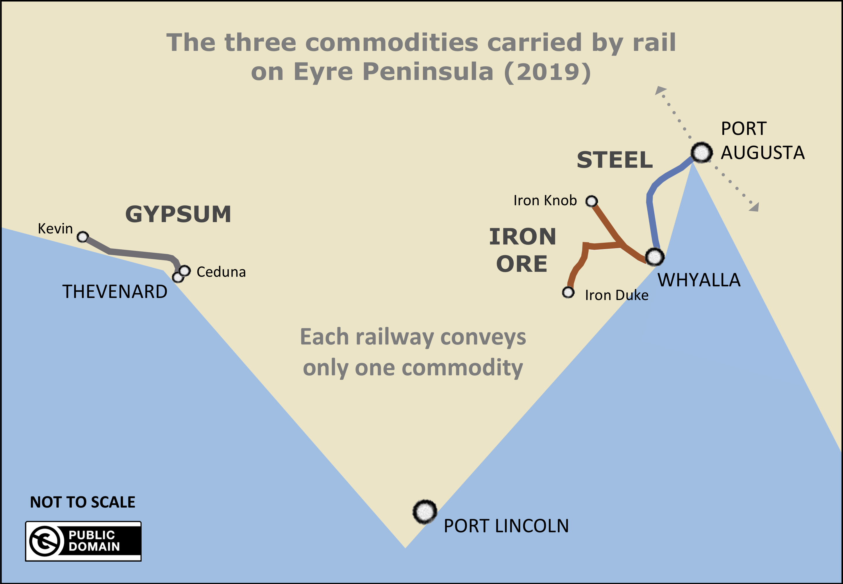
A schematic of the Eyre Peninsula railways in 2019 and the bulk commodities carried on them.
Summary[edit]
| Description |
English: A schematic, not-to-scale representation of Eyre Peninsula, South Australia and the three types of bulk commodity carried on the peninsula's railways after June 2019. |
| Date | |
| Source | Own work |
| Author | SCHolar44 |
| Other versions | Diagram of commodities before cessation of wheat traffic: Schematic of the four commodities carried by rail on Eyre Peninsula, 2017.png |
| Camera location | | View this and other nearby images on: OpenStreetMap |
|---|
Licensing[edit]
I, the copyright holder of this work, hereby publish it under the following license:
| This file is made available under the Creative Commons CC0 1.0 Universal Public Domain Dedication. | |
| The person who associated a work with this deed has dedicated the work to the public domain by waiving all of their rights to the work worldwide under copyright law, including all related and neighboring rights, to the extent allowed by law. You can copy, modify, distribute and perform the work, even for commercial purposes, all without asking permission.
|
File history
Click on a date/time to view the file as it appeared at that time.
| Date/Time | Thumbnail | Dimensions | User | Comment | |
|---|---|---|---|---|---|
| current | 13:53, 7 May 2019 | | 2,900 × 2,009 (391 KB) | SCHolar44 (talk | contribs) | User created page with UploadWizard |
You cannot overwrite this file.
File usage on Commons
There are no pages that use this file.