File:Scene of the late naval fight and the environs of Fortress Monroe, and Norfolk and Suffolk, now threatened by General Burnside. LOC 85690735.jpg
Jump to navigation
Jump to search

Size of this preview: 377 × 599 pixels. Other resolutions: 151 × 240 pixels | 302 × 480 pixels | 483 × 768 pixels | 644 × 1,024 pixels | 1,289 × 2,048 pixels | 4,592 × 7,294 pixels.
Original file (4,592 × 7,294 pixels, file size: 5.29 MB, MIME type: image/jpeg)
Captions
Captions
Add a one-line explanation of what this file represents
Summary[edit]
| Description |
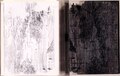
English: Relief shown pictorially. Bird's-eye view of Hampton Roads region showing fortifications, camps, the Monitor lying off Fortress Monroe, and "Gen. Burnside's advance" on Suffolk, Va. Title from lower margin of view appearing in William Jenning Demorest's New York illustrated news, v. 5. no. 124, Mar. 22, 1862, p. 317. Wood block is composed of 12 separate parts joined together, each part 6 x 13 cm. Accompanied by proof copy pulled from wood block. 1 sheet : view ; 29 x 37 cm. LC Civil War maps (2nd ed.), 558.7 Wood block is imperfect: Lower left and right corners damaged with chips missing from block. Available also through the Library of Congress Web site as a raster image. Vault Acquisitions control no. 58-83 |
||
| Title | [Scene of the late naval fight and the environs of Fortress Monroe, and Norfolk and Suffolk, now threatened by General Burnside]. | ||
| Shelf ID | G3882.H3S5 1862 .S3 | ||
| Date | |||
| Source | https://www.loc.gov/item/85690735/ | ||
| Author | Unknown author | ||
| Permission (Reusing this file) |
|
||
| Other versions |
|
||
| Location | Hampton Roads Region · Fort Monroe Region · Region · Fort Monroe Region. · Virginia · Hampton Roads Region. · United States · Hampton Roads | ||
| Part of | Military Battles And Campaigns · American Memory · Civil War Maps · Catalog · Geography And Map Division | ||
| Subject | Aerial Views · Map Printing · Defenses · Hampton Roads Region · Fort Monroe Region · Fort Monroe Region (Va.) · Virginia · Civil War · United States · Maps · Printing · Hampton Roads (Va. : Region) · Wood-Engraving · Specimens · History |

Licensing[edit]
|
This is a faithful photographic reproduction of a two-dimensional, public domain work of art. The work of art itself is in the public domain for the following reason:
The official position taken by the Wikimedia Foundation is that "faithful reproductions of two-dimensional public domain works of art are public domain".
This photographic reproduction is therefore also considered to be in the public domain in the United States. In other jurisdictions, re-use of this content may be restricted; see Reuse of PD-Art photographs for details. | ||||
File history
Click on a date/time to view the file as it appeared at that time.
| Date/Time | Thumbnail | Dimensions | User | Comment | |
|---|---|---|---|---|---|
| current | 16:00, 6 February 2022 | | 4,592 × 7,294 (5.29 MB) | SteinsplitterBot (talk | contribs) | Bot: Image rotated by 90° |
| 09:26, 7 June 2018 |  | 7,294 × 4,600 (5.35 MB) | Fæ (talk | contribs) | LOC Maps https://www.loc.gov/item/85690735/ #22607 |
You cannot overwrite this file.
File usage on Commons
The following 4 pages use this file:
- User:Mattbuck/Railways/2022 February
- File:(Scene of the late naval fight and the environs of Fortress Monroe, and Norfolk and Suffolk, now threatened by General Burnside). LOC 85690735.jpg (file redirect)
- File:Scene of the late naval fight and the environs of Fortress Monroe, and Norfolk and Suffolk, now threatened by General Burnside. LOC 85690735.tif
._LOC_85690735.jpg&redirect=no)