File:Saudi Arabian–Iraqi Neutral Zone 1990.jpg
Jump to navigation
Jump to search

No higher resolution available.
Saudi_Arabian–Iraqi_Neutral_Zone_1990.jpg (404 × 444 pixels, file size: 70 KB, MIME type: image/jpeg)
Captions
Captions
Add a one-line explanation of what this file represents
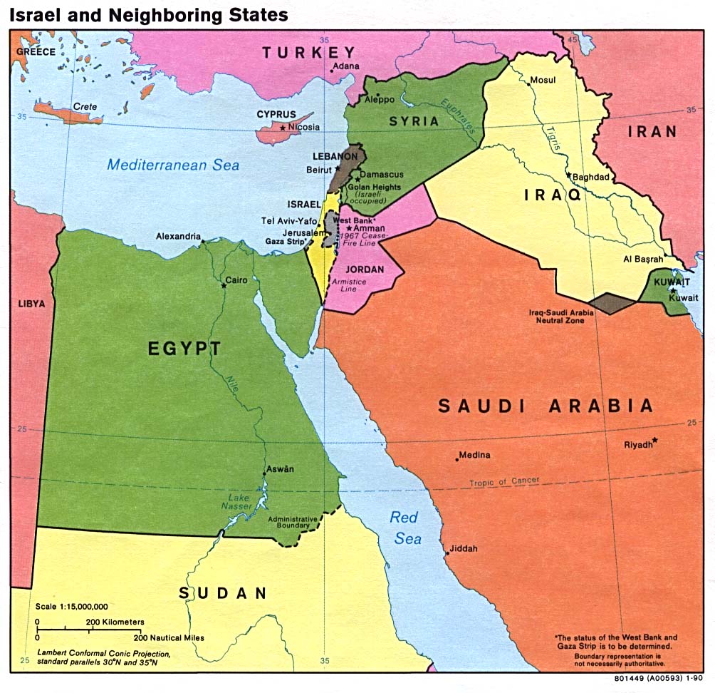
A map showing, Iran, Iraq, Syria, Jordan, Saudi Arabia, Turkey, Kuwait, and the former Iraq - Saudi Arabia Neutral Zone. Map is from http://www.lib.utexas.edu/maps/middle_east_and_asia/israel_nbr90.jpg.
| This image is a work of a Central Intelligence Agency employee, taken or made as part of that person's official duties. As a Work of the United States Government, this image or media is in the public domain in the United States.
|

|
.jpg)
File history
Click on a date/time to view the file as it appeared at that time.
| Date/Time | Thumbnail | Dimensions | User | Comment | |
|---|---|---|---|---|---|
| current | 07:29, 29 January 2007 | | 404 × 444 (70 KB) | Hoshie (talk | contribs) | A map showing, Iran, Iraq, Syria, Jordan, Saudi Arabia, Turkey, Kuwait, and the former Iraq - Saudi Arabia Neutral Zone. Map is from [http://www.lib.utexas.edu/maps/middle_east_and_asia/israel_nbr90.jpg http://www.lib.utexas.edu/maps/middle_east_and_asia/ |
You cannot overwrite this file.
File usage on Commons
The following 5 pages use this file:
File usage on other wikis
The following other wikis use this file:
- Usage on ar.wikipedia.org
- Usage on ca.wikipedia.org
- Usage on cs.wikipedia.org
- Usage on de.wikipedia.org
- Usage on el.wikipedia.org
- Usage on en.wikipedia.org
- Usage on eo.wikipedia.org
- Usage on es.wikipedia.org
- Usage on fa.wikipedia.org
- Usage on fi.wikipedia.org
- Usage on fr.wikipedia.org
- Usage on hr.wikipedia.org
- Usage on it.wikipedia.org
- Usage on ja.wikipedia.org
- Usage on ko.wikipedia.org
- Usage on lt.wikipedia.org
- Usage on nl.wikipedia.org
- Usage on no.wikipedia.org
- Usage on pl.wikipedia.org
- Usage on pt.wikipedia.org
- Usage on ru.wikipedia.org
- Usage on uk.wikipedia.org
- Usage on ur.wikipedia.org
- Usage on www.wikidata.org
- Usage on zh.wikipedia.org