File:Saskatchewan-census area 16.png
Jump to navigation
Jump to search

Size of this preview: 347 × 600 pixels. Other resolutions: 139 × 240 pixels | 379 × 655 pixels.
Original file (379 × 655 pixels, file size: 85 KB, MIME type: image/png)
Captions
Captions
Add a one-line explanation of what this file represents
Summary[edit]
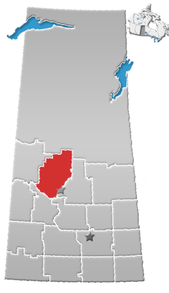
| Description | Saskatchewan census area No. 16 |
| Date | (UTC) |
| Source |
This file was derived from: SK-census divisions.png:  |
| Author |
|
| This is a retouched picture, which means that it has been digitally altered from its original version. The original can be viewed here: SK-census divisions.png:
|
Licensing[edit]
I, the copyright holder of this work, hereby publish it under the following license:
| I, the copyright holder of this work, release this work into the public domain. This applies worldwide. In some countries this may not be legally possible; if so: I grant anyone the right to use this work for any purpose, without any conditions, unless such conditions are required by law. |
Original upload log[edit]
This image is a derivative work of the following images:
- File:SK-census_divisions.png licensed with PD-self
Uploaded with derivativeFX
File history
Click on a date/time to view the file as it appeared at that time.
| Date/Time | Thumbnail | Dimensions | User | Comment | |
|---|---|---|---|---|---|
| current | 20:47, 1 August 2012 | | 379 × 655 (85 KB) | Feuerst (talk | contribs) | == {{int:filedesc}} == {{Information |Description=Saskatchewan census area No. 16 |Source={{Derived from|SK-census_divisions.png|display=50}} |Date=2012-08-01 20:31 (UTC) |Author=*File:SK-census_divisions.png: Qyd *derivative work: ... |
You cannot overwrite this file.
File usage on Commons
There are no pages that use this file.
File usage on other wikis
The following other wikis use this file:
- Usage on de.wikipedia.org
- Usage on en.wikipedia.org
- Mistawasis Nêhiyawak
- Sweetgrass First Nation
- Rural Municipality of Shellbrook No. 493
- Rural Municipality of Leask No. 464
- Division No. 16, Saskatchewan
- Rural Municipality of Canwood No. 494
- Rural Municipality of Spiritwood No. 496
- Ahtahkakoop 104
- Rural Municipality of Blaine Lake No. 434
- Debden, Saskatchewan
- Shell Lake, Saskatchewan
- Borden, Saskatchewan
- Denholm, Saskatchewan
- Krydor, Saskatchewan
- Leask, Saskatchewan
- Leoville, Saskatchewan
- Marcelin, Saskatchewan
- Maymont, Saskatchewan
- Sturgeon Lake First Nation
- Medstead, Saskatchewan
- Parkside, Saskatchewan
- Ruddell, Saskatchewan
- Rural Municipality of North Battleford No. 437
- Rural Municipality of Mayfield No. 406
- Rural Municipality of Great Bend No. 405
- Speers, Saskatchewan
- Canwood
- Richard, Saskatchewan
- Big Shell, Saskatchewan
- Chitek Lake, Saskatchewan
- Echo Bay, Saskatchewan
- Pebble Baye
- Rural Municipality of Big River No. 555
- Rural Municipality of Douglas No. 436
- Rural Municipality of Medstead No. 497
- Rural Municipality of Meeting Lake No. 466
- Rural Municipality of Redberry No. 435
- Rural Municipality of Round Hill No. 467
- Pelican Lake First Nation
- Saulteaux First Nation
- Template:SKDivision16
- Muskeg Lake Cree Nation
- Witchekan Lake First Nation
- Asimakaniseekan Askiy 102A
- Asimakaniseekan Askiy 102B
- Big River 118
- Big River 118A
- Chitek Lake 191
- Gold Eagle Reserve
View more global usage of this file.