File:Santa Clara Valley in California - red border.jpg

From Wikimedia Commons, the free media repository
Jump to navigation Jump to search

Original file(1,254 × 1,146 pixels, file size: 573 KB, MIME type: image/jpeg)

Captions

Captions

This shows Santa Clara Valley in California, outlined in red.

Summary[edit]

Description
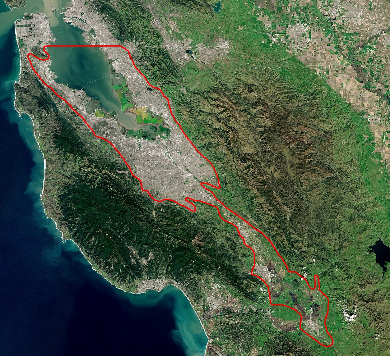
English: This map shows Santa Clara Valley in California, outlined in red.
w:en:Creative Commons
attribution share alike
This file is licensed under the Creative Commons Attribution-ShareAlike 3.0 IGO license.
You are free:
  • to share – to copy, distribute and transmit the work
  • to remix – to adapt the work
Under the following conditions:
  • attribution – You must give appropriate credit, provide a link to the license, and indicate if changes were made. You may do so in any reasonable manner, but not in any way that suggests the licensor endorses you or your use.
  • share alike – If you remix, transform, or build upon the material, you must distribute your contributions under the same or compatible license as the original.
© This image contains data from a satellite in the Copernicus Programme, such as Sentinel-1, Sentinel-2 or Sentinel-3. Attribution is required when using this image.
Attribution: Contains modified Copernicus Sentinel data 2019

The use of Copernicus Sentinel Data is regulated under EU law (Commission Delegated Regulation (EU) No 1159/2013 and Regulation (EU) No 377/2014). Relevant excerpts:


Financial conditions

Free access shall be given to GMES dedicated data [...] made available through GMES dissemination platforms [...].

Conditions regarding use

Access to GMES dedicated data [...] shall be given for the purpose of the following use in so far as it is lawful:

  1. reproduction;
  2. distribution;
  3. communication to the public;
  4. adaptation, modification and combination with other data and information;
  5. any combination of points (a) to (d).

GMES dedicated data [...] may be used worldwide without limitations in time.

Conditions regarding information to be given by users
  1. When distributing or communicating GMES dedicated data [...] to the public, users shall inform the public of the source of that data and information.
  2. Users shall make sure not to convey the impression to the public that the user’s activities are officially endorsed by the Union.
  3. Where that data or information has been adapted or modified, the user shall clearly state this.
Absence of warranty

GMES dedicated data and GMES service information are provided to users without any express or implied warranty, including as regards quality and suitability for any purpose.

Date
Source

File:Bay_Area_by_Sentinel-2,_2019-03-11_(big_version).jpg

cropped with added red border
Author Copernicus Sentinel-2, ESA, User:Binksternet

Licensing[edit]

w:en:Creative Commons
attribution
This file is licensed under the Creative Commons Attribution 3.0 Unported license.
You are free:
  • to share – to copy, distribute and transmit the work
  • to remix – to adapt the work
Under the following conditions:
  • attribution – You must give appropriate credit, provide a link to the license, and indicate if changes were made. You may do so in any reasonable manner, but not in any way that suggests the licensor endorses you or your use.

File history

Click on a date/time to view the file as it appeared at that time.

Date/TimeThumbnailDimensionsUserComment
current20:39, 12 September 2021Thumbnail for version as of 20:39, 12 September 20211,254 × 1,146 (573 KB)Binksternet (talk | contribs)Uploaded a work by Copernicus Sentinel-2, ESA, User:Binksternet from https://commons.wikimedia.org/wiki/File:Bay_Area_by_Sentinel-2,_2019-03-11_(big_version).jpg cropped with added red border with UploadWizard

There are no pages that use this file.

File usage on other wikis

The following other wikis use this file: