File:Sanitary & Topographical Map of Hudson County, N.J.PNG
Jump to navigation
Jump to search

Size of this preview: 800 × 516 pixels. Other resolutions: 320 × 207 pixels | 640 × 413 pixels | 1,094 × 706 pixels.
Original file (1,094 × 706 pixels, file size: 1.59 MB, MIME type: image/png)
Captions
Captions
Add a one-line explanation of what this file represents
| Description |
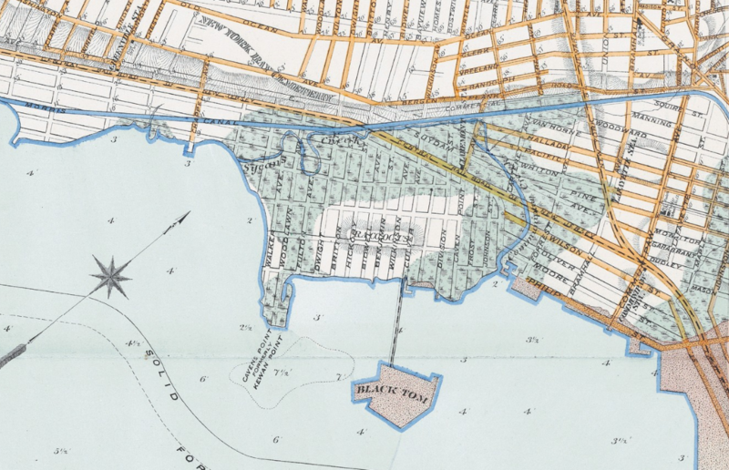
English: Detail showing the location of Black Tom Island from the Sanitary & Topographical Map of Hudson County, N.J. Prepared for the National Board of Health, Washington, D.C. Hoboken, N.J.: Spielmann & Brush, 1880. |
||
| Date | |||
| Source | http://www.njcu.edu/programs/jchistory/Pages/B_Pages/Black_Tom_Explosion.htm | ||
| Author | Spielmann & Brush | ||
| Permission (Reusing this file) |
|
File history
Click on a date/time to view the file as it appeared at that time.
| Date/Time | Thumbnail | Dimensions | User | Comment | |
|---|---|---|---|---|---|
| current | 01:10, 29 May 2017 | | 1,094 × 706 (1.59 MB) | Taterian (talk | contribs) | Transferred from http://www.njcu.edu/programs/jchistory/Images/B_Images/Black_Tom_Explosion/Black%20Tom_4.PNG |
You cannot overwrite this file.
File usage on Commons
There are no pages that use this file.