File:Salisbury Tunnel Junction collision aerial.jpg
Jump to navigation
Jump to search
Size of this preview: 800 × 533 pixels. Other resolutions: 320 × 213 pixels | 640 × 427 pixels | 960 × 640 pixels.
Original file (960 × 640 pixels, file size: 937 KB, MIME type: image/jpeg)
Captions
Captions
Salisbury Tunnel Junction collision aerial
Summary[edit]
| Description |
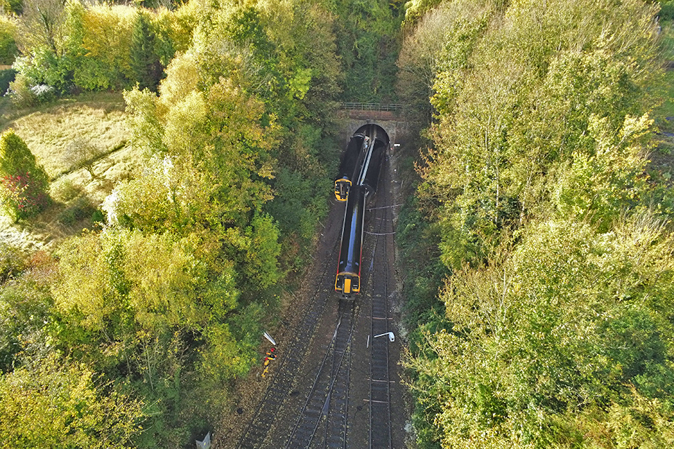
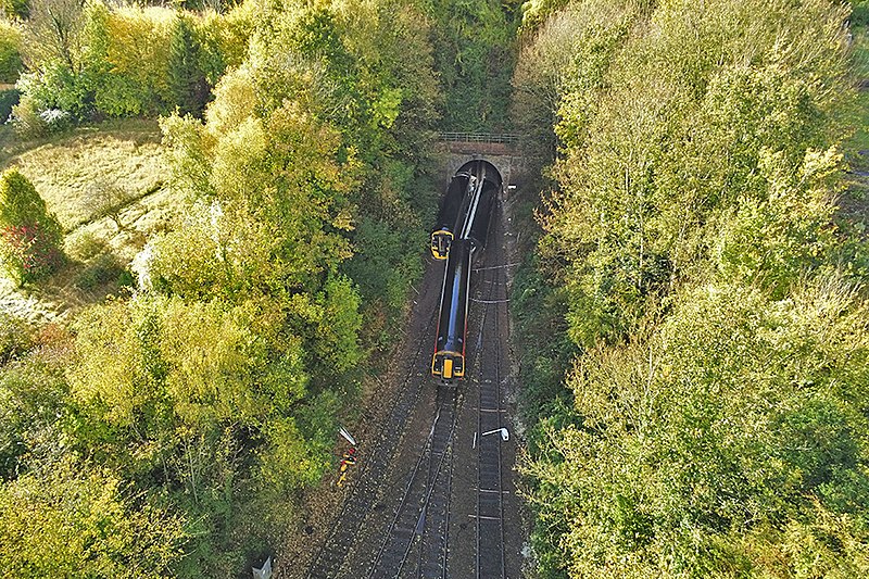
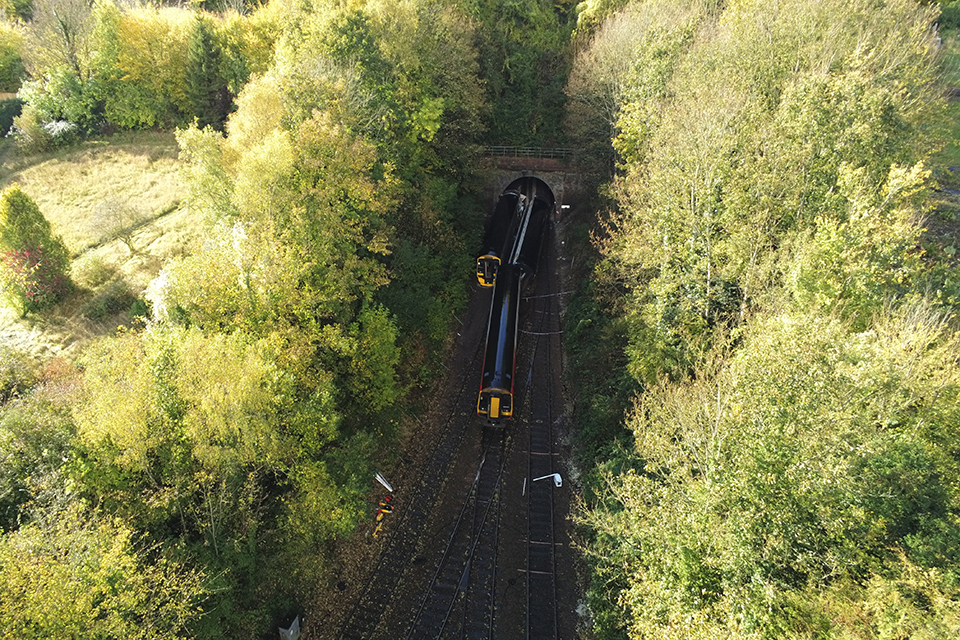
English: Aerial view of Salisbury Tunnel Junction after the collision between two trains on 31 October 2021.
Deutsch: Luftbild der Salisbury Tunnel Junction nach der Kollision zweier Züge am 31. Oktober 2021. |
| Date | |
| Source | https://assets.publishing.service.gov.uk/government/uploads/system/uploads/image_data/file/134477/Figure_1.jpg |
| Author | Rail Accident Investigation Branch |
| Camera location | | View this and other nearby images on: OpenStreetMap |
|---|
Licensing[edit]
_(St_Edwards_Crown).svg)
|
This file is licensed under the United Kingdom Open Government Licence v3.0. |
See also: Meta for information on usage on Wikimedia wikis.
|
File history
Click on a date/time to view the file as it appeared at that time.
| Date/Time | Thumbnail | Dimensions | User | Comment | |
|---|---|---|---|---|---|
| current | 09:43, 30 October 2022 | | 960 × 640 (937 KB) | Murgatroyd49 (talk | contribs) | Image brightened |
| 14:01, 5 November 2021 |  | 960 × 640 (888 KB) | PhiH (talk | contribs) | Uploaded a work by Rail Accident Investigation Branch from https://assets.publishing.service.gov.uk/government/uploads/system/uploads/image_data/file/134477/Figure_1.jpg with UploadWizard |
You cannot overwrite this file.
File usage on Commons
The following 2 pages use this file:
File usage on other wikis
The following other wikis use this file:
- Usage on de.wikipedia.org
- Usage on en.wikipedia.org
Metadata
Categories:
- Files with coordinates missing SDC location of creation (51° N, -2°E)
- 2021 Salisbury rail crash
- British Rail Class 158s of Great Western Railway (First Group)
- British Rail Class 158s in Great Western Railway (First Group) livery
- British Rail Class 158s on the Wessex Main Line
- Trains of Great Western Railway (First Group) on the Wessex Main Line
- British Rail Class 159s of South West Trains
- British Rail Class 159s in Stagecoach white (yellow doors) livery
- British Rail Class 159s on the West of England Line
- Trains of South West Trains on the West of England Line
- Fisherton Tunnel
- Salisbury Tunnel Junction
- November 2021 in Wiltshire