File:Saint Pierre et Miquelon Map.svg
Jump to navigation
Jump to search

Size of this PNG preview of this SVG file: 591 × 368 pixels. Other resolutions: 320 × 199 pixels | 640 × 399 pixels | 1,024 × 638 pixels | 1,280 × 797 pixels | 2,560 × 1,594 pixels.
Original file (SVG file, nominally 591 × 368 pixels, file size: 38 KB)
Captions
Captions
Add a one-line explanation of what this file represents
| Description |
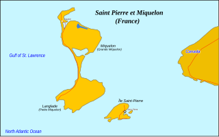
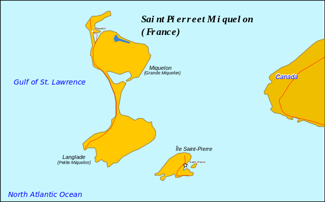
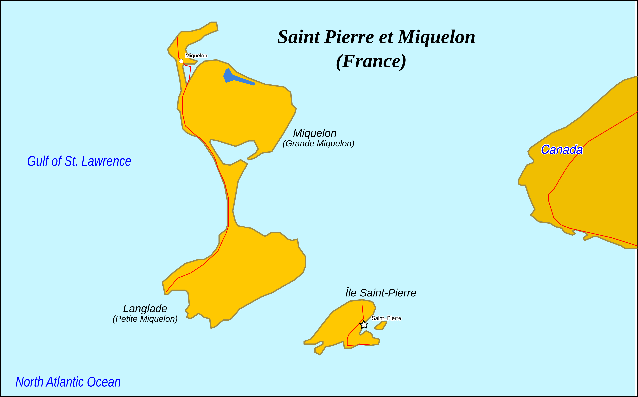
English: Map of Saint Pierre et Miquelon. Information from CIA MAP |
| Date | original unknown |
| Source | outline from PlaniGlobe |
| Author | Planiglobe (outline), RaviC |
| Other versions |
|

Licensing[edit]
This file is licensed under the Creative Commons Attribution 2.5 Generic license.
- You are free:
- to share – to copy, distribute and transmit the work
- to remix – to adapt the work
- Under the following conditions:
- attribution – You must give appropriate credit, provide a link to the license, and indicate if changes were made. You may do so in any reasonable manner, but not in any way that suggests the licensor endorses you or your use.

|
This SVG file contains embedded text that can be translated into your language, using any capable SVG editor, text editor or the SVG Translate tool. For more information see: About translating SVG files. |
File history
Click on a date/time to view the file as it appeared at that time.
| Date/Time | Thumbnail | Dimensions | User | Comment | |
|---|---|---|---|---|---|
| current | 19:10, 16 April 2009 | | 591 × 368 (38 KB) | RaviC (talk | contribs) | {{Information |Description={{en|1=Map of Saint Pierre et Miquelon.}} Information from [http://en.wikipedia.org/wiki/File:Map_of_Saint_Pierre_and_Miquelon.gif CIA MAP] |Source=[http://www.planiglobe.com/omc-bin/omc_cntr?service=map&country=Cayman+Islands o |
You cannot overwrite this file.
File usage on Commons
The following page uses this file:
File usage on other wikis
The following other wikis use this file:
- Usage on als.wikipedia.org