File:Saint Lawrence map-fi.png
Jump to navigation
Jump to search
Size of this preview: 800 × 555 pixels. Other resolutions: 320 × 222 pixels | 640 × 444 pixels | 1,024 × 710 pixels | 1,280 × 888 pixels | 2,560 × 1,775 pixels | 3,425 × 2,375 pixels.
Original file (3,425 × 2,375 pixels, file size: 5.55 MB, MIME type: image/png)
Captions
Captions
Add a one-line explanation of what this file represents
Summary[edit]
| Description |
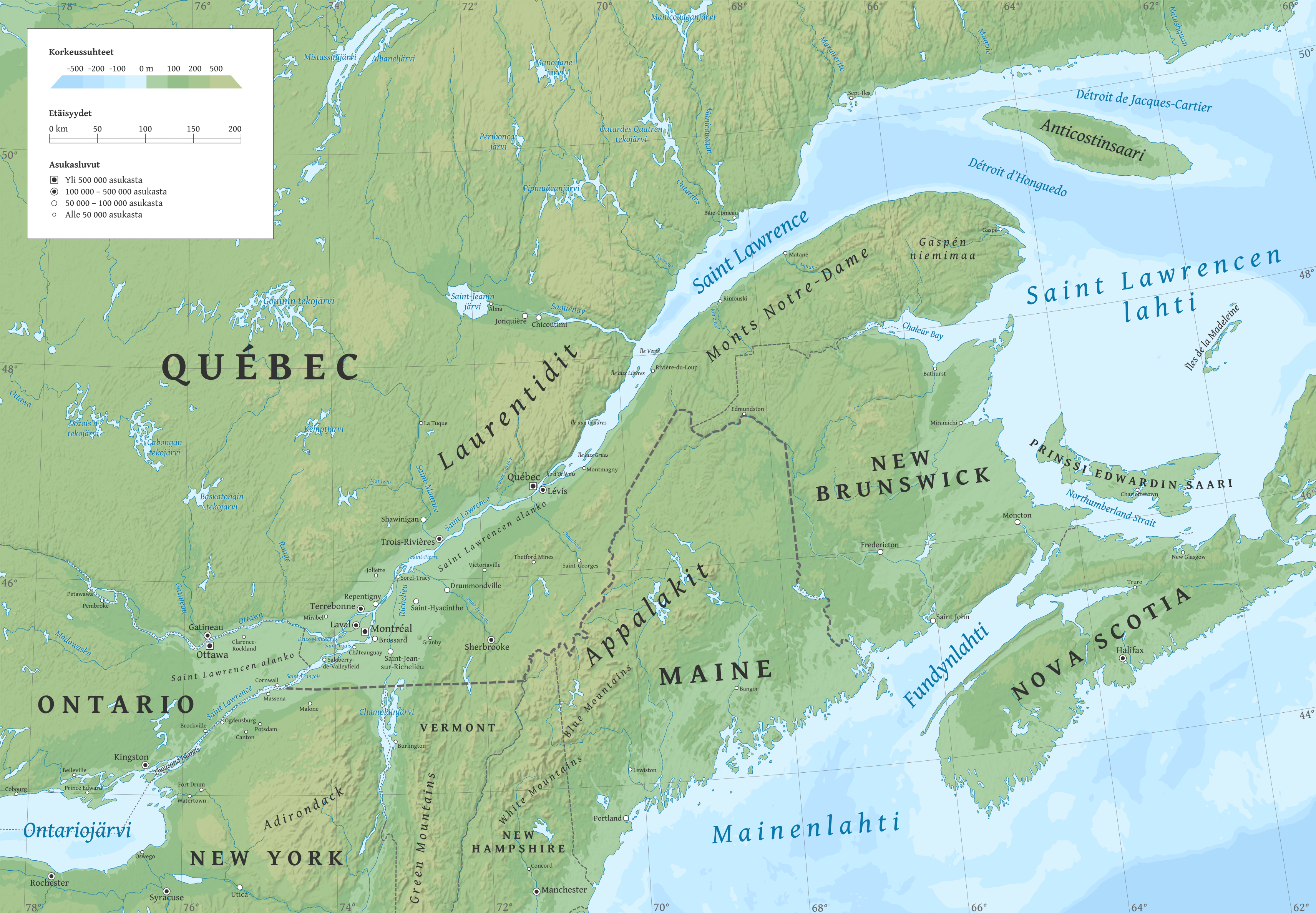
Suomi: Suomenkielinen Saint Lawrencen joen kartta.
English: Map of the Saint Lawrence River in Finnish. |
||
| Date | |||
| Source |
Own work using GRASS GIS, Inkscape and GIMP. Data sources:
|
||
| Author | Halava | ||
| Other versions |
|

Map projection: Universal Transverse Mercator
Typeface: Gentium Book Basic from SIL International
Licensing[edit]
I, the copyright holder of this work, hereby publish it under the following licenses:
This file is licensed under the Creative Commons Attribution-Share Alike 3.0 Unported license.
- You are free:
- to share – to copy, distribute and transmit the work
- to remix – to adapt the work
- Under the following conditions:
- attribution – You must give appropriate credit, provide a link to the license, and indicate if changes were made. You may do so in any reasonable manner, but not in any way that suggests the licensor endorses you or your use.
- share alike – If you remix, transform, or build upon the material, you must distribute your contributions under the same or compatible license as the original.

|
Permission is granted to copy, distribute and/or modify this document under the terms of the GNU Free Documentation License, Version 1.2 or any later version published by the Free Software Foundation; with no Invariant Sections, no Front-Cover Texts, and no Back-Cover Texts. A copy of the license is included in the section entitled GNU Free Documentation License. |
You may select the license of your choice.
File history
Click on a date/time to view the file as it appeared at that time.
| Date/Time | Thumbnail | Dimensions | User | Comment | |
|---|---|---|---|---|---|
| current | 15:13, 14 December 2010 | | 3,425 × 2,375 (5.55 MB) | Halava (talk | contribs) | Small improvements (added labels for towns and mountain ranges) |
| 15:34, 12 December 2010 |  | 3,425 × 2,375 (5.53 MB) | Halava (talk | contribs) | {{Information |Description={{fi|1=Suomenkielinen Saint Lawrencen joen kartta.}} {{en|1=Map of the Saint Lawrence River in Finnish.}} |Source={{own}} |Author=Halava |Date=2010-12-12 |Permission= |other_versions= }} '''Map projection:''' Uni |
You cannot overwrite this file.
File usage on Commons
There are no pages that use this file.
File usage on other wikis
The following other wikis use this file:
- Usage on af.wikipedia.org
- Usage on bn.wikipedia.org
- Usage on es.wikipedia.org
- Usage on fi.wikipedia.org
- Usage on fr.wikipedia.org
- Usage on it.wikipedia.org
- Usage on ja.wikipedia.org
- Usage on pl.wikipedia.org
- Usage on sr.wikipedia.org