File:Sahalie Falls on the east side.jpg

Original file (4,517 × 3,456 pixels, file size: 5.73 MB, MIME type: image/jpeg)
Captions
Captions
Summary[edit]
| Description |
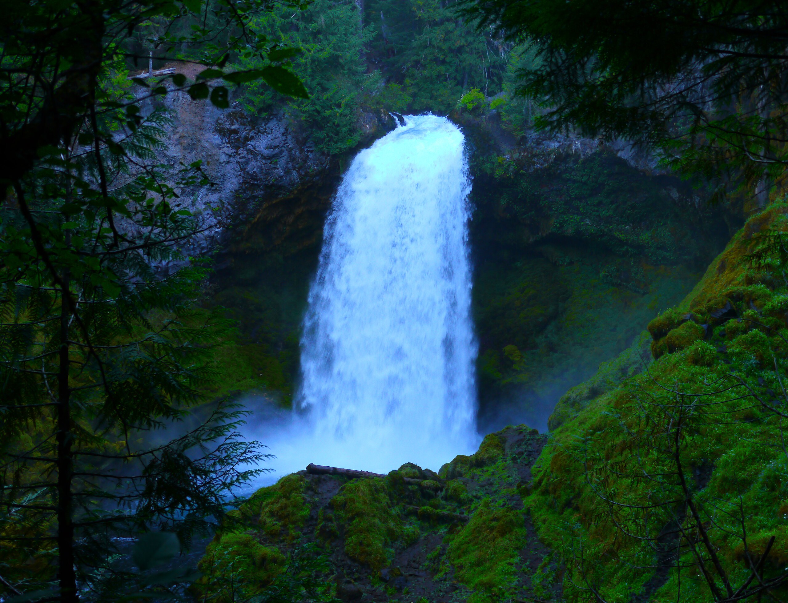
English: Sahalie Falls and Koosah Falls are located along the McKenzie Pass-Santiam Pass and West Cascades National Scenic Byways off Highway 126 in Linn County, Oregon.
The Waterfalls Loop Trail, part of the McKenzie River National Recreation Trail, connects the two waterfalls and offers up close views of the wild McKenzie River. These falls mark the terminus of two thick flows of basaltic andesite lava that dammed Clear Lake and moved into the McKenzie River 3,000 years ago. The results are two breathtaking waterfalls with foaming white water cascades in between. Sahalie (or "Heaven") and Koosah (or "Sky") are Chinook Jargon words - part of a rudimentary trade language that allowed people to exchange news and goods in the area. The Kalapuya, Molalla, Sahaptain and Chinook peoples traveled and traded here, perhaps on their way to obtain obsidian in the high Cascades or to gather huckleberries. Both sites feature parking area, interpretive panels that tell the story of area geology, restrooms and observation points. (www.fs.usda.gov/recarea/willamette/recarea/?recid=4404) |
| Date | |
| Source | https://www.flickr.com/photos/discoveroregon/50357501217/ |
| Author | Rick Obst |
Licensing[edit]
- You are free:
- to share – to copy, distribute and transmit the work
- to remix – to adapt the work
- Under the following conditions:
- attribution – You must give appropriate credit, provide a link to the license, and indicate if changes were made. You may do so in any reasonable manner, but not in any way that suggests the licensor endorses you or your use.
| This image was originally posted to Flickr by Only in Oregon at https://flickr.com/photos/46052415@N08/50357501217. It was reviewed on 23 September 2020 by FlickreviewR 2 and was confirmed to be licensed under the terms of the cc-by-2.0. |
File history
Click on a date/time to view the file as it appeared at that time.
| Date/Time | Thumbnail | Dimensions | User | Comment | |
|---|---|---|---|---|---|
| current | 13:08, 23 September 2020 | | 4,517 × 3,456 (5.73 MB) | RickObst (talk | contribs) | Uploaded a work by Rick Obst from https://www.flickr.com/photos/discoveroregon/50357501217/ with UploadWizard |
You cannot overwrite this file.
File usage on Commons
There are no pages that use this file.