File:Saguaro National Park-situation map.png
Jump to navigation
Jump to search
Size of this preview: 800 × 455 pixels. Other resolutions: 320 × 182 pixels | 640 × 364 pixels | 1,143 × 650 pixels.
Original file (1,143 × 650 pixels, file size: 616 KB, MIME type: image/png)
Captions
Captions
Add a one-line explanation of what this file represents
Summary[edit]
| Camera location | | View this and other nearby images on: OpenStreetMap |
|---|
| Description |
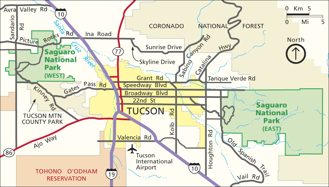
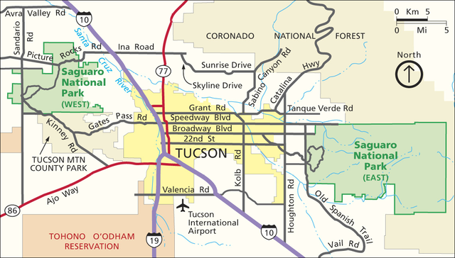
English: Situation map of Saguaro National Park, Arizona, United States.
Français : Carte de localisation du parc national de Saguaro, Arizona, États-Unis. |
| Date | (upload date) |
| Source | U.S. National Park Service |
| Author | U.S. National Park Service, mounted from screenshots and saved in PNG by user:Sting |
| Permission (Reusing this file) |
PD-USGOV-INTERIOR-NPS. |
| Other versions |
|


Licensing[edit]
| This image or media file contains material based on a work of a National Park Service employee, created as part of that person's official duties. As a work of the U.S. federal government, such work is in the public domain in the United States. See the NPS website and NPS copyright policy for more information. |
File history
Click on a date/time to view the file as it appeared at that time.
| Date/Time | Thumbnail | Dimensions | User | Comment | |
|---|---|---|---|---|---|
| current | 16:57, 15 December 2009 | | 1,143 × 650 (616 KB) | Sting (talk | contribs) | == {{int:filedesc}} == {{Location|32|12|52|N|110|55|05|W|scale:300000}}<br/> {{Information |Description={{en|Situation map of Saguaro National Park, Arizona, United States.}} {{fr|Carte de localisation du [[:fr:Parc national |
You cannot overwrite this file.
File usage on Commons
The following 3 pages use this file:
File usage on other wikis
The following other wikis use this file:
- Usage on da.wikipedia.org
- Usage on de.wikipedia.org
- Usage on fr.wikipedia.org
- Usage on pl.wikipedia.org
- Usage on tr.wikipedia.org