File:SR 39.svg

Original file (SVG file, nominally 567 × 2,091 pixels, file size: 2.02 MB)
Captions
Captions
For a version that works, see Image:SR 39.jpg.
| This work has been released into the public domain by its author, SPUI. This applies worldwide. In some countries this may not be legally possible; if so: |
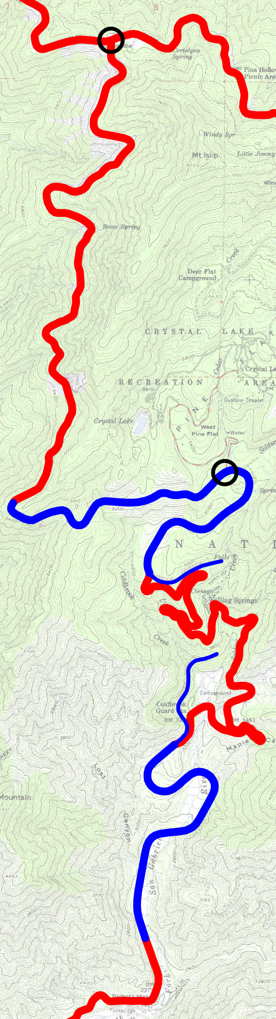
State Route 39 traced on 1972 USGS topos (public domain). Red is older roads; blue was reconstructed ca. 1967. Thinner blue was never completed. Black circles show the extent of the section closed since 1978 due to landslides.
This is not the "Convict Road" that includes the "Bridge to Nowhere" and two tunnels. That is in the next canyon to the east.
File history
Click on a date/time to view the file as it appeared at that time.
| Date/Time | Thumbnail | Dimensions | User | Comment | |
|---|---|---|---|---|---|
| current | 09:25, 20 March 2006 | 567 × 2,091 (2.02 MB) | SPUI~commonswiki (talk | contribs) | smaller | |
| 09:03, 20 March 2006 | 576 × 2,157 (7.17 MB) | SPUI~commonswiki (talk | contribs) | {{spuimap}} en:State Route 39 (California) traced on 1972 USGS topos (public domain). Red is older roads; blue was reconstructed ca. 1967. Thinner blue was never completed. Black circles show the extent of the section closed since 1978 due to landsl |
You cannot overwrite this file.
File usage on Commons
The following 3 pages use this file:
File usage on other wikis
The following other wikis use this file:
- Usage on en.wikipedia.org