File:Rottnest aerial photo 2.jpg
Jump to navigation
Jump to search

Size of this preview: 800 × 600 pixels. Other resolutions: 320 × 240 pixels | 640 × 480 pixels | 1,024 × 768 pixels | 1,280 × 960 pixels | 2,560 × 1,920 pixels.
Original file (2,560 × 1,920 pixels, file size: 5.29 MB, MIME type: image/jpeg)
Captions
Captions
Add a one-line explanation of what this file represents
| Description |
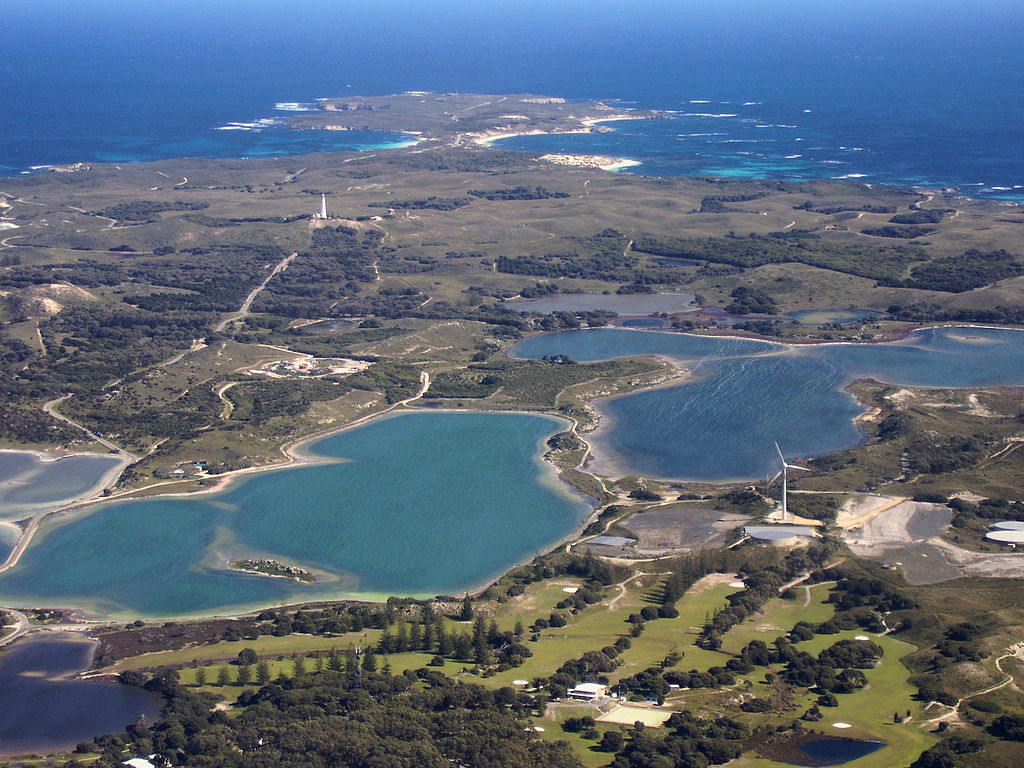
English: Aerial photograph of central Rottnest Island, photographed from above the Thomson Bay settlement, looking west towards Cape Vlamingh. Visible in the foreground are the golf course, wind turbine, Mt Herschell and some salt lakes. |
| Date | |
| Source | Own work |
| Author | Mark |
| Other versions |
.jpg)
Licensing[edit]
I, the copyright holder of this work, hereby publish it under the following license:

|
Permission is granted to copy, distribute and/or modify this document under the terms of the GNU Free Documentation License, Version 1.2 or any later version published by the Free Software Foundation; with no Invariant Sections, no Front-Cover Texts, and no Back-Cover Texts. A copy of the license is included in the section entitled GNU Free Documentation License. |
File history
Click on a date/time to view the file as it appeared at that time.
| Date/Time | Thumbnail | Dimensions | User | Comment | |
|---|---|---|---|---|---|
| current | 11:35, 11 August 2008 | | 2,560 × 1,920 (5.29 MB) | Mark (talk | contribs) | {{Information |Description={{en|1=Aerial photograph of central Rottnest Island, photographed from above the Thomson Bay settlement, looking west towards Cape Vlamingh. Visible in the foreground are the golf course, wind turbine, Mt H |
You cannot overwrite this file.
File usage on Commons
The following page uses this file:
File usage on other wikis
The following other wikis use this file:
- Usage on de.wikipedia.org
- Usage on en.wikipedia.org
- Usage on fr.wikipedia.org
- Usage on gl.wikipedia.org
- Usage on incubator.wikimedia.org
- Usage on nl.wikipedia.org