File:Ropeburn.jpg
Jump to navigation
Jump to search
Size of this preview: 450 × 600 pixels. Other resolutions: 180 × 240 pixels | 600 × 800 pixels.
Original file (600 × 800 pixels, file size: 119 KB, MIME type: image/jpeg)
Captions
Captions
Add a one-line explanation of what this file represents
Summary[edit]
| Description |
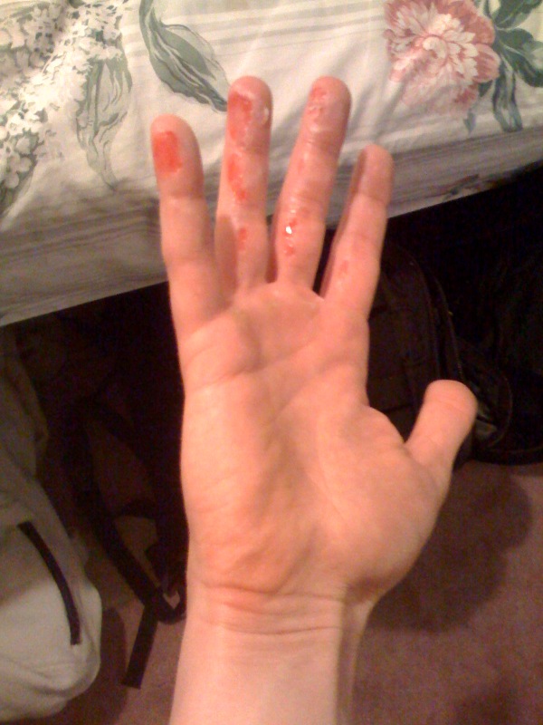
English: Self-captured photograph of a rope burn (friction burn). |
||
| Date | |||
| Source | Self-captured photograph. | ||
| Author | Adam Gould | ||
| Permission (Reusing this file) |
|
| Camera location | | View this and other nearby images on: OpenStreetMap |
|---|
Yaphank, NY.
They can be painful.
File history
Click on a date/time to view the file as it appeared at that time.
| Date/Time | Thumbnail | Dimensions | User | Comment | |
|---|---|---|---|---|---|
| current | 02:05, 24 February 2009 | | 600 × 800 (119 KB) | Nemilar (talk | contribs) | {{Information |Description={{en|1=Self-captured photograph of a rope burn (friction burn).}} |Source=Self-captured photograph. |Author=Adam Gould |Date=2009-02-12 |Permission={{PD-user-en|Jesusjonez}} |other_versions= }} Yaphank, NY. <!--{{ImageUpload|ful |
You cannot overwrite this file.
File usage on Commons
There are no pages that use this file.
File usage on other wikis
The following other wikis use this file:
- Usage on ar.wikipedia.org
- Usage on en.wikipedia.org
- Usage on sr.wikipedia.org
- Usage on vi.wikipedia.org
- Usage on www.wikidata.org