File:Roman Empire.svg
Jump to navigation
Jump to search

Size of this PNG preview of this SVG file: 800 × 554 pixels. Other resolutions: 320 × 222 pixels | 640 × 443 pixels | 1,024 × 709 pixels | 1,280 × 887 pixels | 2,560 × 1,774 pixels | 4,330 × 3,000 pixels.
Original file (SVG file, nominally 4,330 × 3,000 pixels, file size: 6.33 MB)
Captions
Captions
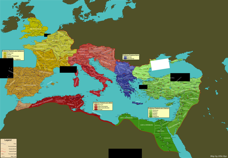
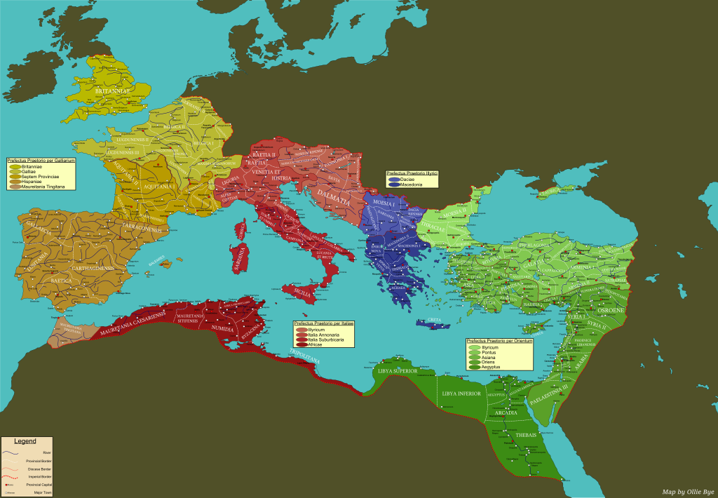
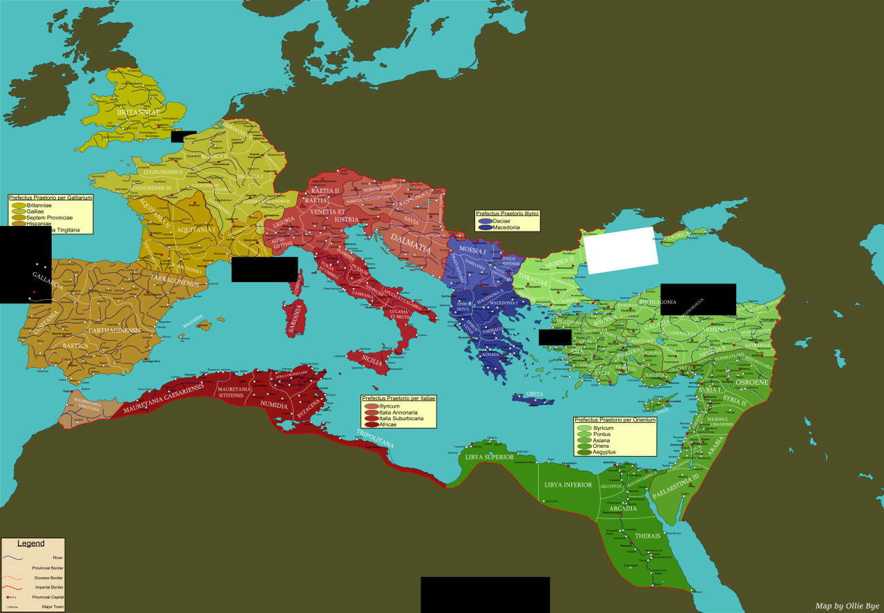
Map of the provinces, diocese and praetorian prefects of the Roman Empire c. 395
Summary[edit]
| Description |
English: A map of the provinces, diocese and praetorian prefects of the Roman Empire c. 395. This map also includes several major towns, as well as provincial capitals and rivers. |
| Date | |
| Source | Own work |
| Author | Ollie Bye |
Licensing[edit]
I, the copyright holder of this work, hereby publish it under the following license:
This file is licensed under the Creative Commons Attribution-Share Alike 4.0 International license.
- You are free:
- to share – to copy, distribute and transmit the work
- to remix – to adapt the work
- Under the following conditions:
- attribution – You must give appropriate credit, provide a link to the license, and indicate if changes were made. You may do so in any reasonable manner, but not in any way that suggests the licensor endorses you or your use.
- share alike – If you remix, transform, or build upon the material, you must distribute your contributions under the same or compatible license as the original.
File history
Click on a date/time to view the file as it appeared at that time.
| Date/Time | Thumbnail | Dimensions | User | Comment | |
|---|---|---|---|---|---|
| current | 14:44, 3 October 2015 | | 4,330 × 3,000 (6.33 MB) | Ollie Bye (talk | contribs) | User created page with UploadWizard |
You cannot overwrite this file.
File usage on Commons
There are no pages that use this file.
File usage on other wikis
The following other wikis use this file:
- Usage on en.wikipedia.org