File:Roissy CDG Landsat.png
Jump to navigation
Jump to search
No higher resolution available.
Roissy_CDG_Landsat.png (461 × 190 pixels, file size: 159 KB, MIME type: image/png)
Captions
Captions
Add a one-line explanation of what this file represents
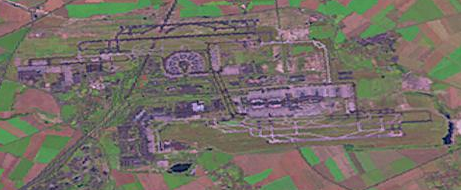
Aéroport Roissy-Charles-de-Gaulle by Landsat
extracted from the uncompressed Image:Paris suburbs Landsat.jpg
This image is a work of the United States National Geospatial-Intelligence Agency or one of its predecessor agencies. As a work of the U.S. federal government, the image is in the public domain.
|
 |
File history
Click on a date/time to view the file as it appeared at that time.
| Date/Time | Thumbnail | Dimensions | User | Comment | |
|---|---|---|---|---|---|
| current | 01:04, 26 October 2005 | 461 × 190 (159 KB) | David.Monniaux (talk | contribs) | Aéroport Roissy-Charles-de-Gaulle by Landsat extracted from the uncompressed Image:Paris suburbs Landsat.jpg {{PD-USGov-military-NGA}} |
You cannot overwrite this file.
File usage on Commons
The following page uses this file: