File:Rockland Ash map.png
Jump to navigation
Jump to search
No higher resolution available.
Rockland_Ash_map.png (283 × 334 pixels, file size: 8 KB, MIME type: image/png)
Captions
Captions
Add a one-line explanation of what this file represents
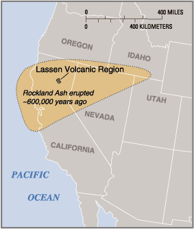
PD USGS image from http://pubs.usgs.gov/fs/2000/fs022-00/
This image is in the public domain in the United States because it only contains materials that originally came from the United States Geological Survey, an agency of the United States Department of the Interior. For more information, see the official USGS copyright policy.
|
File history
Click on a date/time to view the file as it appeared at that time.
| Date/Time | Thumbnail | Dimensions | User | Comment | |
|---|---|---|---|---|---|
| current | 01:44, 25 September 2006 | | 283 × 334 (8 KB) | Mav (talk | contribs) | PD USGS image from http://pubs.usgs.gov/fs/2000/fs022-00/ {{PD-USGov-USGS}} Category:Lassen Volcanic National Park |
You cannot overwrite this file.
File usage on Commons
The following page uses this file:
File usage on other wikis
The following other wikis use this file:
- Usage on fr.wikipedia.org
- Usage on it.wikipedia.org
Categories:
- Volcanism of Lassen Volcanic National Park
- Maps of California
- Maps of Idaho
- Maps of Oregon
- Maps of Nevada
- Maps of Utah
- Maps of Lassen volcano
- Ash distribution maps of historical eruptions in the United States
- Volcanic ash in California
- Pleistocene caldera-forming eruptions
- Mount Tehama
- Pleistocene volcanism of California
- Rockland Tephra
- Rockland Caldera complex