File:Robert Cane turret on Canal Walk, Kilkenny.jpg
Jump to navigation
Jump to search

Size of this preview: 705 × 599 pixels. Other resolutions: 282 × 240 pixels | 565 × 480 pixels | 904 × 768 pixels | 1,205 × 1,024 pixels | 2,409 × 2,048 pixels | 2,880 × 2,448 pixels.
Original file (2,880 × 2,448 pixels, file size: 3.54 MB, MIME type: image/jpeg)
Captions
Captions
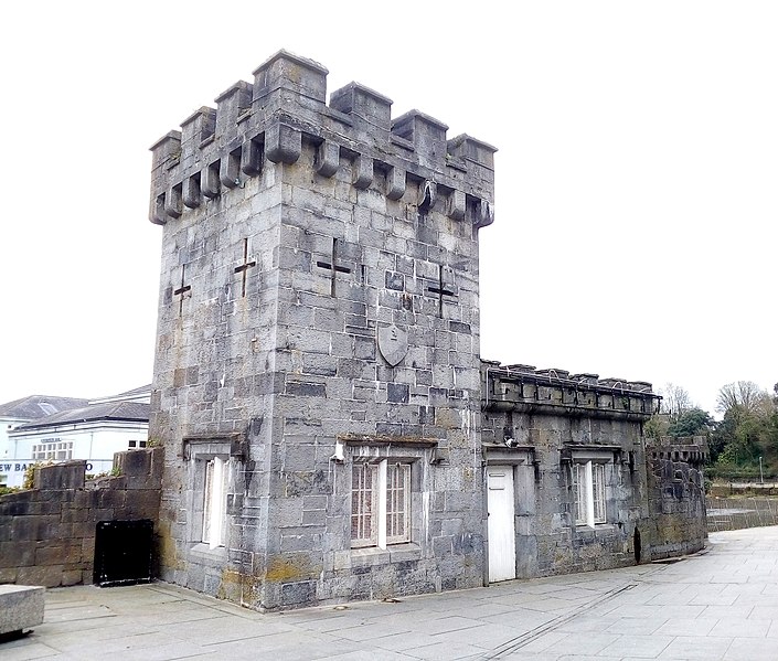
The mock Tudor turret on the Canal Walk in Kilkenny
Summary[edit]
| Description |
English: The turret was paid for by Alderman Robert Cane, M.D., possibly designed by William Robertson. It is vacant as of 2019, but was used as a workshop and other uses in the past. |
||
| Date | |||
| Source | Own work | ||
| Author | A.-K. D. |

| Camera location | | View this and other nearby images on: OpenStreetMap |
|---|
The mock tudor turret on Kilkenny's Canal walk was paid for by Dr Robert Cane, Alderman of the City of Kilkenny. It was possibly designed by William Robertson. It bears a benchmark one of the corners.
Licensing[edit]
I, the copyright holder of this work, hereby publish it under the following license:
This file is licensed under the Creative Commons Attribution-Share Alike 4.0 International license.
- You are free:
- to share – to copy, distribute and transmit the work
- to remix – to adapt the work
- Under the following conditions:
- attribution – You must give appropriate credit, provide a link to the license, and indicate if changes were made. You may do so in any reasonable manner, but not in any way that suggests the licensor endorses you or your use.
- share alike – If you remix, transform, or build upon the material, you must distribute your contributions under the same or compatible license as the original.
File history
Click on a date/time to view the file as it appeared at that time.
| Date/Time | Thumbnail | Dimensions | User | Comment | |
|---|---|---|---|---|---|
| current | 16:19, 16 March 2020 | | 2,880 × 2,448 (3.54 MB) | A.-K. D. (talk | contribs) | Uploaded own work with UploadWizard |
You cannot overwrite this file.
File usage on Commons
There are no pages that use this file.