File:River Gruinard - geograph.org.uk - 1122115.jpg
Jump to navigation
Jump to search
No higher resolution available.
River_Gruinard_-_geograph.org.uk_-_1122115.jpg (640 × 425 pixels, file size: 100 KB, MIME type: image/jpeg)
Captions
Captions
Add a one-line explanation of what this file represents
Summary[edit]
| Description |
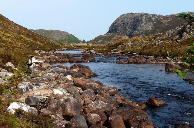
English: River Gruinard Low water conditions here in May compared to one of the other submissions for this stretch of the river. The large flat-topped boulder on the left of the gap through which the water is flowing can be seen in the other image taken looking upstream in much higher water conditions but in the latter case in appears as a flat rock just above water level. Interestingly all three submissions to date show the same tree or trees on the left bank of the river. |
| Date | |
| Source | From geograph.org.uk |
| Author | AlastairG |
| Attribution (required by the license) | AlastairG / River Gruinard / |
| Camera location | | View this and other nearby images on: OpenStreetMap |
|---|
_heading:337.00&language=en)
| Object location | | View this and other nearby images on: OpenStreetMap |
|---|
_heading:337.00&language=en)
Licensing[edit]

|
This image was taken from the Geograph project collection. See this photograph's page on the Geograph website for the photographer's contact details. The copyright on this image is owned by AlastairG and is licensed for reuse under the Creative Commons Attribution-ShareAlike 2.0 license.
|
This file is licensed under the Creative Commons Attribution-Share Alike 2.0 Generic license.
Attribution: AlastairG
- You are free:
- to share – to copy, distribute and transmit the work
- to remix – to adapt the work
- Under the following conditions:
- attribution – You must give appropriate credit, provide a link to the license, and indicate if changes were made. You may do so in any reasonable manner, but not in any way that suggests the licensor endorses you or your use.
- share alike – If you remix, transform, or build upon the material, you must distribute your contributions under the same or compatible license as the original.
File history
Click on a date/time to view the file as it appeared at that time.
| Date/Time | Thumbnail | Dimensions | User | Comment | |
|---|---|---|---|---|---|
| current | 01:23, 25 February 2011 | | 640 × 425 (100 KB) | GeographBot (talk | contribs) | == {{int:filedesc}} == {{Information |description={{en|1=River Gruinard Low water conditions here in May compared to one of the other submissions for this stretch of the river. The large flat-topped boulder on the left of the gap through which the water i |
You cannot overwrite this file.
File usage on Commons
There are no pages that use this file.