File:River-Poddle-2010-02-19c.jpg
Jump to navigation
Jump to search

Size of this preview: 800 × 600 pixels. Other resolutions: 320 × 240 pixels | 640 × 480 pixels | 1,000 × 750 pixels.
Original file (1,000 × 750 pixels, file size: 169 KB, MIME type: image/jpeg)
Captions
Captions
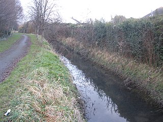
View of the River Poddle in Templeogue, Dublin, Ireland.
Summary[edit]
| Camera location | | View this and other nearby images on: OpenStreetMap |
|---|
| Description |
English: View of the River Poddle, Dublin, where it forms the border between the townlands of Templeogue (left bank, or south) and Whitehall (right bank, or north). The river flows northeast towards the camera (which points southwest) and is about to cross under Templeville Road which is out of sight, just a few metres behind the camera. See also River-Poddle-2010-02-19a.jpg and River-Poddle-2010-02-19b.jpg. |
| Date | |
| Source | Own work |
| Author | User:O'Dea |
| Other versions |
|


Licensing[edit]
I, the copyright holder of this work, hereby publish it under the following license:
This file is licensed under the Creative Commons Attribution-Share Alike 4.0 International license.
Attribution: © O'Dea at Wikimedia Commons, CC BY-SA 4.0
- You are free:
- to share – to copy, distribute and transmit the work
- to remix – to adapt the work
- Under the following conditions:
- attribution – You must give appropriate credit, provide a link to the license, and indicate if changes were made. You may do so in any reasonable manner, but not in any way that suggests the licensor endorses you or your use.
- share alike – If you remix, transform, or build upon the material, you must distribute your contributions under the same or compatible license as the original.
File history
Click on a date/time to view the file as it appeared at that time.
| Date/Time | Thumbnail | Dimensions | User | Comment | |
|---|---|---|---|---|---|
| current | 10:02, 10 July 2010 | | 1,000 × 750 (169 KB) | Spideog (talk | contribs) | {{Information |Description={{en|1=View of the River Poddle, Dublin, a few metres southwest of Templeville Road, prior to flowing under that road. The river is flowing northeast towards the camera, parallel to Glendown Grove.}} |Source={{own}} |Author=[[Us |
You cannot overwrite this file.
File usage on Commons
The following 2 pages use this file:
File usage on other wikis
The following other wikis use this file:
- Usage on gl.wikipedia.org