File:Ribbon Development in Great Britain.jpg
Jump to navigation
Jump to search
Size of this preview: 800 × 599 pixels. Other resolutions: 320 × 240 pixels | 640 × 480 pixels | 1,024 × 767 pixels | 1,280 × 959 pixels.
Original file (1,280 × 959 pixels, file size: 334 KB, MIME type: image/jpeg)
Captions
Captions
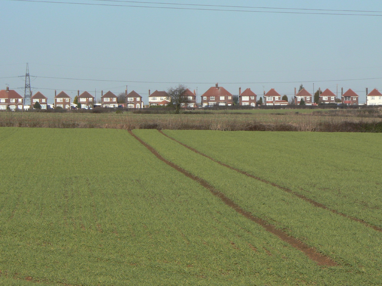
Landscape with Ribbon Development in the background, occurring along a major street.
Summary[edit]
| Description |
English: Example of a Ribbon Development, this one in Great Britain. |
| Date | |
| Source | https://www.geograph.org.uk/photo/1689248 |
| Author | Alan Murray-Rust |
| Attribution (required by the license) | Alan Murray-Rust / Landscape with ribbon development / |
| Camera location | | View this and other nearby images on: OpenStreetMap |
|---|
_heading:22.00&language=en)
| Object location | | View this and other nearby images on: OpenStreetMap |
|---|
_heading:22.00&language=en)
Licensing[edit]

|
This image was taken from the Geograph project collection. See this photograph's page on the Geograph website for the photographer's contact details. The copyright on this image is owned by Alan Murray-Rust and is licensed for reuse under the Creative Commons Attribution-ShareAlike 2.0 license.
|
This file is licensed under the Creative Commons Attribution-Share Alike 2.0 Generic license.
Attribution: Alan Murray-Rust
- You are free:
- to share – to copy, distribute and transmit the work
- to remix – to adapt the work
- Under the following conditions:
- attribution – You must give appropriate credit, provide a link to the license, and indicate if changes were made. You may do so in any reasonable manner, but not in any way that suggests the licensor endorses you or your use.
- share alike – If you remix, transform, or build upon the material, you must distribute your contributions under the same or compatible license as the original.
File history
Click on a date/time to view the file as it appeared at that time.
| Date/Time | Thumbnail | Dimensions | User | Comment | |
|---|---|---|---|---|---|
| current | 13:53, 1 November 2021 | | 1,280 × 959 (334 KB) | Bjh21 (talk | contribs) | Replaced with the highest-resolution version that Geograph has |
| 21:07, 31 October 2021 |  | 640 × 480 (63 KB) | Chicagotransitplanner (talk | contribs) | Uploaded a work by Alan Murray-Rust from https://www.geograph.org.uk/photo/1689248 with UploadWizard |
You cannot overwrite this file.
File usage on Commons
There are no pages that use this file.