File:Reliefkarte Vereinigtes Königreich.png
Jump to navigation
Jump to search

Size of this preview: 378 × 599 pixels. Other resolutions: 151 × 240 pixels | 303 × 480 pixels | 484 × 768 pixels | 646 × 1,024 pixels | 1,292 × 2,048 pixels | 2,825 × 4,478 pixels.
Original file (2,825 × 4,478 pixels, file size: 7.79 MB, MIME type: image/png)
Captions
Captions
Add a one-line explanation of what this file represents
Summary[edit]
| Description |
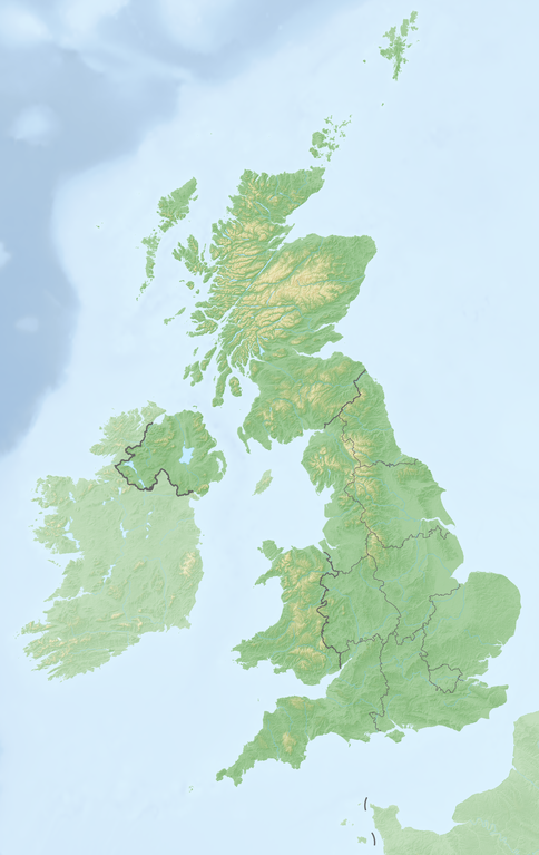
Deutsch: Reliefkarte Vereinigtes_Königreich
Topographischer Hintergrund: NASA Shuttle Radar Topography Mission (public domain). SRTM3 v.2. |
||||||||
| Date | |||||||||
| Source | Own work | ||||||||
| Author | Tschubby | ||||||||
| Permission (Reusing this file) |
I, the copyright holder of this work, hereby publish it under the following licenses:
This file is licensed under the Creative Commons Attribution-Share Alike 2.5 Generic, 2.0 Generic and 1.0 Generic license.
You may select the license of your choice. |

File history
Click on a date/time to view the file as it appeared at that time.
| Date/Time | Thumbnail | Dimensions | User | Comment | |
|---|---|---|---|---|---|
| current | 10:36, 21 May 2018 | | 2,825 × 4,478 (7.79 MB) | Tschubby (talk | contribs) | {{Information |description= |source= |date= |author= |permission= |other versions= }} |
| 10:19, 21 May 2018 |  | 2,826 × 4,479 (7.79 MB) | Tschubby (talk | contribs) | == {{int:filedesc}} == {{Information |Description= {{de| Reliefkarte Vereinigtes_Königreich}} Topographischer Hintergrund: [http://www2.jpl.nasa.gov/srtm NASA Shuttle Radar Topography Mission] (public domain). SRTM3 v.2.<br /> Grenzen: Spain location map.svg |Source={{own}} |Date= 2018-05-21 |Author= Tschubby |Permission= {{self|GFDL|Cc-by-sa-3.0-migrated|Cc-by-sa-2.5,2.0,1.0}} |other_versions= }} [[Category:Location maps of the United K... |
You cannot overwrite this file.
File usage on Commons
There are no pages that use this file.
File usage on other wikis
The following other wikis use this file:
- Usage on bg.wikipedia.org
- Usage on de.wikipedia.org
- Großbritannien (Insel)
- Vereinigtes Königreich
- Kanalinseln
- Irische See
- MSF (Zeitzeichensender)
- GBZ (Rufzeichen)
- Sender Lisnagarvey
- Nordkanal (Meerenge)
- Bristolkanal
- Vorlage:Positionskarte Vereinigtes Königreich
- Vorlage:Positionskarte Schottland
- Benutzer:Wiki surfer bcr/Baustellen
- Vorlage:Infobox Burg
- Shepperton
- St.-Georgs-Kanal
- Vorlage:Infobox Burg/Doku
- Vorlage:Positionskarte Nordirland
- Vorlage:Positionskarte England
- Liste der Kernreaktoren im Vereinigten Königreich
- Kategorie:Rennstrecke im Vereinigten Königreich
- Wikipedia:Kartenwerkstatt/Positionskarten/Europa
- Vorlage:Positionskarte Isle of Man
- Vorlage:Positionskarte Wales
- Vorlage:Positionskarte Kanalinseln
- St Donat’s Castle
- Vorlage:Infobox Wasserfall
- Vorlage:Infobox Wasserfall/Doku
- Diskussion:Box Tunnel
- Benutzer:Haigst-Mann/Geschichte DT SW
- Vorlage:Positionskarte Kernkraftwerke im Vereinigten Königreich
- Vorlage:Positionskarte Städte im Vereinigten Königreich
- Britische Formel-4-Meisterschaft 2015
- Carter Bar
- Douglas Tower
- Benutzer:Altkatholik62/Wirral Peninsula
- Liste von Kraftwerken im Vereinigten Königreich
View more global usage of this file.