File:Reliefkarte Ukraine.png
Jump to navigation
Jump to search

Size of this preview: 800 × 544 pixels. Other resolutions: 320 × 217 pixels | 640 × 435 pixels | 1,024 × 696 pixels | 1,280 × 870 pixels | 2,876 × 1,954 pixels.
Original file (2,876 × 1,954 pixels, file size: 8 MB, MIME type: image/png)
Captions
Captions
Add a one-line explanation of what this file represents
Summary[edit]
| Description |
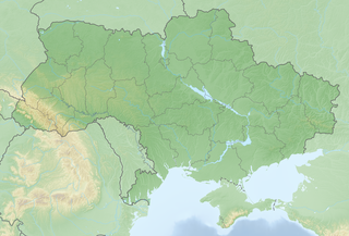
Deutsch: Reliefkarte Ukraine
Topographischer Hintergrund: NASA Shuttle Radar Topography Mission (public domain). SRTM3 v.2.
|
||||||||||||
| Date | |||||||||||||
| Source | Own work | ||||||||||||
| Author | Tschubby | ||||||||||||
| Permission (Reusing this file) |
I, the copyright holder of this work, hereby publish it under the following licenses:
This file is licensed under the Creative Commons Attribution-Share Alike 2.5 Generic, 2.0 Generic and 1.0 Generic license.
You may select the license of your choice. |
||||||||||||

File history
Click on a date/time to view the file as it appeared at that time.
| Date/Time | Thumbnail | Dimensions | User | Comment | |
|---|---|---|---|---|---|
| current | 21:49, 9 May 2018 | | 2,876 × 1,954 (8 MB) | Tschubby (talk | contribs) | == {{int:filedesc}} == {{Information |Description= {{de| Reliefkarte Ukraine}} Topographischer Hintergrund: [http://www2.jpl.nasa.gov/srtm NASA Shuttle Radar Topography Mission] (public domain). SRTM3 v.2. |Source={{own}} |Date= 2018-05-09 |Author= Tschubby |Permission= {{self|GFDL|Cc-by-sa-3.0-migrated|Cc-by-sa-2.5,2.0,1.0}} |other_versions= }} Category:Location maps of Ukraine Category:Physical maps of Ukraine |
You cannot overwrite this file.
File usage on Commons
There are no pages that use this file.
File usage on other wikis
The following other wikis use this file:
- Usage on arz.wikipedia.org
- Usage on cs.wikipedia.org
- Usage on de.wikipedia.org
- Usage on fr.wikipedia.org
- Mer d'Azov
- Kiev
- Crimée
- Bataille de Koursk
- Bataille d'Inkerman
- Bataille de Balaklava
- Lviv
- Dnipro
- Odessa
- Kalouch
- Liste des villes d'Ukraine par subdivisions
- Liste des villes d'Ukraine
- Île des Serpents
- Bataille de Poltava
- Poltava
- Donetsk
- Oujhorod
- Kharkiv
- Zaporijjia
- Massacre de Babi Yar
- Kadiïvka
- Tchernobyl
- Bilhorod-Dnistrovskyï
- Kherson
- Belz (Ukraine)
- Berdytchiv
- Loutsk
- Tcherkassy
- Mykolaïv
- Marioupol
- Soumy
- Bataille de Khotin (1673)
- Kremenets
- Tchernivtsi
- Kortelisy
- Izmaïl
- Kryvyï Rih
- Vinnytsia
- Kilia
- Khotyn
- Bataille de Lemberg
- Starobilsk
- Hoverla
- Centrale nucléaire de Tchernobyl
- Centrale nucléaire de Zaporijjia
- Baie d'Arabat
View more global usage of this file.