File:Regions of Europe Map.png
Jump to navigation
Jump to search
Size of this preview: 800 × 531 pixels. Other resolutions: 320 × 212 pixels | 640 × 425 pixels | 1,070 × 710 pixels.
Original file (1,070 × 710 pixels, file size: 319 KB, MIME type: image/png)
Captions
Captions
Add a one-line explanation of what this file represents
Summary[edit]
| Description |
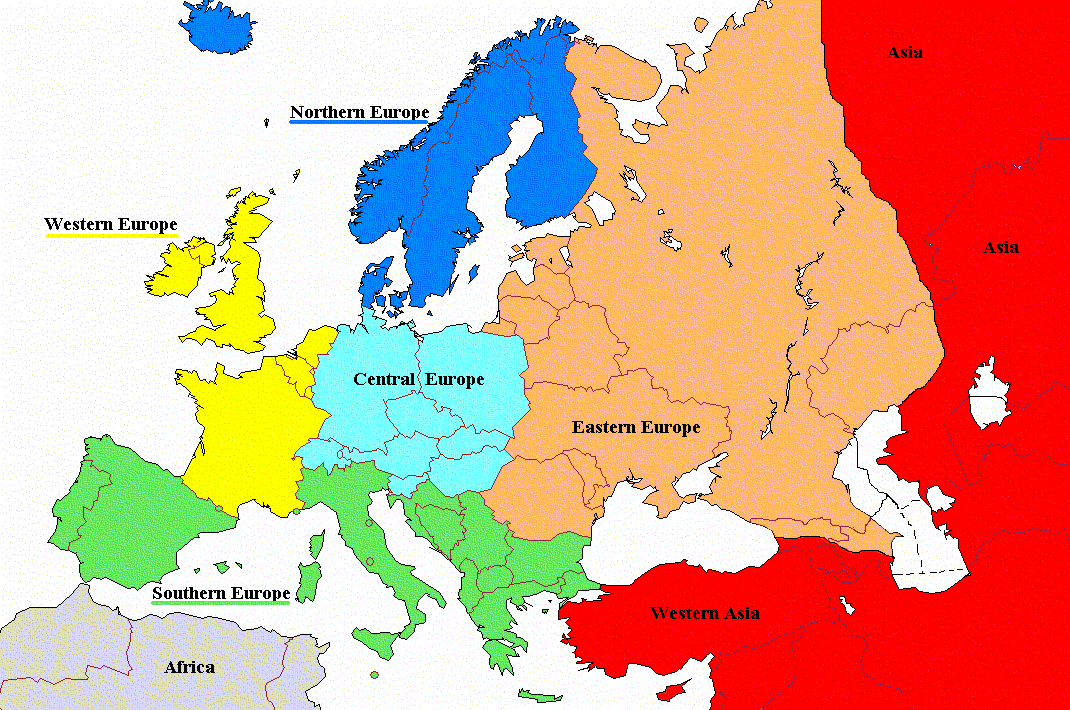
English: Regions of Europe with labels and corrected coloring |
| Date | |
| Source | File:Regions_of_Europe_Map.png |
| Author | Koyos |
| Other versions |
|

Licensing[edit]
| I, the copyright holder of this work, release this work into the public domain. This applies worldwide. In some countries this may not be legally possible; if so: I grant anyone the right to use this work for any purpose, without any conditions, unless such conditions are required by law. |
File history
Click on a date/time to view the file as it appeared at that time.
| Date/Time | Thumbnail | Dimensions | User | Comment | |
|---|---|---|---|---|---|
| current | 10:06, 19 August 2022 | | 1,070 × 710 (319 KB) | Рагин1987 (talk | contribs) | Cyprus shaded |
| 06:01, 28 November 2011 |  | 1,070 × 710 (171 KB) | DerFreischutz (talk | contribs) | Changed color according to the boundary. Everything above the border is Eastern Europe. | |
| 09:48, 3 February 2009 |  | 1,070 × 710 (150 KB) | Koyos (talk | contribs) | reverting geographically inaccurate color coding | |
| 10:40, 18 July 2008 |  | 1,070 × 710 (57 KB) | Aegean Boy~commonswiki (talk | contribs) | {{Information |Description= |Source= |Date= |Author= |Permission= |other_versions= }} | |
| 09:29, 23 August 2006 |  | 1,070 × 710 (150 KB) | Aongus (talk | contribs) | {{Information |Description=Regions of Europe |Permission= {{PD}} }} |
You cannot overwrite this file.
File usage on Commons
The following 3 pages use this file:
File usage on other wikis
The following other wikis use this file:
- Usage on af.wiktionary.org
- Usage on cdo.wikipedia.org
- Usage on de.wiktionary.org
- Usage on es.wikipedia.org
- Usage on nl.wiktionary.org
- Usage on sh.wikipedia.org
- Usage on sl.wiktionary.org
- Usage on sq.wikipedia.org
- Usage on sr.wikipedia.org