File:Regionmulhousiennesatellite.png
Jump to navigation
Jump to search
Size of this preview: 800 × 518 pixels. Other resolutions: 320 × 207 pixels | 640 × 415 pixels | 880 × 570 pixels.
Original file (880 × 570 pixels, file size: 2.57 MB, MIME type: image/png)
Captions
Captions
Add a one-line explanation of what this file represents
Summary[edit]
| Description |
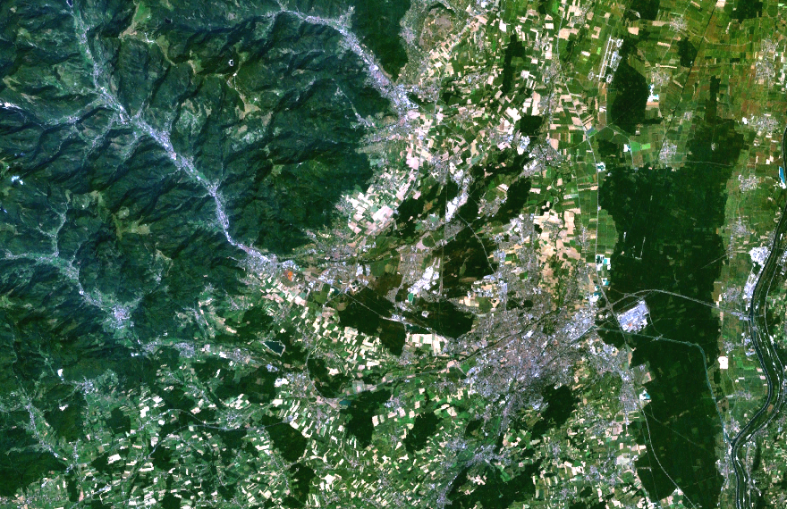
English: satellite picture of Mulhouse
Français : image satellite de la région mulhousienne |
| Source | NASA |
| Author | NASA |
Licensing[edit]
| This file is in the public domain in the United States because it was solely created by NASA. NASA copyright policy states that "NASA material is not protected by copyright unless noted". (See Template:PD-USGov, NASA copyright policy page or JPL Image Use Policy.) | ||
 |
Warnings:
|
File history
Click on a date/time to view the file as it appeared at that time.
| Date/Time | Thumbnail | Dimensions | User | Comment | |
|---|---|---|---|---|---|
| current | 15:29, 8 October 2009 | | 880 × 570 (2.57 MB) | Monsieur Fou (talk | contribs) | modification contraste/luminosité |
| 19:23, 16 April 2009 |  | 880 × 570 (2.46 MB) | Monsieur Fou (talk | contribs) | {{Information |Description={{en|1=satellite picture of Mulhouse}} {{fr|1=image satellite de la région mulhousienne}} |Source=NASA |Author=NASA |Date= |Permission=domaine public |other_versions= }} <!--{{ImageUpload|full}}--> [[Category:Satellite picture | |
| 19:22, 16 April 2009 |  | 880 × 570 (2.46 MB) | Monsieur Fou (talk | contribs) | {{Information |Description={{en|1=satellite picture of Mulhouse}} {{fr|1=image satellite de la région mulhousienne}} |Source=NASA |Author=NASA |Date= |Permission= |other_versions= }} <!--{{ImageUpload|full}}--> Category:Satellite pictures of France |
You cannot overwrite this file.
File usage on Commons
There are no pages that use this file.
File usage on other wikis
The following other wikis use this file:
- Usage on fr.wikipedia.org