File:Redwood City port aerial view.jpg
Jump to navigation
Jump to search

Size of this preview: 800 × 533 pixels. Other resolutions: 320 × 213 pixels | 640 × 427 pixels | 1,024 × 683 pixels | 1,500 × 1,000 pixels.
Original file (1,500 × 1,000 pixels, file size: 853 KB, MIME type: image/jpeg)
Captions
Captions
Add a one-line explanation of what this file represents
Summary[edit]
| Camera location | | View this and other nearby images on: OpenStreetMap |
|---|
| Description |
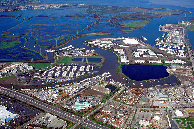
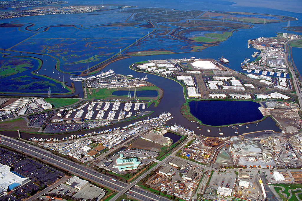
English: Aerial view of the port of Redwood City in San Mateo County, California, USA. The major deepwater port is visible at the far right in the photograph. Redwood Creek angles across the picture from lower left to upper right, forming the port and emptying into lower San Francisco Bay at the top. Corkscrew Slough winds across the wetlands of Bair Island at the top of the picture. View is to the northeast. |
|||
| Date | not specified or unknown | |||
| Source |
U.S. Army Corps of Engineers Digital Visual Library Image page Image description page Digital Visual Library home page |
|||
| Author | U.S. Army Corps of Engineers, photographer not specified or unknown | |||
| Permission (Reusing this file) |
|
File history
Click on a date/time to view the file as it appeared at that time.
| Date/Time | Thumbnail | Dimensions | User | Comment | |
|---|---|---|---|---|---|
| current | 00:41, 5 May 2007 | | 1,500 × 1,000 (853 KB) | DanMS (talk | contribs) | {{Information | Description = {{en|Aerial view of the port of Redwood City in San Mateo County, California, USA. The major deepwater port is visible at the far right in the photograph. Redwood Creek angles across the picture from lower left to upper ri |
You cannot overwrite this file.
File usage on Commons
The following 3 pages use this file:
File usage on other wikis
The following other wikis use this file:
- Usage on en.wikipedia.org
- Portal:San Francisco Bay Area/Selected picture/Archive
- Portal:San Francisco Bay Area/Did you know/Archive
- Port of Redwood City
- Redwood Creek (San Mateo County)
- Portal:California/Selected picture/4
- Portal:California/Selected picture/Archives
- Portal:San Francisco Bay Area/Selected picture/61
- User:Mercurywoodrose/SFBA galleries
- Portal:San Francisco Bay Area/Did you know/52
- Usage on es.wikipedia.org
- Usage on fi.wikipedia.org
- Usage on ja.wikipedia.org
- Usage on ml.wikipedia.org
- Usage on oc.wikipedia.org
- Usage on ru.wikipedia.org
- Usage on ur.wikipedia.org
- Usage on www.wikidata.org