File:Rashi map of Israel.jpg
Original file (4,774 × 6,215 pixels, file size: 3.29 MB, MIME type: image/jpeg)
Captions
Captions
Summary[edit]
| Title |
Angliae, Scotiae, Et Hiberniae, Sive Britannicar: Insularum Descriptio [cartographic material]. |
|||||||||||||||||||||||
| Description |
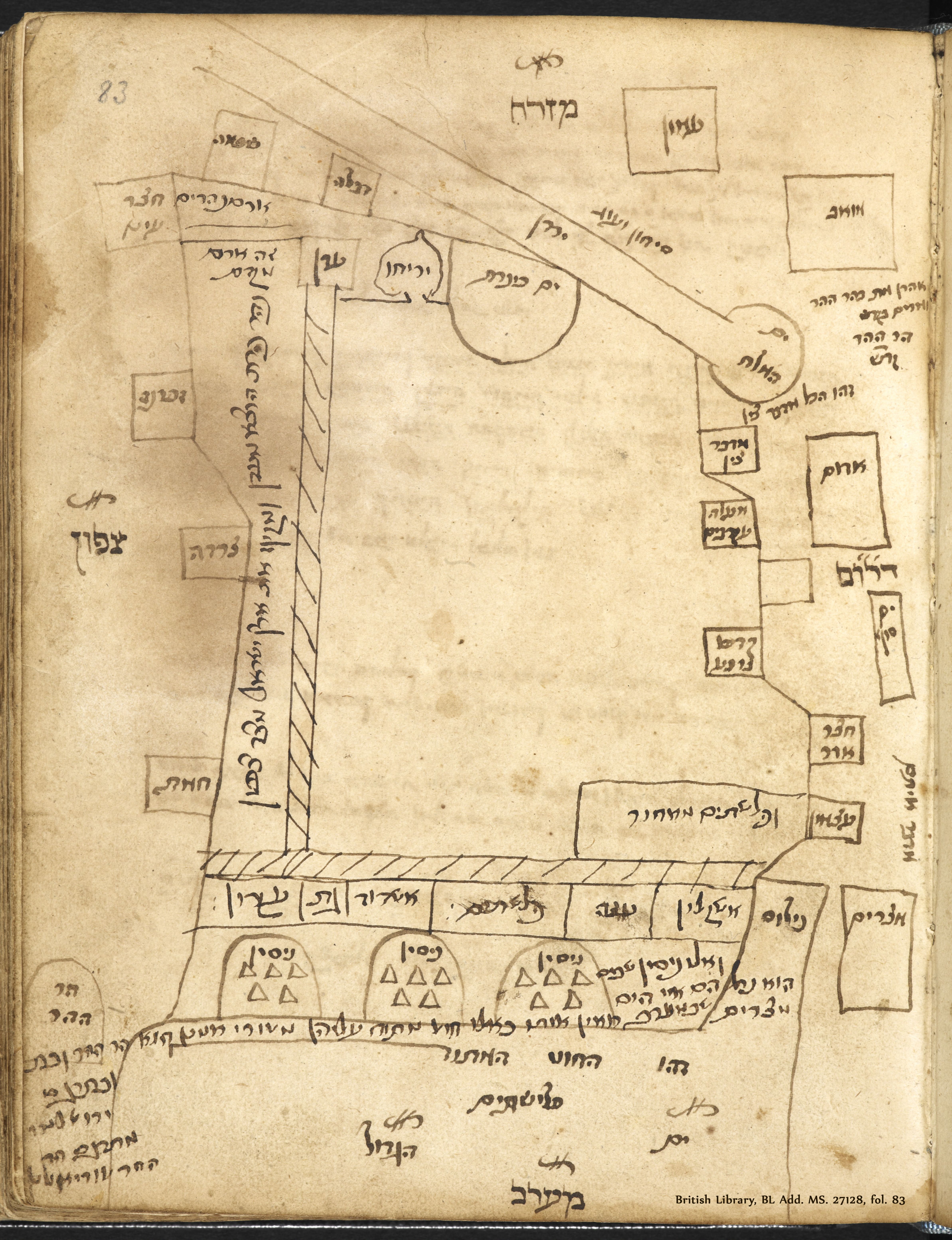
English: Map of Eretz Israel created by Rashi, Digital image of the original in The British Library, BL Add. MS. 27128, fol. 83.
The British Library London England Add. 27128, fol. 83.
עברית: מפת ארץ ישראל לפי רש"י, סריקה של המפה שנמצאת בספרייה הבריטית, BL Add. MS. 27128, fol. 83 |
|||||||||||||||||||||||
| Date | unknown | |||||||||||||||||||||||
| Source | National Library of Israel | |||||||||||||||||||||||
| Creator |
|
|||||||||||||||||||||||
| Credit line | אוסף המפות ע"ש ערן לאור | |||||||||||||||||||||||
| Georeferencing | If inappropriate please set warp_status = skip to hide. | |||||||||||||||||||||||
| Archival data | ||||||||||||||||||||||||
| Collection |
|
|||||||||||||||||||||||
| Dimensions | 376x500x540 mm | |||||||||||||||||||||||

Licensing[edit]
|
This is a faithful photographic reproduction of a two-dimensional, public domain work of art. The work of art itself is in the public domain for the following reason:
The official position taken by the Wikimedia Foundation is that "faithful reproductions of two-dimensional public domain works of art are public domain".
This photographic reproduction is therefore also considered to be in the public domain in the United States. In other jurisdictions, re-use of this content may be restricted; see Reuse of PD-Art photographs for details. | ||||
File history
Click on a date/time to view the file as it appeared at that time.
| Date/Time | Thumbnail | Dimensions | User | Comment | |
|---|---|---|---|---|---|
| current | 11:58, 21 July 2022 | | 4,774 × 6,215 (3.29 MB) | Shimon.tre (talk | contribs) | == {{int:filedesc}} == {{map |Title=Angliae, Scotiae, Et Hiberniae, Sive Britannicar: Insularum Descriptio [cartographic material]. |Description= {{en|1=Map of Eretz Israel created by Rashi, Digital image of the original in The British Library, BL Add. MS. 27128, fol. 83. The British Library London England Add. 27128, fol. 83.}} {{he|1=מפת ארץ ישראל לפי רש"י, סריקה של המפה שנמצאת בספרייה הבריטית, BL Add. MS. 27128, fol. 83 }} |Dimensions = 376x500x540 mm |Source=[https://www.nli.org.il/he/ma... |
You cannot overwrite this file.
File usage on Commons
There are no pages that use this file.
File usage on other wikis
The following other wikis use this file:
- Usage on he.wikipedia.org