File:Rannerdale Knotts (2) - geograph.org.uk - 690519.jpg
Jump to navigation
Jump to search
No higher resolution available.
Rannerdale_Knotts_(2)_-_geograph.org.uk_-_690519.jpg (640 × 427 pixels, file size: 232 KB, MIME type: image/jpeg)
Captions
Captions
Add a one-line explanation of what this file represents
Summary[edit]
_-_geograph.org.uk_-_690519.jpg&action=edit§ion=1)
| Description |
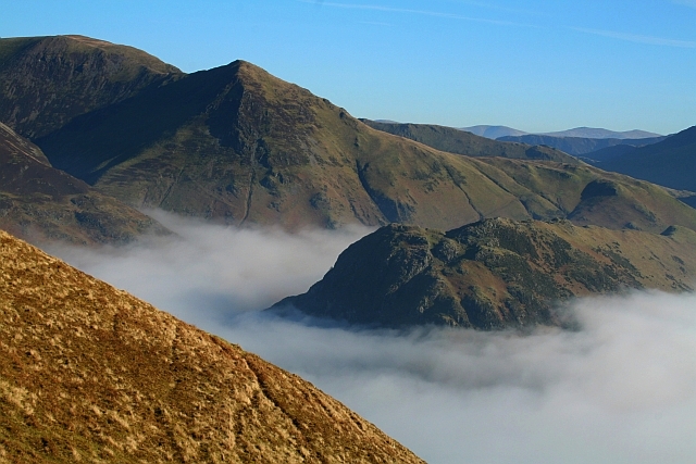
English: Rannerdale Knotts (2) Seen during a day long temperature inversion from the southern end of Mellbreak. The pyramidical fell beyond and to the left is Whiteless Pike with Wandope beyond that taking the eye towards the top left corner of the pic. Crummock Water would normally be visible in the bottom right. |
| Date | |
| Source | From geograph.org.uk |
| Author | Steve Partridge |
| Attribution (required by the license) | Steve Partridge / Rannerdale Knotts (2) / |
| Camera location | | View this and other nearby images on: OpenStreetMap |
|---|
_-_geograph.org.uk_-_690519.jpg¶ms=054.551849_N_-003.318180_E_globe:Earth_type:camera_source:geograph-osgb36(NY1483818199)_heading:90.00&language=en)
| Object location | | View this and other nearby images on: OpenStreetMap |
|---|
_-_geograph.org.uk_-_690519.jpg¶ms=054.553500_N_-003.290000_E_globe:Earth_class:object_type:object_source:geograph-osgb36(NY166183)_heading:90.00&language=en)
Licensing[edit]
_-_geograph.org.uk_-_690519.jpg&action=edit§ion=2)

|
This image was taken from the Geograph project collection. See this photograph's page on the Geograph website for the photographer's contact details. The copyright on this image is owned by Steve Partridge and is licensed for reuse under the Creative Commons Attribution-ShareAlike 2.0 license.
|
This file is licensed under the Creative Commons Attribution-Share Alike 2.0 Generic license.
Attribution: Steve Partridge
- You are free:
- to share – to copy, distribute and transmit the work
- to remix – to adapt the work
- Under the following conditions:
- attribution – You must give appropriate credit, provide a link to the license, and indicate if changes were made. You may do so in any reasonable manner, but not in any way that suggests the licensor endorses you or your use.
- share alike – If you remix, transform, or build upon the material, you must distribute your contributions under the same or compatible license as the original.
File history
Click on a date/time to view the file as it appeared at that time.
| Date/Time | Thumbnail | Dimensions | User | Comment | |
|---|---|---|---|---|---|
| current | 05:50, 8 February 2011 | | 640 × 427 (232 KB) | GeographBot (talk | contribs) | == {{int:filedesc}} == {{Information |description={{en|1=Rannerdale Knotts (2) Seen during a day long temperature inversion from the southern end of Mellbreak. The pyramidical fell beyond and to the left is Whiteless Pike with Wandope beyond that taking |
You cannot overwrite this file.
File usage on Commons
There are no pages that use this file.
_-_geograph.org.uk_-_690519.jpg&oldid=726344622)