File:Railways of New Brunswick map-fr.svg
Jump to navigation
Jump to search

Size of this PNG preview of this SVG file: 610 × 600 pixels. Other resolutions: 244 × 240 pixels | 488 × 480 pixels | 781 × 768 pixels | 1,042 × 1,024 pixels | 2,083 × 2,048 pixels | 2,237 × 2,199 pixels.
Original file (SVG file, nominally 2,237 × 2,199 pixels, file size: 2.72 MB)
Captions
Captions
Add a one-line explanation of what this file represents
Summary[edit]
| Description |
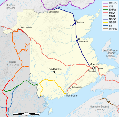
English: Map of railways companies of New Brunswick, Canada, with relief. French version.
Equirectangular projection, WGS84 datum
Geographic limits of the map:
Français : Carte des compagnies de chemins de fer du Nouveau-Brunswick, Canada, avec le relief. Version en français.
Projection équirectangulaire, système géodésique WGS84.
Limites géographiques de la carte :
|
| Date | (UTC) |
| Source |
Own work. English: .
Français : .
|
| Author | Sémhur (talk) |
| Other versions | |
| Attribution (required by the license) | © Sémhur / Wikimedia Commons / |
| SVG | W3C-validity not checked. |
| Graphic Lab |
| Camera location | | View this and other nearby images on: OpenStreetMap |
|---|
Licensing[edit]
I, the copyright holder of this work, hereby publish it under the following licenses:
| Copyleft: This work of art is free; you can redistribute it and/or modify it according to terms of the Free Art License. You will find a specimen of this license on the Copyleft Attitude site as well as on other sites. |
This file is licensed under the Creative Commons Attribution-Share Alike Attribution-Share Alike 4.0 International, 3.0 Unported, 2.5 Generic, 2.0 Generic and 1.0 Generic license.
- You are free:
- to share – to copy, distribute and transmit the work
- to remix – to adapt the work
- Under the following conditions:
- attribution – You must give appropriate credit, provide a link to the license, and indicate if changes were made. You may do so in any reasonable manner, but not in any way that suggests the licensor endorses you or your use.
- share alike – If you remix, transform, or build upon the material, you must distribute your contributions under the same or compatible license as the original.
You may select the license of your choice.
File history
Click on a date/time to view the file as it appeared at that time.
| Date/Time | Thumbnail | Dimensions | User | Comment | |
|---|---|---|---|---|---|
| current | 09:09, 30 May 2014 | | 2,237 × 2,199 (2.72 MB) | Sémhur (talk | contribs) | Valid SVG |
| 15:08, 21 October 2011 |  | 2,237 × 2,199 (2.72 MB) | Sémhur (talk | contribs) | == {{int:filedesc}} == {{Information |Description={{Multilingual description |en=Map of railways companies of en:New Brunswick, Canada, with relief. French version. Equirectangular projection, WGS84 datum *Standard meridian: 66° 15' W *True scale |
You cannot overwrite this file.
File usage on Commons
There are no pages that use this file.
File usage on other wikis
The following other wikis use this file: