File:Quellsumpf Kesselbronn 5.jpg
Original file (5,184 × 3,888 pixels, file size: 22.12 MB, MIME type: image/jpeg)
Captions
Captions
Summary[edit]
| Description |
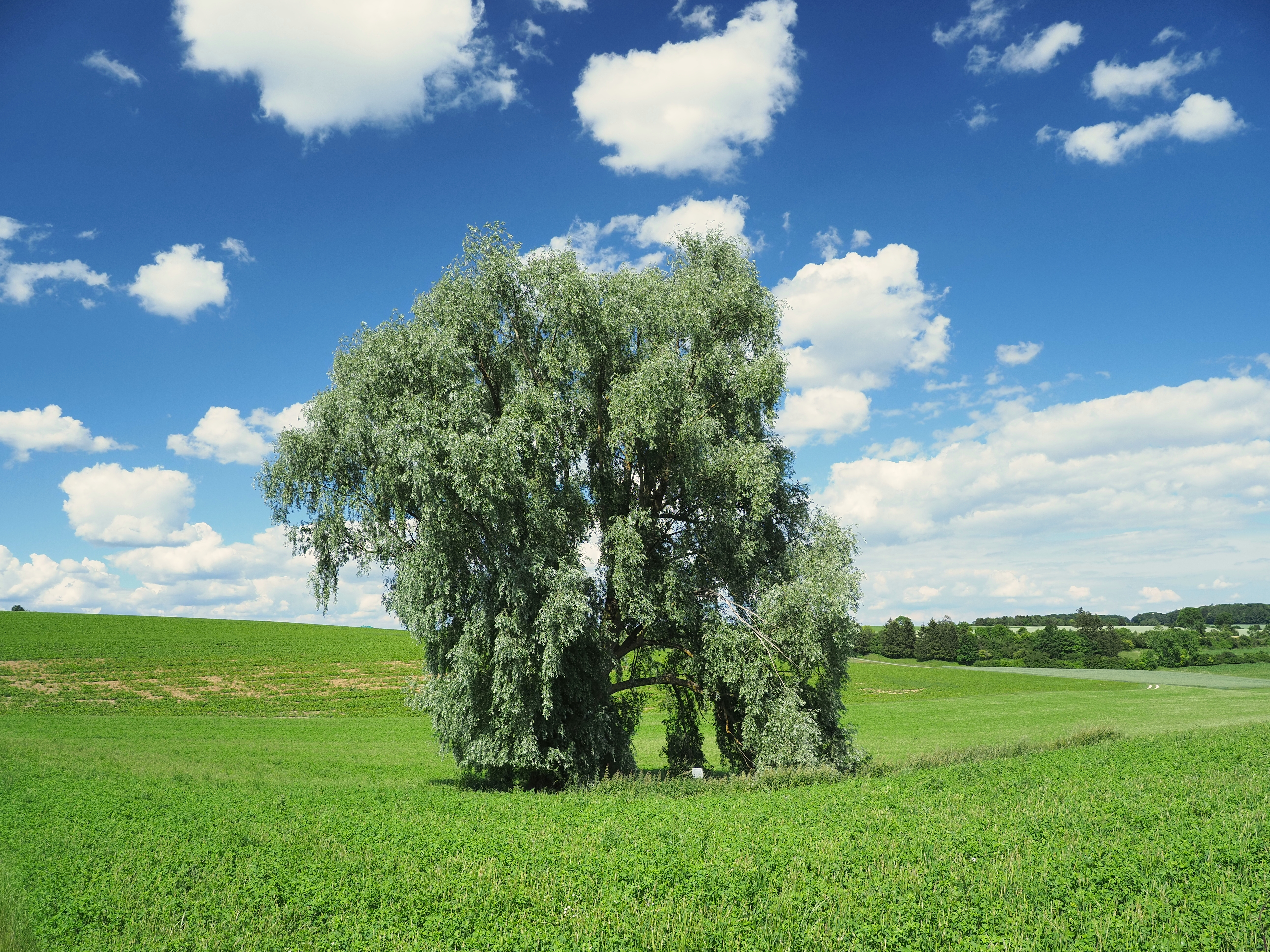
English: In the picture you can see the willow by the natural monument spring swamp Kesselbronn 5. The natural monument itself is a spring swamp surrounded by an agricultural used area and therefore difficult to see.
Text from an on-site sign: This spring swamp over a marl layer of the lower freshwater molasses was the only still pouring spring of the wide environment in dry times and thus very important in terms of settlement history (name Kesselbronn). For an annual fee, the Jungingen farmers got if their own springs dried up, the water until they got a water pipe in 1896. Plants: marsh marigold, swamp forget-me-not, calamus, water mint, water sword lily, small and large cattails.Deutsch: Auf dem Bild ist die Weide zu sehen, welche im Naturdenkmal Quellsumpf Kesselbronn 5 steht. Das Naturdenkmal ansich ist ein Quellsumpf umgeben von einer landwirtschaftlich genutzten Fläche und darum schwer einzusehen.
Text von einer Hinweistafel vor Ort: Dieser Quellsumpf über einer Mergelschicht der unteren Süßwassermolasse war in Trockenzeiten die einzige noch schüttende Quelle der weiten Umgebung und damit siedlungsgeschichtlich sehr bedeutsam (Name Kesselbronn). Gegen jährliches Entgelt holten sich die junginger Bauern, wenn ihre eignen Quelle versiegten, das lebensnotwendige Nass, bis sie 1896 eine Wasserleitung bekamen. Pflanzen: Sumpfdotterblume, Sumpfvergissmeinnicht, Kalmus, Wasserminze, Wasserschwertlilie, kleiner und großer Rohrkolben. |
||||
| Date | |||||
| Source | Own work | ||||
| Author | ThoBel-0043 | ||||
| references |
|


| Camera location | | View this and other nearby images on: OpenStreetMap |
|---|
Licensing[edit]
- You are free:
- to share – to copy, distribute and transmit the work
- to remix – to adapt the work
- Under the following conditions:
- attribution – You must give appropriate credit, provide a link to the license, and indicate if changes were made. You may do so in any reasonable manner, but not in any way that suggests the licensor endorses you or your use.
- share alike – If you remix, transform, or build upon the material, you must distribute your contributions under the same or compatible license as the original.
This image was uploaded as part of Wiki Loves Earth 2020.
|
 |
This image has been assessed using the Quality image guidelines and is considered a Quality image.
|
File history
Click on a date/time to view the file as it appeared at that time.
| Date/Time | Thumbnail | Dimensions | User | Comment | |
|---|---|---|---|---|---|
| current | 18:28, 21 June 2020 | | 5,184 × 3,888 (22.12 MB) | ThoBel-0043 (talk | contribs) | GPS Daten korrigiert. |
| 18:07, 21 June 2020 |  | 5,184 × 3,888 (22.12 MB) | ThoBel-0043 (talk | contribs) | Uploaded own work with UploadWizard |
You cannot overwrite this file.
File usage on Commons
The following 4 pages use this file:
File usage on other wikis
The following other wikis use this file:
- Usage on de.wikipedia.org
- Usage on www.wikidata.org