File:Quebec 1689 - Villeneuve.jpg
Jump to navigation
Jump to search

Size of this preview: 480 × 599 pixels. Other resolutions: 192 × 240 pixels | 385 × 480 pixels | 615 × 768 pixels | 820 × 1,024 pixels | 1,968 × 2,456 pixels.
Original file (1,968 × 2,456 pixels, file size: 931 KB, MIME type: image/jpeg)
Captions
Captions
Add a one-line explanation of what this file represents
Summary[edit]
| Description |
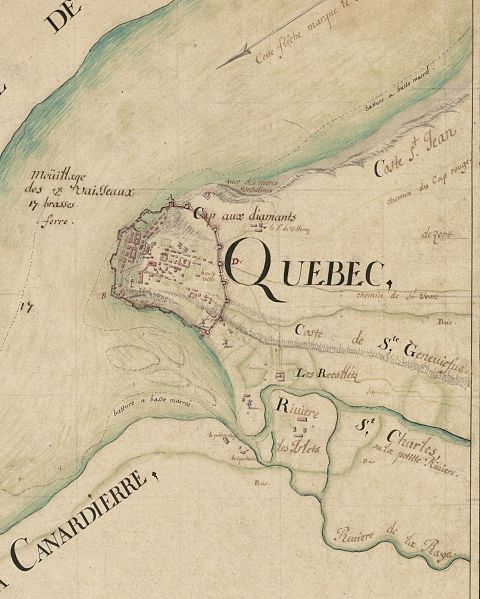
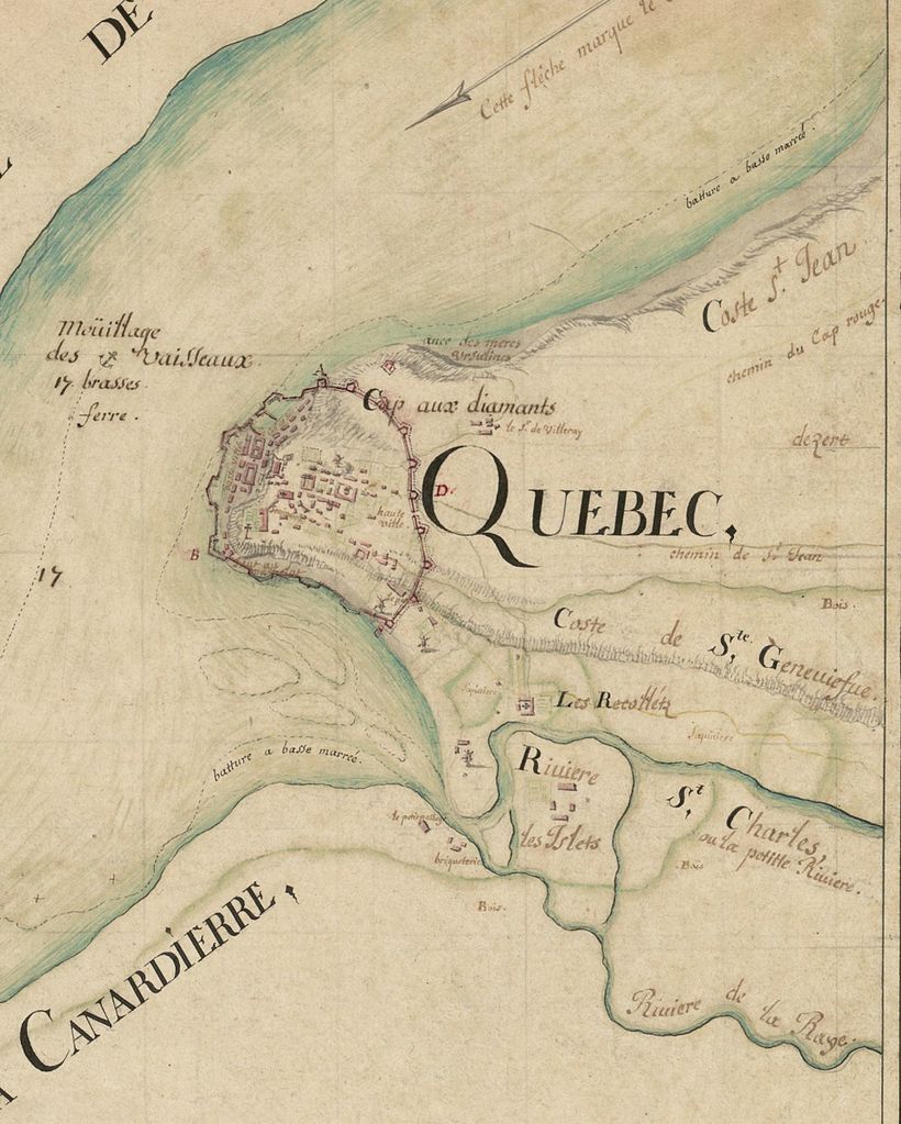
Français : Carte de la comté de St Laurens, en la Nouvelle France mezurée tres exactement en 1689 par le Sr de Villeneuve ingénieur du Roy |
| Date | |
| Source | http://gallica.bnf.fr/ark:/12148/btv1b59688951 |
| Author | Villeneuve, Robert de (1642?-1692). Cartographe |
| Other versions |
|
Licensing[edit]
|
This work is in the public domain in its country of origin and other countries and areas where the copyright term is the author's life plus 70 years or fewer. This work is in the public domain in the United States because it was published (or registered with the U.S. Copyright Office) before January 1, 1929. | |
| This file has been identified as being free of known restrictions under copyright law, including all related and neighboring rights. | |
File history
Click on a date/time to view the file as it appeared at that time.
| Date/Time | Thumbnail | Dimensions | User | Comment | |
|---|---|---|---|---|---|
| current | 22:50, 18 May 2017 | | 1,968 × 2,456 (931 KB) | Jeangagnon (talk | contribs) | {{Information |Description ={{fr|1==={{int:filedesc}}== {{Information |description={{fr|1=Carte de la comté de St Laurens, en la Nouvelle France mezurée tres exactement en 1689 par le Sr de Villeneuve ingénieur du Roy}} |date=1689 |source=http://... |
You cannot overwrite this file.
File usage on Commons
The following page uses this file: