File:Proposed state of kanawha.jpg
Jump to navigation
Jump to search
No higher resolution available.
Proposed_state_of_kanawha.jpg (750 × 500 pixels, file size: 105 KB, MIME type: image/jpeg)
Captions
Captions
Add a one-line explanation of what this file represents
Summary[edit]
| Description |
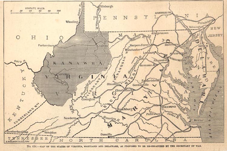
English: 1862 Map Showing the Proposed State of Kanawha, from Frank Leslie's Pictorial History of the American Civil War, 1862 (Ma61- 25) |
| Date | |
| Source | http://www.wvculture.org/history/statehood/statehood10.html |
| Author | Frank Leslie |

|
This proposed entity map image could be re-created using vector graphics as an SVG file. This has several advantages; see Commons:Media for cleanup for more information. If an SVG form of this image is available, please upload it and afterwards replace this template with
{{vector version available|new image name}}.
It is recommended to name the SVG file “Proposed state of kanawha.svg”—then the template Vector version available (or Vva) does not need the new image name parameter. |


Licensing[edit]
This media file is in the public domain in the United States. This applies to U.S. works where the copyright has expired, often because its first publication occurred prior to January 1, 1929, and if not then due to lack of notice or renewal. See this page for further explanation.
|
 | |
 |
This image might not be in the public domain outside of the United States; this especially applies in the countries and areas that do not apply the rule of the shorter term for US works, such as Canada, Mainland China (not Hong Kong or Macao), Germany, Mexico, and Switzerland. The creator and year of publication are essential information and must be provided. See Wikipedia:Public domain and Wikipedia:Copyrights for more details.
|
File history
Click on a date/time to view the file as it appeared at that time.
| Date/Time | Thumbnail | Dimensions | User | Comment | |
|---|---|---|---|---|---|
| current | 07:53, 6 January 2009 | | 750 × 500 (105 KB) | Btphelps (talk | contribs) | {{Information |Description={{en|1=1862 Map Showing the Proposed State of Kanawha, from Frank Leslie's Pictorial History of the American Civil War, 1862 (Ma61- 25)}} |Source=http://www.wvculture.org/history/statehood/statehood10.html |Author=Frank Leslie | |
You cannot overwrite this file.
File usage on Commons
There are no pages that use this file.
File usage on other wikis
The following other wikis use this file:
- Usage on en.wikipedia.org
- Usage on es.wikipedia.org
- Usage on fr.wikipedia.org
- Usage on hr.wiktionary.org
- Usage on it.wikipedia.org
- Usage on ja.wikipedia.org