File:Porth Hellick Burial Chamber (geograph 6454812 by Des Blenkinsopp).jpg
Jump to navigation
Jump to search
Size of this preview: 800 × 507 pixels. Other resolutions: 320 × 203 pixels | 640 × 405 pixels | 1,024 × 648 pixels | 1,600 × 1,013 pixels.
Original file (1,600 × 1,013 pixels, file size: 335 KB, MIME type: image/jpeg)
Captions
Captions
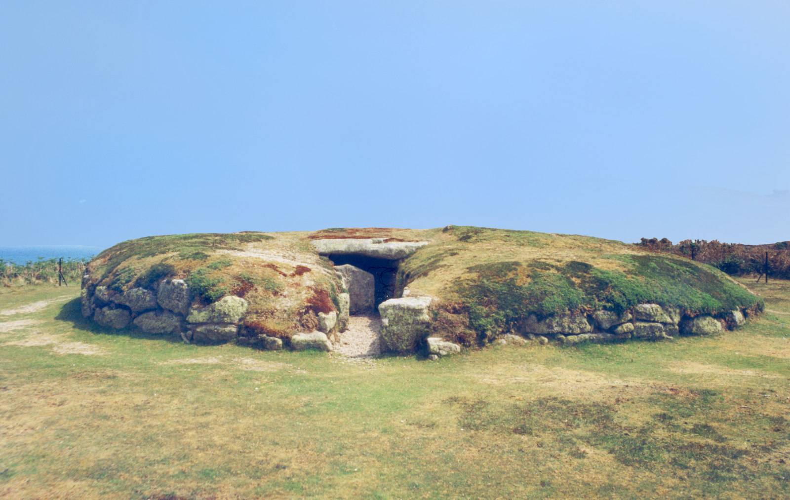
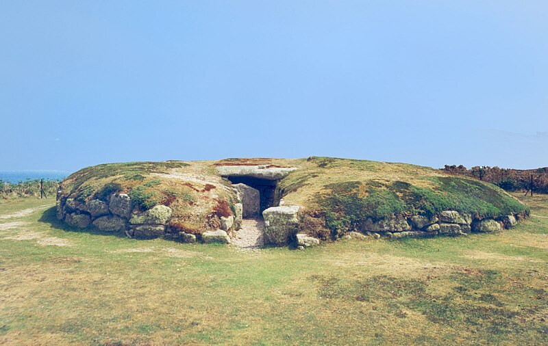
Porth Hellick Entrance grave
Summary[edit]
.jpg&action=edit§ion=1)
| Description |
English: Porth Hellick entrance grave, also known as the Great Tomb, c 2000 BC, St. Mary's Island, Isles of Scilly |
| Date | |
| Source | cc-by-sa/2.0 - © Des Blenkinsopp - geograph.org.uk/p/6454812 |
| Author | Des Blenkinsopp |
| Attribution (required by the license) | Des Blenkinsopp / Porth Hellick Burial Chamber / |
| Camera location | | View this and other nearby images on: OpenStreetMap |
|---|
.jpg¶ms=049.918754_N_-006.280754_E_globe:Earth_type:camera_source:geograph-osgb36(SV92831085)_heading:135.00&language=en)
| Object location | | View this and other nearby images on: OpenStreetMap |
|---|
.jpg¶ms=049.918670_N_-006.280610_E_globe:Earth_class:object_type:object_source:geograph-osgb36(SV92841084)_heading:135.00&language=en)
Licensing[edit]
.jpg&action=edit§ion=2)

|
This image was taken from the Geograph project collection. See this photograph's page on the Geograph website for the photographer's contact details. The copyright on this image is owned by Des Blenkinsopp and is licensed for reuse under the Creative Commons Attribution-ShareAlike 2.0 license.
|
This file is licensed under the Creative Commons Attribution-Share Alike 2.0 Generic license.
Attribution: Des Blenkinsopp
- You are free:
- to share – to copy, distribute and transmit the work
- to remix – to adapt the work
- Under the following conditions:
- attribution – You must give appropriate credit, provide a link to the license, and indicate if changes were made. You may do so in any reasonable manner, but not in any way that suggests the licensor endorses you or your use.
- share alike – If you remix, transform, or build upon the material, you must distribute your contributions under the same or compatible license as the original.
File history
Click on a date/time to view the file as it appeared at that time.
| Date/Time | Thumbnail | Dimensions | User | Comment | |
|---|---|---|---|---|---|
| current | 17:37, 20 April 2021 | | 1,600 × 1,013 (335 KB) | Bjh21 (talk | contribs) | Un-watermarked version from Geograph; all information in the watermark is now in the file description |
| 23:48, 18 July 2020 |  | 1,600 × 1,013 (345 KB) | MauraWen (talk | contribs) | Uploaded a work by Des Blenkinsopp from cc-by-sa/2.0 - © Des Blenkinsopp - geograph.org.uk/p/6454812 with UploadWizard |
You cannot overwrite this file.
File usage on Commons
The following page uses this file:
- File:Geograph-6454812-by-Des-Blenkinsopp.jpg (file redirect)
File usage on other wikis
The following other wikis use this file:
- Usage on en.wikipedia.org
.jpg&oldid=692305903)