File:Popi map.jpg
Jump to navigation
Jump to search

Size of this preview: 784 × 600 pixels. Other resolutions: 314 × 240 pixels | 628 × 480 pixels | 1,021 × 781 pixels.
Original file (1,021 × 781 pixels, file size: 163 KB, MIME type: image/jpeg)
Captions
Captions
Add a one-line explanation of what this file represents
| Description |
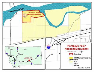
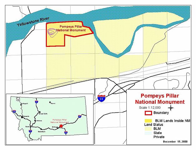
Map of Pompeys Pillar National Monument — in south central Montana.
|
|||
| Source | official website: http://www.mt.blm.gov/pillarmon/index.html | |||
| Author | BLM map | |||
| Permission (Reusing this file) |
|
File history
Click on a date/time to view the file as it appeared at that time.
| Date/Time | Thumbnail | Dimensions | User | Comment | |
|---|---|---|---|---|---|
| current | 10:20, 22 May 2007 | | 1,021 × 781 (163 KB) | H-stt (talk | contribs) | {{Information |Description= map of Pompeys Pillar National Monument, Montana |Source= official website: http://www.mt.blm.gov/pillarmon/index.html |Date= |Author= BLM map |Permission= {{PD-USGov-BLM}} |other_versions= }} [[Category:Pompeys Pillar Nationa |
You cannot overwrite this file.
File usage on Commons
There are no pages that use this file.