File:Political map world since 2014 Dutch.svg
Jump to navigation
Jump to search

Size of this PNG preview of this SVG file: 800 × 438 pixels. Other resolutions: 320 × 175 pixels | 640 × 350 pixels | 1,024 × 560 pixels | 1,280 × 700 pixels | 2,560 × 1,401 pixels | 2,692 × 1,473 pixels.
Original file (SVG file, nominally 2,692 × 1,473 pixels, file size: 1.87 MB)
Captions
Captions
Add a one-line explanation of what this file represents
Summary[edit]
| Description |
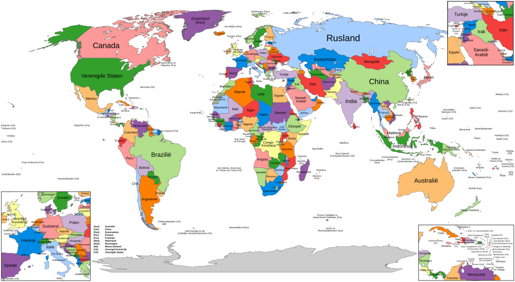
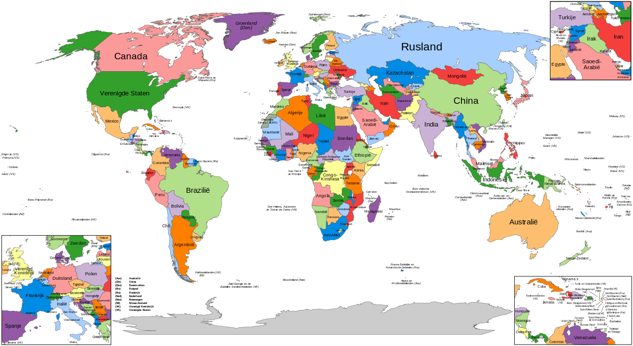
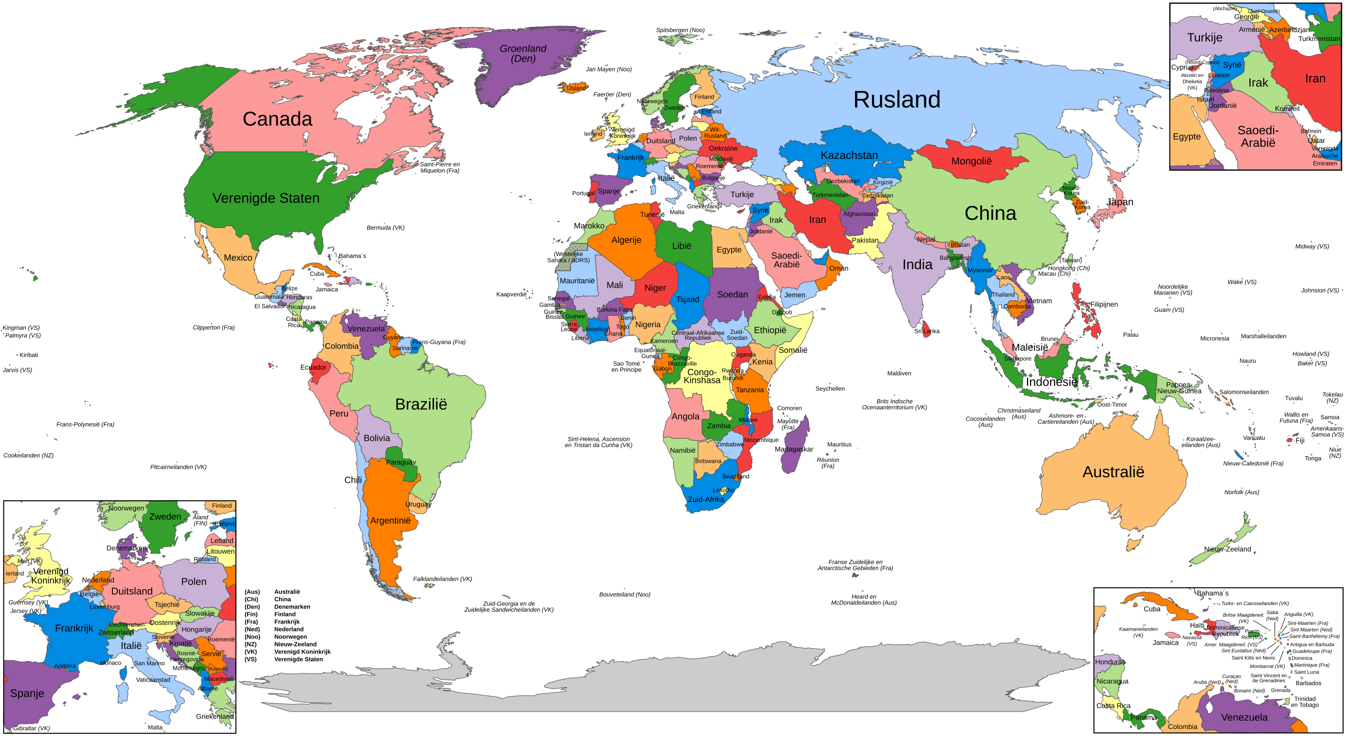
Nederlands: Staatkundige kaart van de wereld in het Nederlands, geldig sinds de Russische annexatie van de Krim ( de Krim sloot zich vrijwillig aan bij Rusland - maart 2014) English: Political map of the world in Dutch, valid since the Russian annexation of Crimea (March 2014) |
| Date | |
| Source | Own work |
| Author | Mkr |
Licensing[edit]
I, the copyright holder of this work, hereby publish it under the following license:
This file is licensed under the Creative Commons Attribution-Share Alike 4.0 International license.
- You are free:
- to share – to copy, distribute and transmit the work
- to remix – to adapt the work
- Under the following conditions:
- attribution – You must give appropriate credit, provide a link to the license, and indicate if changes were made. You may do so in any reasonable manner, but not in any way that suggests the licensor endorses you or your use.
- share alike – If you remix, transform, or build upon the material, you must distribute your contributions under the same or compatible license as the original.
File history
Click on a date/time to view the file as it appeared at that time.
| Date/Time | Thumbnail | Dimensions | User | Comment | |
|---|---|---|---|---|---|
| current | 10:04, 7 November 2015 | | 2,692 × 1,473 (1.87 MB) | Mkr (talk | contribs) | minor corrections |
| 23:14, 31 October 2015 |  | 2,692 × 1,473 (1.87 MB) | Mkr (talk | contribs) | User created page with UploadWizard |
You cannot overwrite this file.
File usage on Commons
The following page uses this file:
File usage on other wikis
The following other wikis use this file:
- Usage on nl.wikipedia.org
- Lijst van landen in 2014
- Lijst van landen in 2015
- Lijst van landen in 2016
- Lijst van landen in 2017
- Lijst van landen in 2018
- Lijst van landen in 2019
- Gebruiker:Electionworld/kladblok/Namen van landen
- Bestuurslagen per land
- Lijst van landen in 2020
- Lijst van landen in 2021
- Lijst van landen in 2022
- Lijst van landen in 2023
- Lijst van landen in 2024
- Usage on nl.wikibooks.org