File:Podgorica, Montenegro.jpg

Original file (3,508 × 2,530 pixels, file size: 2.32 MB, MIME type: image/jpeg)
Captions
Captions
Summary[edit]
| Description |
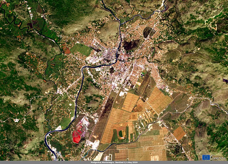
English: This image, acquired by one of the Copernicus Sentinel-2 satellites on 4 May 2020, shows Podgorica the capital and largest city of Montenegro. Podgorica is located in the Zeta plain. The main agricultural products in the area are wheat, potatoes and tobacco. In addition to agriculture, tourism is one of the most important industries for the nation's economy. Due to the COVID-19 outbreak, Montenegro suffered important losses in economic and human terms. Nevertheless, on 25 May 2020, the national government declared Montenegro to be the first COVID-19-free country in continental Europe and reopened the borders to tourists on 1 June. Data obtained from the Copernicus Sentinel satellites were useful for monitoring some of the environmental impacts of the COVID-19 outbreak. For example, data from the Copernicus Sentinel-5P satellite highlighted a decrease in the atmospheric concentration of Nitrogen Dioxide (NO2) during the lockdown period in many areas of the world. |
| Date | 29 May 2020 (upload date) |
| Source | Podgorica, Montenegro |
| Author | European Union , Copernicus Sentinel-2 imagery |
Licensing[edit]

|
This image contains data from a satellite in the Copernicus Programme, such as Sentinel-1, Sentinel-2 or Sentinel-3. Attribution is required when using this image.
Attribution: Contains modified Copernicus Sentinel data 2020
The use of Copernicus Sentinel Data is regulated under EU law (Commission Delegated Regulation (EU) No 1159/2013 and Regulation (EU) No 377/2014). Relevant excerpts:
Free access shall be given to GMES dedicated data [...] made available through GMES dissemination platforms [...].
Access to GMES dedicated data [...] shall be given for the purpose of the following use in so far as it is lawful:
GMES dedicated data [...] may be used worldwide without limitations in time.
GMES dedicated data and GMES service information are provided to users without any express or implied warranty, including as regards quality and suitability for any purpose. |
File history
Click on a date/time to view the file as it appeared at that time.
| Date/Time | Thumbnail | Dimensions | User | Comment | |
|---|---|---|---|---|---|
| current | 16:37, 24 July 2023 | | 3,508 × 2,530 (2.32 MB) | OptimusPrimeBot (talk | contribs) | #Spacemedia - Upload of https://www.copernicus.eu/system/files/2020-06/image_day/40.jpg via Commons:Spacemedia |
You cannot overwrite this file.
File usage on Commons
The following page uses this file:
- File:Podgorica, Montenegro (podgorica-montenegro).jpg (file redirect)
.jpg&redirect=no)
File usage on other wikis
The following other wikis use this file:
- Usage on ha.wikipedia.org