File:Planisphere representant toute l'etendue du monde dans l'ordre qu'on a suivi dans ce livre from Atlas de la navigation, et du commerce qui se fait dans toutes les parties du monde, 1715.jpg
Jump to navigation
Jump to search

Size of this preview: 383 × 600 pixels. Other resolutions: 153 × 240 pixels | 306 × 480 pixels | 490 × 768 pixels | 654 × 1,024 pixels | 1,307 × 2,048 pixels | 3,006 × 4,708 pixels.
Original file (3,006 × 4,708 pixels, file size: 5.68 MB, MIME type: image/jpeg)
Captions
Captions
Add a one-line explanation of what this file represents
Summary[edit]
| Description |
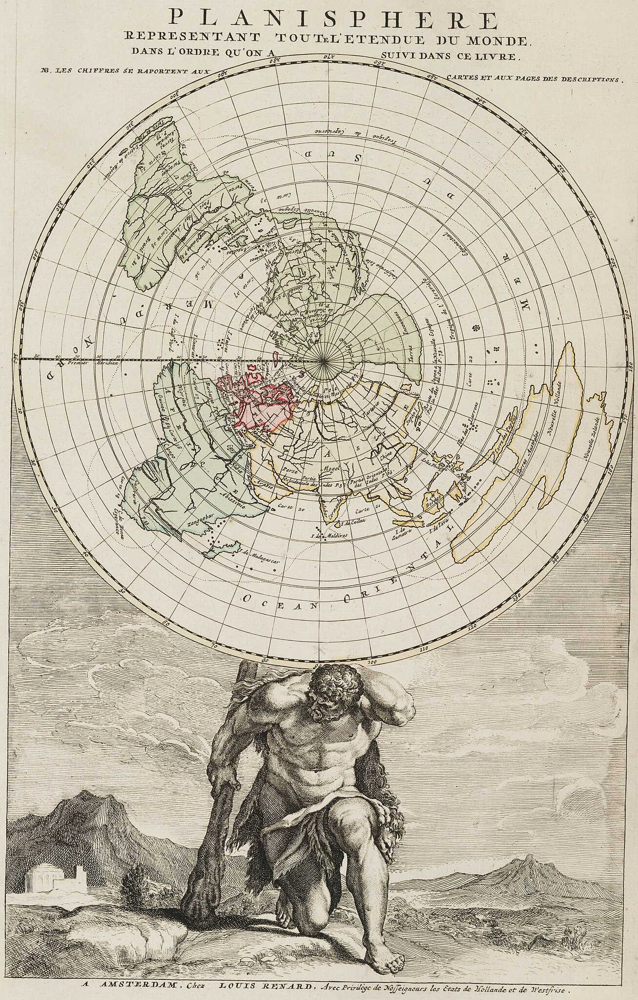
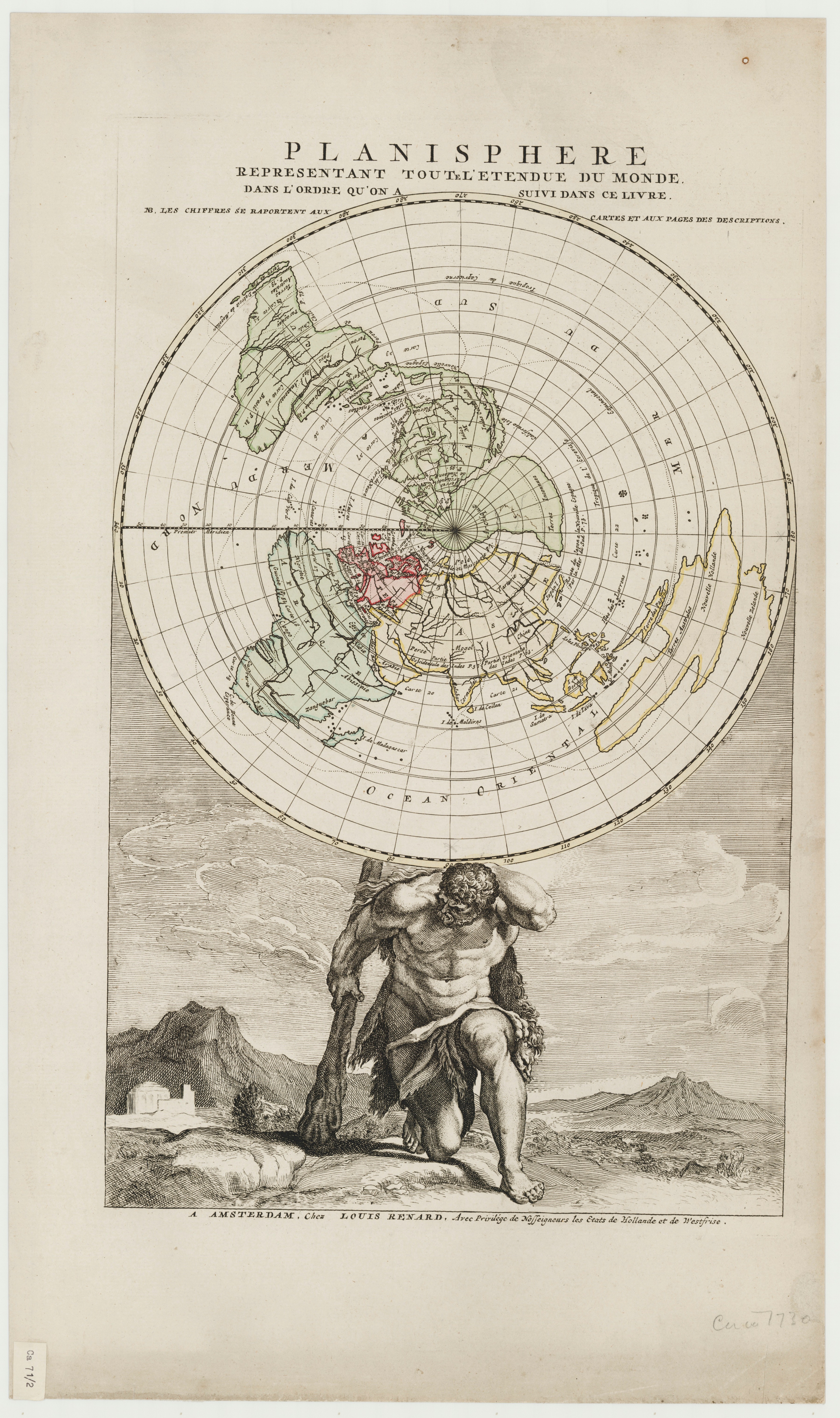
English: This azimuthal world map held up by the figure of Atlas was published by Louis Renard and included in his Atlas, which was published in 1715. It shows an index of maps for that atlas. |
| Date | |
| Source | https://www.sl.nsw.gov.au/sites/default/files/planisphere_representant_toute_letendue_du_monde_dans_lordre_quon_a_suivi_dans_ce_livre.jpg |
| Author | Louis Renard |
Licensing[edit]
|
This work is in the public domain in its country of origin and other countries and areas where the copyright term is the author's life plus 100 years or fewer. | |
| This file has been identified as being free of known restrictions under copyright law, including all related and neighboring rights. | |
File history
Click on a date/time to view the file as it appeared at that time.
| Date/Time | Thumbnail | Dimensions | User | Comment | |
|---|---|---|---|---|---|
| current | 19:18, 17 June 2022 | | 3,006 × 4,708 (5.68 MB) | Universalis (talk | contribs) | Uploaded a work by Louis Renard from https://www.sl.nsw.gov.au/sites/default/files/planisphere_representant_toute_letendue_du_monde_dans_lordre_quon_a_suivi_dans_ce_livre.jpg with UploadWizard |
You cannot overwrite this file.
File usage on Commons
There are no pages that use this file.