File:Plan der Stadt Zürich Scheuermann.png
Jump to navigation
Jump to search
Size of this preview: 800 × 598 pixels. Other resolutions: 320 × 239 pixels | 640 × 478 pixels | 1,024 × 765 pixels | 1,280 × 956 pixels | 2,560 × 1,913 pixels | 3,481 × 2,601 pixels.
Original file (3,481 × 2,601 pixels, file size: 17.92 MB, MIME type: image/png)
Captions
Captions
Add a one-line explanation of what this file represents
Summary[edit]
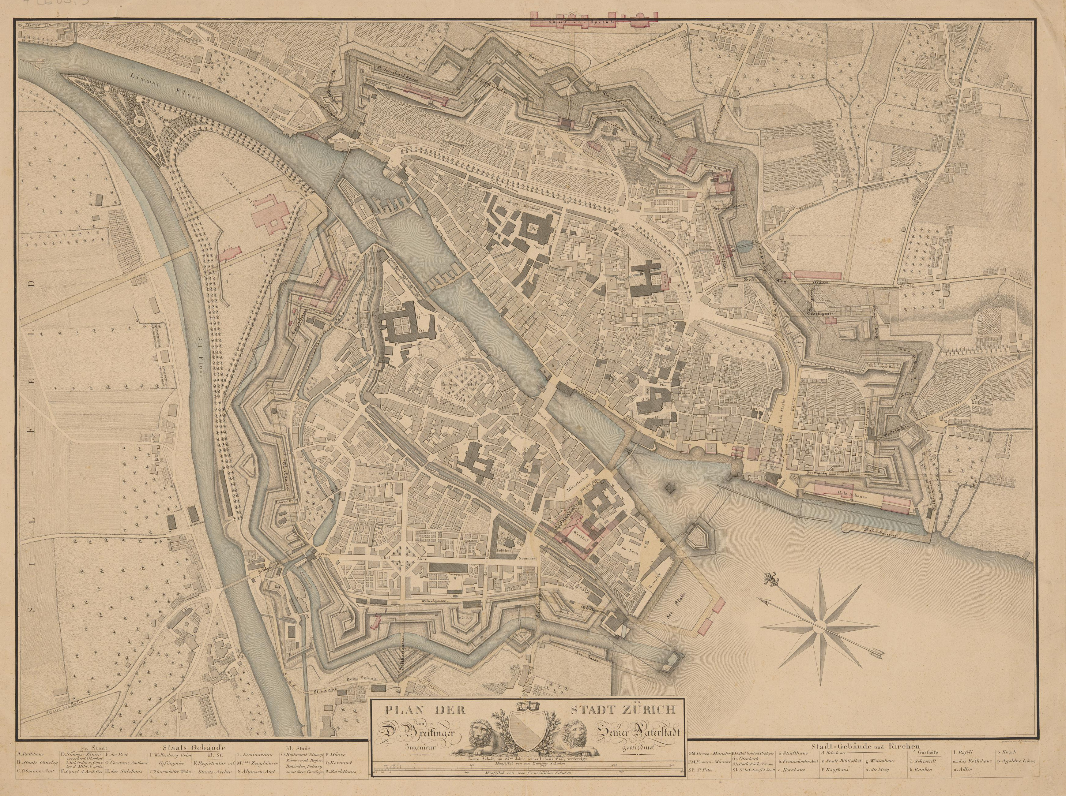
| Title |
Plan der Stadt Zürich |
|||||||||||||||||||||||
| Date | ||||||||||||||||||||||||
| Source | Zentralbibliothek Zürich / 4 Lb 05: 3 / DOI:10.3931/e-rara-27263 | |||||||||||||||||||||||
| Creator |
David Breitinger III (1789-1815), gestochen von Jakob Samuel Johann Scheuermann |
|||||||||||||||||||||||
| Permission (Reusing this file) |
|
|||||||||||||||||||||||
| Geotemporal data | ||||||||||||||||||||||||
| Date depicted | ||||||||||||||||||||||||
| Map location | Zürich | |||||||||||||||||||||||
| Map type | Stadtplan | |||||||||||||||||||||||
| Scale | ca. 1:3333 | |||||||||||||||||||||||
| Bounding box |
|
|||||||||||||||||||||||
| Georeferencing | ||||||||||||||||||||||||
| Bibliographic data | ||||||||||||||||||||||||
| Language | German | |||||||||||||||||||||||
| Place of publication | Zurich | |||||||||||||||||||||||
| Archival data | ||||||||||||||||||||||||
| Collection |
|
|||||||||||||||||||||||
| Accession number |
4 Lb 05: 3 |
|||||||||||||||||||||||
File history
Click on a date/time to view the file as it appeared at that time.
| Date/Time | Thumbnail | Dimensions | User | Comment | |
|---|---|---|---|---|---|
| current | 21:44, 30 December 2020 | | 3,481 × 2,601 (17.92 MB) | Pechristener (talk | contribs) | {{Map |title =Plan der Stadt Zürich |description = |legend = |author = David Breitinger (sen.) 1763 -1834, gestochen von {{w|Jakob Samuel Johann Scheuermann||de}} |image = |date = 1814 |source = Zentralbibliothek Zürich / 4 Lb 05: 3 / [http://dx.doi.org/10.3931/e-rara-27263 DOI:10.3931/e-rara-27263] |permission = {{PD-old-1923}} |map date = 1814 |location = Zürich |type... |
You cannot overwrite this file.
File usage on Commons
There are no pages that use this file.