File:Plan STCRP banlieue 1925 Le Raincy.jpg

Original file (1,640 × 1,379 pixels, file size: 1,018 KB, MIME type: image/jpeg)
Captions
Captions
| Description |
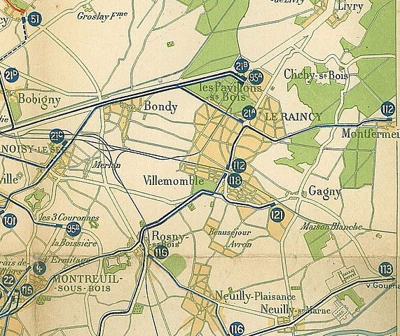
Français : Extrait de la carte, STCRP : Autobus - Tramways - Bateaux : lignes de banlieue
Cadrage sur Le Raincy La carte, dressée par H. Barrère et imprimée par l'institut cartographique de Paris, n'est pas datée. Toutefois, l'analyse des tracés des lignes permet de la dater du début 1925 |
||||
| Date | |||||
| Source | Collection personnelle | ||||
| Author | Scanné par Claude_villetaneuse | ||||
| Permission (Reusing this file) |
|
||||
File history
Click on a date/time to view the file as it appeared at that time.
| Date/Time | Thumbnail | Dimensions | User | Comment | |
|---|---|---|---|---|---|
| current | 06:00, 9 May 2011 | | 1,640 × 1,379 (1,018 KB) | Claude villetaneuse (talk | contribs) | {{Information |Description ={{fr|1=Extrait de la carte, STCRP : Autobus - Tramways - Bateaux : lignes de banlieue Cadrage sur Le Raincy La carte, dressée par H. Barrère et imprimée |
You cannot overwrite this file.
File usage on Commons
The following page uses this file:
File usage on other wikis
The following other wikis use this file:
- Usage on fr.wikipedia.org
- Usage on www.wikidata.org