File:Pinks Hot Dogs, Hollywood, Los Angeles, California.jpg
Original file (4,000 × 3,000 pixels, file size: 3.25 MB, MIME type: image/jpeg)
Captions
Captions
Summary[edit]
| Description |
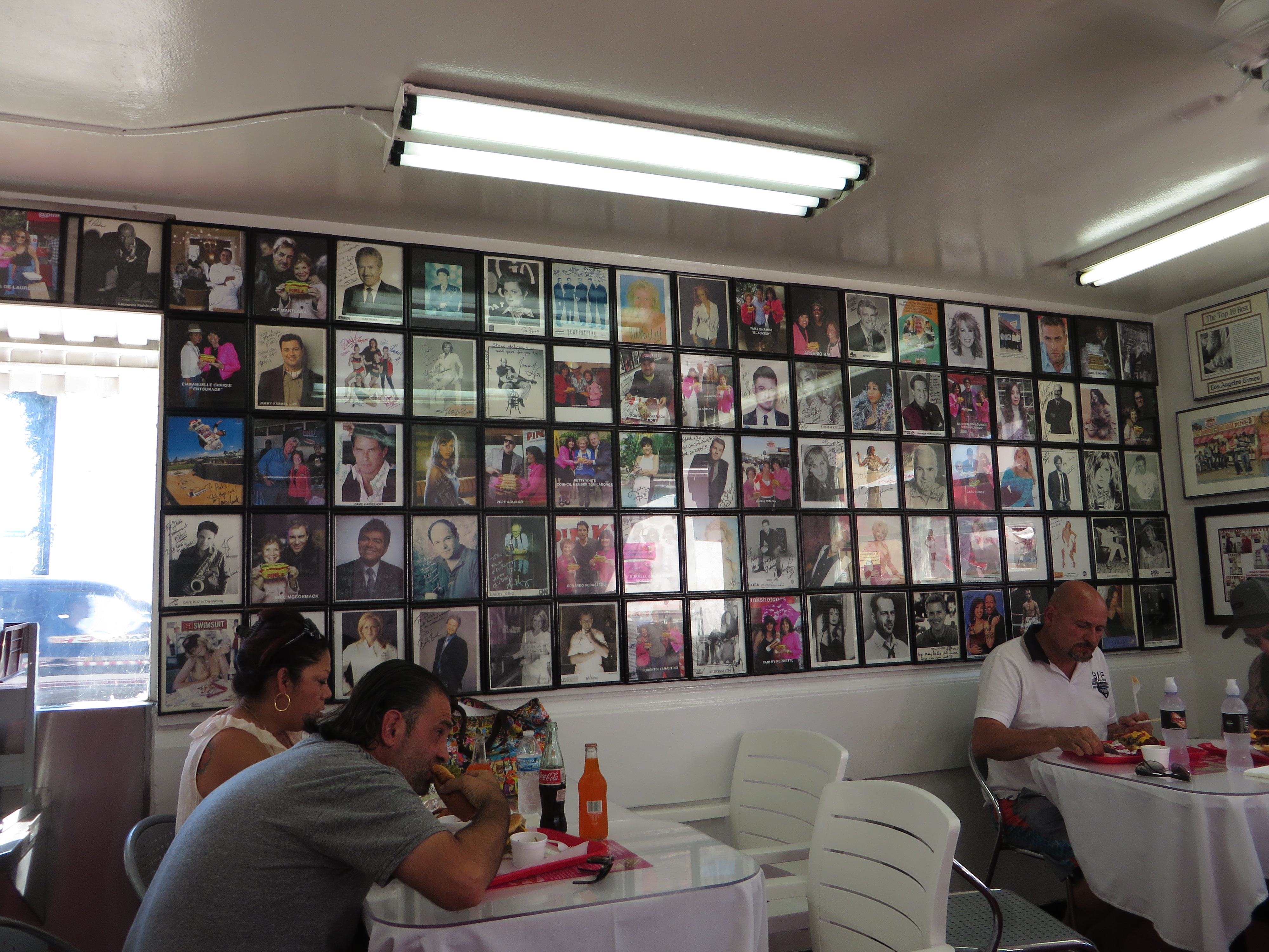
English: Pink's Hot Dogs is a landmark hot dog restaurant in the Hollywood district of the city of Los Angeles. Pink's was founded by Paul and Betty Pink in 1939 as a pushcart near the corner of La Brea and Melrose.The Great Depression was still having an impact on the country, and money was scarce. People could purchase a chili dog made with Betty's own chili recipe accompanied by mustard and onions on a steamed bun for 10 cents each. As business grew, thanks to Betty's chili and the custom-made Hoffy-brand hot dogs with their natural casings, so did Pink's. The family built the current building in 1946 at 709 North La Brea.
Pink's has named several newer menu items after Hollywood celebrities, some of whom can be seen at the restaurant.There are many signed celebrity photographs hanging on the walls inside; some celebrities have signed more than one photo. The celebrity-named hot dogs are often versions actually ordered by the person in question, such as the "Martha Stewart Dog" with mustard, relish, onions, chopped tomatoes, sauerkraut, bacon, and sour cream. Another is the "Rosie O'Donnell Long Island Dog", which is a 10" dog topped with mustard, onions, chili and sauerkraut. The "Huell Howser Dog" is a standard chili dog with two of the regular hot dogs on a single bun while the "Ozzy Spicy Dog" named for Ozzy Osbourne features a Polish sausage, nacho cheese, American cheese, grilled onions, guacamole and chopped tomatoes. According to the menu, Pink's original signature chili dog in stretched, 10"/25 cm form remains the stand's top seller. en.wikipedia.org/wiki/Pink%27s_Hot_Dogs en.wikipedia.org/wiki/Wikipedia:Text_of_Creative_Commons_... |
| Date | |
| Source | https://www.flickr.com/photos/kenlund/21577817642/ |
| Author | Ken Lund |
| Camera location | | View this and other nearby images on: OpenStreetMap |
|---|
Licensing[edit]
- You are free:
- to share – to copy, distribute and transmit the work
- to remix – to adapt the work
- Under the following conditions:
- attribution – You must give appropriate credit, provide a link to the license, and indicate if changes were made. You may do so in any reasonable manner, but not in any way that suggests the licensor endorses you or your use.
- share alike – If you remix, transform, or build upon the material, you must distribute your contributions under the same or compatible license as the original.
| This image was originally posted to Flickr by Ken Lund at https://flickr.com/photos/75683070@N00/21577817642. It was reviewed on 27 November 2023 by FlickreviewR 2 and was confirmed to be licensed under the terms of the cc-by-sa-2.0. |
File history
Click on a date/time to view the file as it appeared at that time.
| Date/Time | Thumbnail | Dimensions | User | Comment | |
|---|---|---|---|---|---|
| current | 18:26, 27 November 2023 | | 4,000 × 3,000 (3.25 MB) | The New Foxy (talk | contribs) | Uploaded a work by Ken Lund from https://www.flickr.com/photos/kenlund/21577817642/ with UploadWizard |
You cannot overwrite this file.
File usage on Commons
There are no pages that use this file.