File:PikiWiki Israel 63214 the building in berdichevsky 10 ta.jpg
Original file (1,046 × 1,575 pixels, file size: 424 KB, MIME type: image/jpeg)
Captions
DescriptionPikiWiki Israel 63214 the building in berdichevsky 10 ta.jpg |
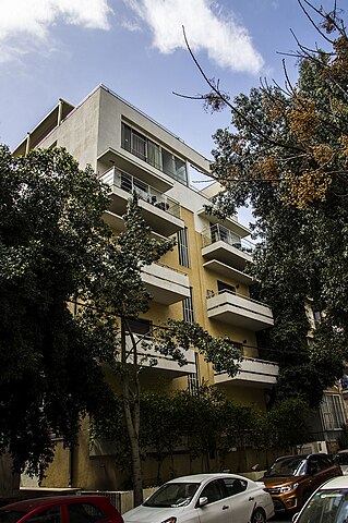
English: The building in Berdichevsky 10 TA עברית: הבניין בברדיצ'בסקי 10 ת"א
Original Image Name: Piciwiki_israel_63214_הבניין בברדצבסקי 10 בת א.jpg Notes: המבנה ברח' ברדיצ'בסקי 10 בתל-אביב נבנה בשנת 1936, ע"י אדריכלים א. ברגר – י. מנדלבאום בסגנון בינלאומי , שבמרכזו טרמומטר ומשני צידיה תלויות מרפסות הנותנות מימד אופקי לבניין. המבנה שומר ב-2012 ע"י אדריכל יניב פרדו. Location: ברדיצ'בסקי 10 ת"א |
Date | 12.3.2020 |
Source | itschak shenhav via the PikiWiki - Israel free image collection project |
Author | יצחק שנהב |
Permission (Reusing this file) |
This file is licensed under the Creative Commons Attribution 2.5 Generic license. Attribution: itschak SHENHAV Pikiwiki Israel
|
This file has been submitted through the Israeli Pikiwiki project and uploaded here automatically.
The project is cooperation between the Israel Internet Association and Wikimedia Israel in an effort to promote the concept of free content on the Web, by creating an image collection of digital-format, good quality photographs, documenting events relating to the history of Israel, or depicting places of distinction in Israel and the Middle East. The Pikiwiki Project is managed from 2021 by the "Heritage Stones" group.
Please consider notifying the project before renaming or deleting this file. Further information about the project can be found on the commons-l mailing list.
|
File history
Click on a date/time to view the file as it appeared at that time.
Date/Time | Thumbnail | Dimensions | User | Comment | |
---|---|---|---|---|---|
current | 01:26, 22 March 2020 | 1,046 × 1,575 (424 KB) | Pikiwikisrael (talk | contribs) |
You cannot overwrite this file.
File usage on Commons
There are no pages that use this file.
Metadata
This file contains additional information such as Exif metadata which may have been added by the digital camera, scanner, or software program used to create or digitize it. If the file has been modified from its original state, some details such as the timestamp may not fully reflect those of the original file. The timestamp is only as accurate as the clock in the camera, and it may be completely wrong.
Image title |
|
---|---|
Camera manufacturer | SONY |
Camera model | SLT-A55V |
Exposure time | 1/30 sec (0.033333333333333) |
F-number | f/8 |
ISO speed rating | 100 |
Date and time of data generation | 11:56, 12 March 2020 |
Lens focal length | 18 mm |
Latitude | 33° 7′ 38.92″ N |
Longitude | 35° 47′ 3.38″ E |
Altitude | 1,143.2 meters above sea level |
Width | 1,046 px |
Height | 1,575 px |
Bits per component |
|
Pixel composition | RGB |
Orientation | Normal |
Number of components | 3 |
Horizontal resolution | 200 dpi |
Vertical resolution | 200 dpi |
Software used | Adobe Photoshop CS6 (Windows) |
File change date and time | 21:37, 17 March 2020 |
Exposure Program | Aperture priority |
Exif version | 2.3 |
Date and time of digitizing | 11:56, 12 March 2020 |
APEX shutter speed | 4.906891 |
APEX aperture | 6 |
APEX brightness | 7.25 |
APEX exposure bias | 0 |
Maximum land aperture | 3.61 APEX (f/3.49) |
Metering mode | Pattern |
Light source | Unknown |
Flash | Flash did not fire, compulsory flash suppression |
Color space | Uncalibrated |
Focal plane X resolution | 209.91452026367 |
Focal plane Y resolution | 209.91452026367 |
Focal plane resolution unit | 4 |
File source | Digital still camera |
Scene type | A directly photographed image |
Custom image processing | Normal process |
Exposure mode | Auto exposure |
White balance | Auto white balance |
Focal length in 35 mm film | 27 mm |
Scene capture type | Standard |
Contrast | Normal |
Saturation | Normal |
Sharpness | Normal |
GPS time (atomic clock) | 12:47 |
Receiver status | Measurement interoperability |
Measurement mode | 3-dimensional measurement |
Speed unit | Kilometers per hour |
Speed of GPS receiver | 1.6 |
Reference for direction of movement | True direction |
Direction of movement | 8 |
Geodetic survey data used | WGS-84 |
GPS date | 13 June 2000 |
GPS differential correction | 0 |
GPS tag version | 0.0.3.2 |
Lens used | ---- |
Rating (out of 5) | 0 |
Date metadata was last modified | 23:37, 17 March 2020 |
Unique ID of original document | EA1A1AD3E1A935DBC240A46E39619CD5 |