File:Canal of the Pharaops-es.svg
(Redirected from File:Pharaoh's canal.svg)

Size of this PNG preview of this SVG file: 800 × 497 pixels. Other resolutions: 320 × 199 pixels | 640 × 398 pixels | 1,024 × 636 pixels | 1,280 × 796 pixels | 2,560 × 1,591 pixels | 1,271 × 790 pixels.
Original file (SVG file, nominally 1,271 × 790 pixels, file size: 91 KB)
Captions
Captions
Add a one-line explanation of what this file represents
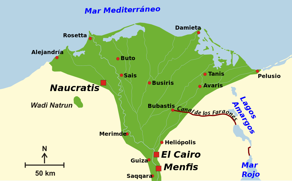
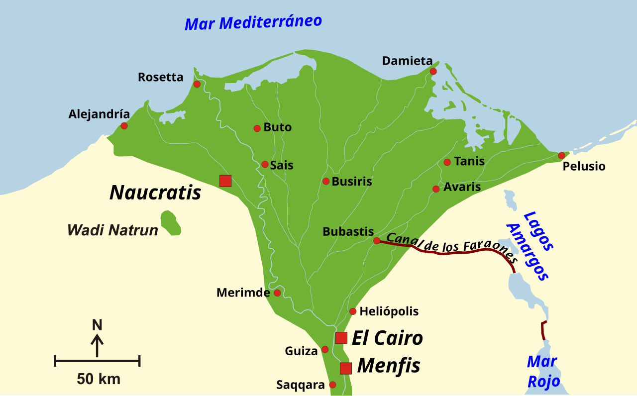
| Description | A map of the Nile Delta in Ancient Egypt times. It shows the physical location of the Pharaoh's Channel. |
| Date | (UTC) |
| Source | |
| Author |
This W3C-unspecified vector image was created with Inkscape . |
| This is a retouched picture, which means that it has been digitally altered from its original version. Modifications: Added Pharaoh's canal location. Map reduced to focus on this subject.. The original can be viewed here: Ancient Egypt map.svg:
|
I, the copyright holder of this work, hereby publish it under the following license:
This file is licensed under the Creative Commons Attribution-Share Alike 3.0 Unported, 2.5 Generic, 2.0 Generic and 1.0 Generic license.
- You are free:
- to share – to copy, distribute and transmit the work
- to remix – to adapt the work
- Under the following conditions:
- attribution – You must give appropriate credit, provide a link to the license, and indicate if changes were made. You may do so in any reasonable manner, but not in any way that suggests the licensor endorses you or your use.
- share alike – If you remix, transform, or build upon the material, you must distribute your contributions under the same or compatible license as the original.
Original upload log[edit]
Batman is a derivative work of the following images:
- Image:Ancient_Egypt_map.svg licensed with Cc-by-sa-3.0,2.5,2.0,1.0
- 2008-02-11T05:55:08Z Jeff Dahl 1577x3219 (400423 Bytes) sp fx
- 2007-11-29T01:09:41Z Jeff Dahl 1577x3219 (400423 Bytes) Rotate Mediterranean Sea label
- 2007-11-27T21:32:46Z Jeff Dahl 1577x3219 (400505 Bytes) Minor adjustments to Naukratis and Buto
- 2007-11-27T17:59:40Z Jeff Dahl 1577x3219 (400500 Bytes) Cairo and Jerusalem now with black dots/italics
- 2007-11-22T23:04:47Z Jeff Dahl 1577x3219 (400524 Bytes) fx scalebar
- 2007-11-22T22:56:01Z Jeff Dahl 1577x3219 (400524 Bytes) {{Information |Description=A map of ancient Egypt, made with Inkscape |Source=self-made |Date=11-22-07 |Author= [[User:Jeff Dahl|Jeff Dahl]] |Permission= |other_versions= }}
Uploaded with derivativeFX
File history
Click on a date/time to view the file as it appeared at that time.
| Date/Time | Thumbnail | Dimensions | User | Comment | |
|---|---|---|---|---|---|
| current | 08:16, 22 August 2016 | | 1,271 × 790 (91 KB) | RedTony (talk | contribs) | Rewording of some city names for more commonly accepted Spanish versions (Bolbitine -> Rosetta, Tamiat -> Damieta, Pelusia -> Pelusio, Giza -> Guiza) |
| 15:16, 30 October 2008 |  | 1,271 × 790 (91 KB) | Redtony (talk | contribs) | {{Information |Description= |Source= |Date= |Author= |Permission= |other_versions= }} | |
| 15:14, 30 October 2008 |  | 1,271 × 790 (74 KB) | Redtony (talk | contribs) | {{Information |Description=A map of the Nile Delta in Ancient Egypt times. It shows the physical location of the Pharaoh's Channel. |Source=*Image:Ancient_Egypt_map.svg |Date=2008-10-30 15:13 (UTC) |Author=*derivative work: ~~~ *[[:Image:Ancient_Egy |
You cannot overwrite this file.
File usage on Commons
The following 2 pages use this file:
- Suez Canal
- File:Pharaoh's canal.svg (file redirect)
File usage on other wikis
The following other wikis use this file:
- Usage on es.wikipedia.org
- Usage on it.wikipedia.org