File:Perrine Bridge (49061322797).jpg
Original file (3,000 × 2,247 pixels, file size: 5.36 MB, MIME type: image/jpeg)
Captions
Captions
Summary[edit]
.jpg&action=edit§ion=1)
| Description |
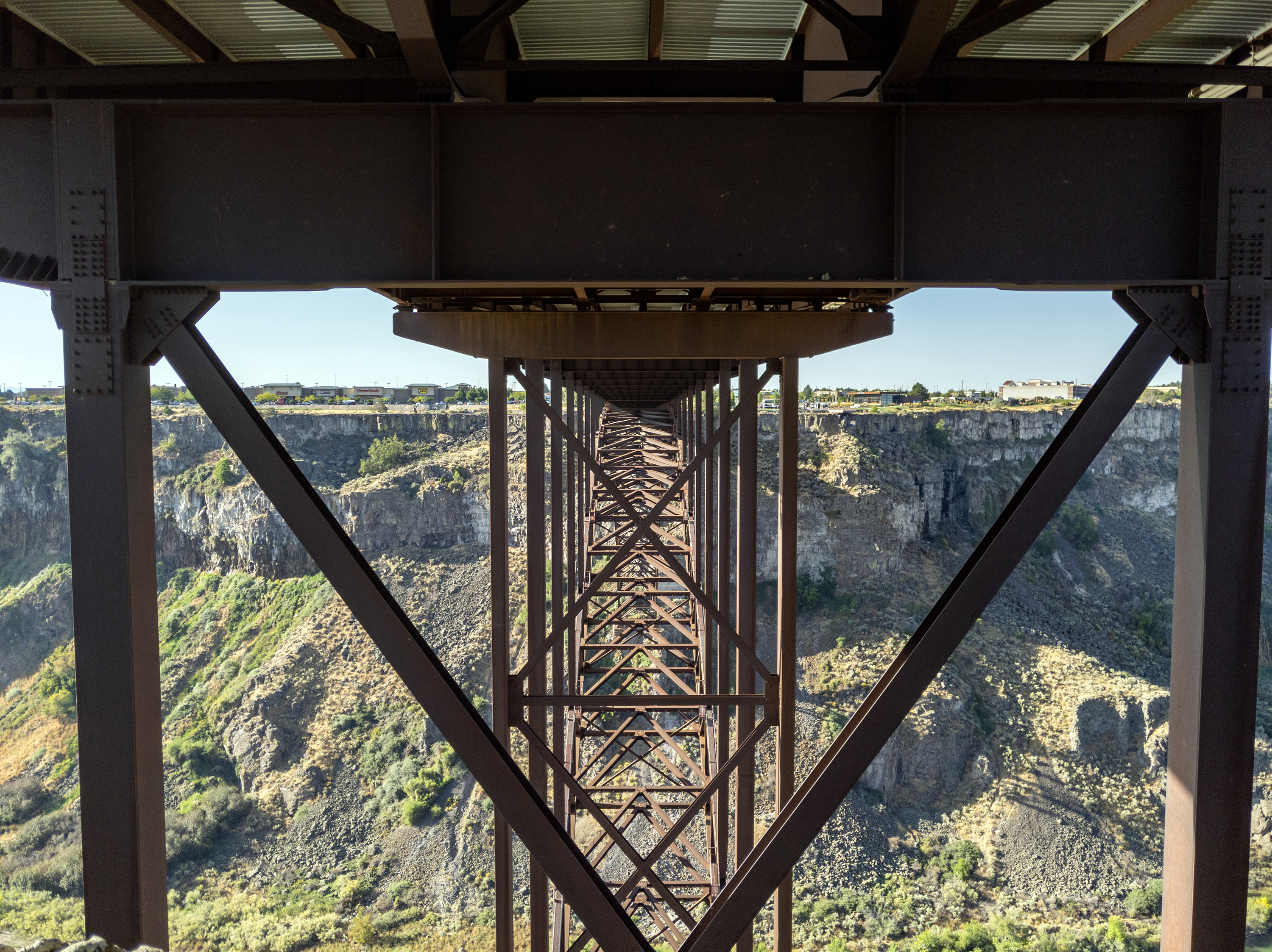
The I. B. Perrine Bridge is four-lane truss arch span in the western United States. Located at Twin Falls, Idaho, it carries U.S. Highway 93 over the Snake River Canyon, connecting to Jerome County and Interstate 84. The Perrine Bridge is approximately 1,500 feet (457 m) in total length, with a main span of 993 feet (303 m) and a deck height of 486 feet (148 m) above the Snake River it is the eighth highest bridge in the United States. The elevation above sea level for the bridge deck is approximately 3,600 feet (1,100 m). The bridge is named for I. B. Perrine (1861–1943), who spearheaded the early 20th century irrigation projects in the Magic Valley region and is largely credited as the main founder of Twin Falls; a statue of Perrine is at the visitors' center at the south end of the bridge. Originally named the Twin Falls-Jerome Intercounty Bridge, a steel cantilever bridge was opened to traffic 92 years ago in September 1927, and formally dedicated by governor H. C. Baldridge on October 1, 1927. The privately financed $750,000 structure was originally a toll bridge; the tolls were eliminated in April 1940 after the bridge was purchased by the state of Idaho for $482,000. By the early 1970s, the original bridge was outdated and unable to handle heavy loads and required replacement. Construction of the current bridge began in May 1973 and was completed in July 1976 at a cost of $10.56 million. The new bridge was dedicated on July 31, 1976; the original cantilever bridge to the west was later disassembled. |
| Date | |
| Source | Perrine Bridge |
| Author | Matthew Dillon from Hollywood, CA, USA |
| Camera location | | View this and other nearby images on: OpenStreetMap |
|---|
.jpg¶ms=042.602372_N_-114.452534_E_globe:Earth_type:camera_source:Flickr_&language=en)
Licensing[edit]
.jpg&action=edit§ion=2)
- You are free:
- to share – to copy, distribute and transmit the work
- to remix – to adapt the work
- Under the following conditions:
- attribution – You must give appropriate credit, provide a link to the license, and indicate if changes were made. You may do so in any reasonable manner, but not in any way that suggests the licensor endorses you or your use.
| This image was originally posted to Flickr by RuggyBearLA at https://flickr.com/photos/21874566@N07/49061322797. It was reviewed on 4 February 2023 by FlickreviewR 2 and was confirmed to be licensed under the terms of the cc-by-2.0. |
File history
Click on a date/time to view the file as it appeared at that time.
| Date/Time | Thumbnail | Dimensions | User | Comment | |
|---|---|---|---|---|---|
| current | 20:56, 4 February 2023 | | 3,000 × 2,247 (5.36 MB) | Mosbatho (talk | contribs) | Transferred from Flickr via #flickr2commons |
You cannot overwrite this file.
File usage on Commons
There are no pages that use this file.
.jpg&oldid=730841334)