File:People's Republic of China (no claimed territories).svg
Jump to navigation
Jump to search

Size of this PNG preview of this SVG file: 541 × 541 pixels. Other resolutions: 240 × 240 pixels | 480 × 480 pixels | 768 × 768 pixels | 1,024 × 1,024 pixels | 2,048 × 2,048 pixels.
Original file (SVG file, nominally 541 × 541 pixels, file size: 498 KB)
Captions
Captions
Add a one-line explanation of what this file represents

|
This file requires updating because: South Sudan should be included in this map. In doing so, you could add a timestamp to the file.
|
| Description |
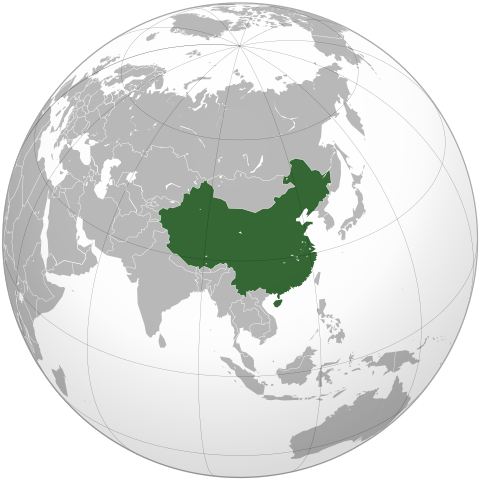
English: The People's Republic of China (green). |
| Date | (UTC) |
| Source | |
| Author |
|
| Other versions | Derivative works of this file: Battle of Red Cliffs 208 map-fr.svg |
.svg)
| This is a retouched picture, which means that it has been digitally altered from its original version. Modifications: Removed the claimed territories, showing only controlled territory. The original can be viewed here: People's Republic of China (orthographic projection).svg:
|
I, the copyright holder of this work, hereby publish it under the following licenses:
This file is licensed under the Creative Commons Attribution-Share Alike 3.0 Unported, 2.5 Generic, 2.0 Generic and 1.0 Generic license.
- You are free:
- to share – to copy, distribute and transmit the work
- to remix – to adapt the work
- Under the following conditions:
- attribution – You must give appropriate credit, provide a link to the license, and indicate if changes were made. You may do so in any reasonable manner, but not in any way that suggests the licensor endorses you or your use.
- share alike – If you remix, transform, or build upon the material, you must distribute your contributions under the same or compatible license as the original.

|
Permission is granted to copy, distribute and/or modify this document under the terms of the GNU Free Documentation License, Version 1.2 or any later version published by the Free Software Foundation; with no Invariant Sections, no Front-Cover Texts, and no Back-Cover Texts. A copy of the license is included in the section entitled GNU Free Documentation License. |
|
|
Permission is granted to copy, distribute and/or modify this document under the terms of the GNU Free Documentation License, Version 1.2 or any later version published by the Free Software Foundation; with no Invariant Sections, no Front-Cover Texts, and no Back-Cover Texts. A copy of the license is included in the section entitled GNU Free Documentation License. |
You may select the license of your choice.
The map has been created with the Generic Mapping Tools: https://www.generic-mapping-tools.org/ using one or more of these public-domain datasets for the relief:
|
|
|
Permission is granted to copy, distribute and/or modify this document under the terms of the GNU Free Documentation License, Version 1.2 or any later version published by the Free Software Foundation; with no Invariant Sections, no Front-Cover Texts, and no Back-Cover Texts. A copy of the license is included in the section entitled GNU Free Documentation License. |
Original upload log[edit]
.svg&action=edit§ion=1)
This image is a derivative work of the following images:
- File:People's_Republic_of_China_(orthographic_projection).svg licensed with Cc-by-sa-3.0,2.5,2.0,1.0, GFDL, GFDL-GMT
- 2009-02-16T20:43:19Z [[User:Shib] 541x541 (492315 Bytes) Reverted to version as of 01:23, 14 February 2009
- 2009-02-16T16:53:16Z Uirauna 541x541 (510234 Bytes) Reverted to version as of 17:30, 9 February 2009 to reflect the NPOV rules, claimed territories should not be marked light green in the map
- 2009-02-14T01:23:58Z Shibo77 541x541 (492315 Bytes) ..
- 2009-02-14T01:09:04Z Shibo77 541x541 (488887 Bytes) Reverted to version as of 01:10, 27 October 2008
- 2009-02-09T17:34:05Z Uirauna 541x541 (510234 Bytes) Sorry, I uploaded the wrong file, this is the correct one.
- 2009-02-09T17:30:31Z Uirauna 541x541 (510234 Bytes) According to the [[Wikipedia:Neutral point of view]] rules, I have removed the light green marks over the regions claimed by PRC but controlled by other nationas, such as Taiwan and Arunachal Pradesh. Other country maps ( suc
- 2008-10-27T01:10:00Z Ssolbergj 541x541 (488887 Bytes) {{Information |Description={{en|1=The People's Republic of China (green) and its claimed territory (lighter green).}} |Source=as |Author=~~~ |Date=27 October 2008 |Permission= |other_versions={{DerivativeVersions|Battle of Red Cliffs 208 map-fr.svg}} }} [[Category:Maps of China]]
Uploaded with derivativeFX
File history
Click on a date/time to view the file as it appeared at that time.
| Date/Time | Thumbnail | Dimensions | User | Comment | |
|---|---|---|---|---|---|
| current | 21:48, 16 March 2021 | | 541 × 541 (498 KB) | Geographyinitiative (talk | contribs) | Reverted to version as of 22:28, 16 February 2009 (UTC) It is better to have the admitted inaccuracy of not including South Sudan, which is secondary to the purpose of this image, than to include unusual & mysterious light and dark green circles along the coastline of the Asian mainland in the water implying some kind of territorial jurisdiction not explained in the description of the image. |
| 12:39, 4 August 2013 |  | 553 × 553 (289 KB) | Flappiefh (talk | contribs) | Added South Sudan. | |
| 22:28, 16 February 2009 |  | 541 × 541 (498 KB) | Uirauna (talk | contribs) | {{Information |Description={{en|1=The People's Republic of China (green).}} |Source=*File:People's_Republic_of_China_(orthographic_projection).svg |Date=2009-02-16 22:22 (UTC) |Author=*[[:File:People's_Republic_of_China_(orthographic_projection).svg |
You cannot overwrite this file.
File usage on Commons
There are no pages that use this file.
File usage on other wikis
The following other wikis use this file:
- Usage on ar.wikipedia.org
- Usage on en.wikipedia.org
- Usage on uz.wikipedia.org
.svg&oldid=771552022)