File:Pass Creek Covered Bridge (14038119622).jpg
Original file (4,556 × 3,037 pixels, file size: 1.73 MB, MIME type: image/jpeg)
Captions
Captions
Summary[edit]
.jpg&action=edit§ion=1)
| Description |
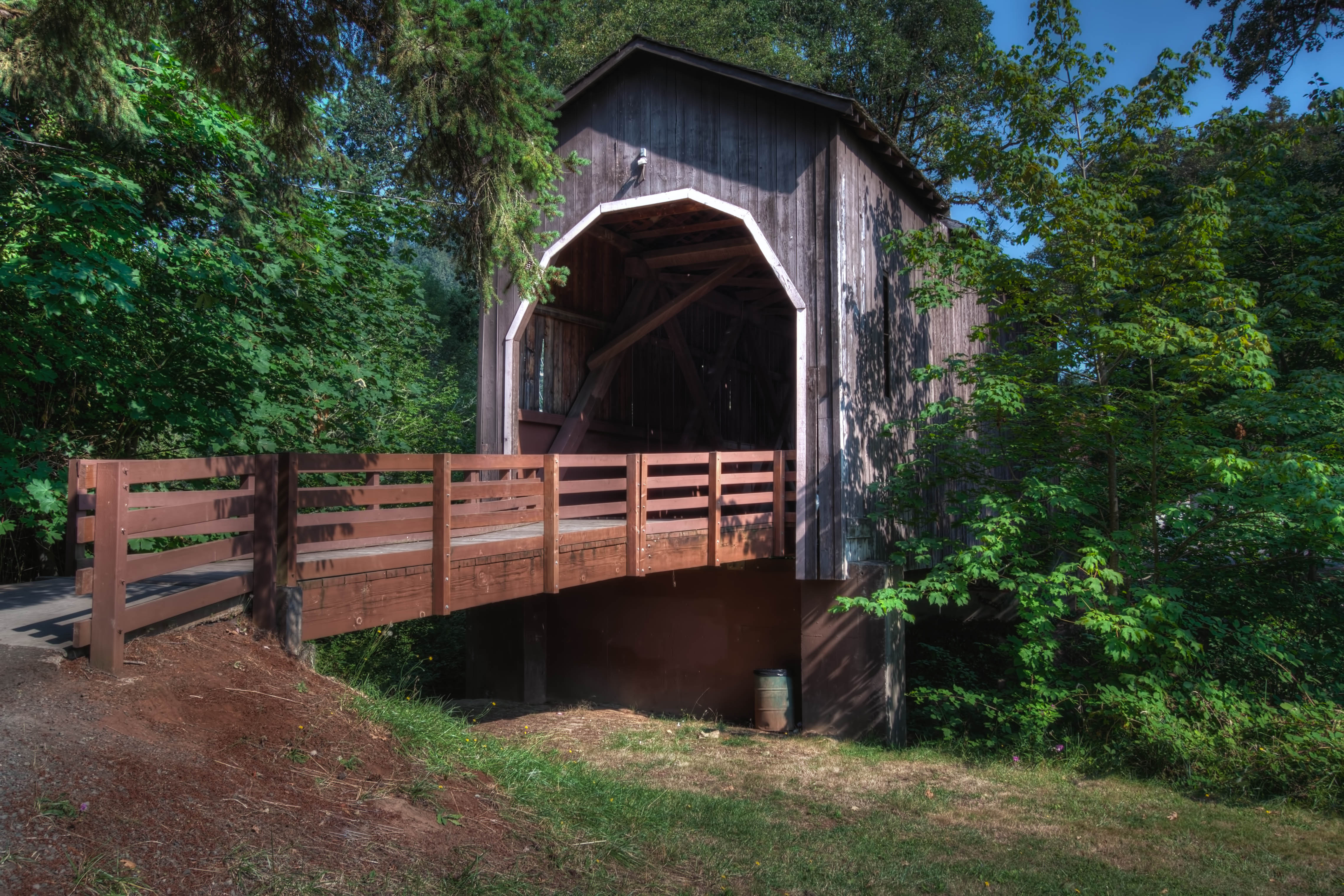
Although the official date of construction of the current Pass Creek Bridge is listed as 1925, members of the Umpqua Historic Preservation Society attest the span was constructed in 1906. Mamie Krewson Matoon, who was born in 1894, remembered a covered bridge over Pass Creek as a child. "It was an old bridge at the time. Long before Drain had lights, we packed a lantern on dark nights when going through it in a hack drawn by two horses." The original bridge at this site was built in the 1870s along the Overland Stage Route, as Drain was an important junction which linked the Willamette Valley and Jacksonville. An 1895-era photograph shows the wagon bridge and adjacent railroad bridge, both being covered. The wooden rail span was replaced soon after. Old timers recall the Pass Creek Bridge provided excitement when a horse-drawn wagon crashed through the floor around 1920 while hauling supplies for a Thanksgiving turkey shoot. Although the wagon dropped below the decking, the only casualties were the words uttered by the driver, the drowning of turkeys and splashing of supplies into the creek. It is probable the covered wagon bridge at this location was either rebuilt or replaced in 1925, displacing the earlier span. Holes in the lower chords indicate that it may have been salvaged from another bridge. Today a concrete bridge now crosses Pass Creek where the old wooden structure once rested. In the fall of 1987, after the roof and siding of the covered bridge were removed, a 90-ton crane lifted the trusses and moved them one block away where the structure was reassembled the following year. The wooden bridge had been closed to traffic since 1981, causing the handful of local residents surrounding the span to maneuver under a cramped railroad trestle to get to their homes. |
| Date | |
| Source | Pass Creek Covered Bridge |
| Author | Sandy Horvath-Dori from Grand Junction, CO, USA |
| Camera location | | View this and other nearby images on: OpenStreetMap |
|---|
.jpg¶ms=043.662563_N_-123.319355_E_globe:Earth_type:camera_source:Flickr_&language=en)
Licensing[edit]
.jpg&action=edit§ion=2)
- You are free:
- to share – to copy, distribute and transmit the work
- to remix – to adapt the work
- Under the following conditions:
- attribution – You must give appropriate credit, provide a link to the license, and indicate if changes were made. You may do so in any reasonable manner, but not in any way that suggests the licensor endorses you or your use.
| This image was originally posted to Flickr by sandyhd at https://flickr.com/photos/40110469@N04/14038119622. It was reviewed on 3 August 2015 by FlickreviewR and was confirmed to be licensed under the terms of the cc-by-2.0. |
File history
Click on a date/time to view the file as it appeared at that time.
| Date/Time | Thumbnail | Dimensions | User | Comment | |
|---|---|---|---|---|---|
| current | 21:25, 3 August 2015 | | 4,556 × 3,037 (1.73 MB) | Wilfredor (talk | contribs) | Transferred from Flickr via Flickr2Commons |
You cannot overwrite this file.
File usage on Commons
There are no pages that use this file.
File usage on other wikis
The following other wikis use this file:
- Usage on en.wikipedia.org
- Usage on www.wikidata.org
.jpg&oldid=875126668)