File:Palapala Honua, engraved by Kalama and Kepohoni, 1839.jpg
Jump to navigation
Jump to search
Size of this preview: 800 × 500 pixels. Other resolutions: 320 × 200 pixels | 640 × 400 pixels | 1,024 × 641 pixels | 1,280 × 801 pixels | 2,560 × 1,601 pixels | 5,320 × 3,328 pixels.
Original file (5,320 × 3,328 pixels, file size: 6.69 MB, MIME type: image/jpeg)
Captions
Captions
Add a one-line explanation of what this file represents
Summary[edit]
| Description |
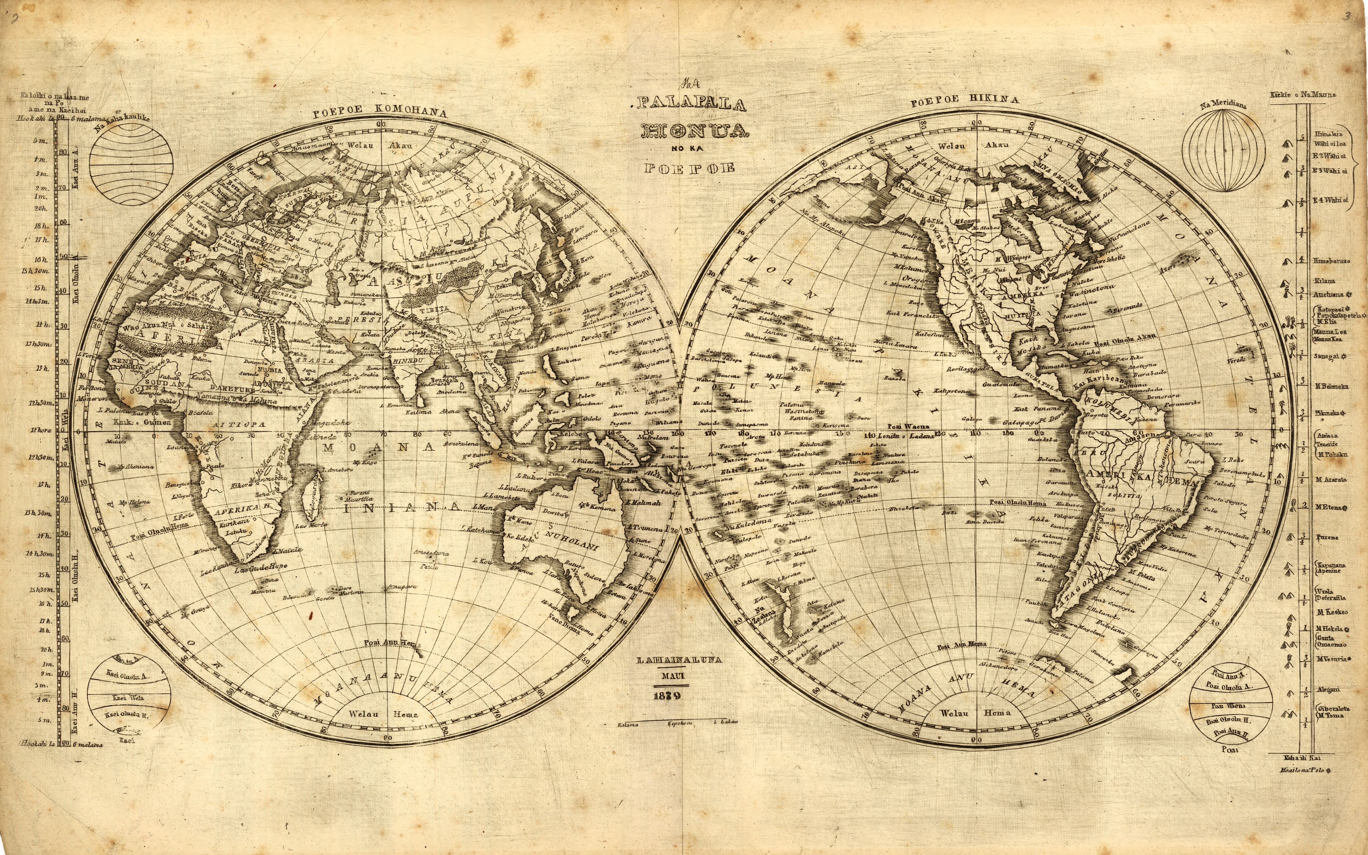
English: Palapala Honua – Kalama and Kepohoni – 1839. The Hawaiian language version of a world map was engraved to aid students in learning geography of the world. The diagram on the right of the map shows the relative heights of major mountains, as then known around the world. This map represents a joint effort by Kalama and Kepohoni. Several students at the Lahainaluna Seminary school did the actual drawing and engraving of the maps. Two of the most prolific were Kalama and Kapeau. |
| Date | |
| Source | |
| Author | Lahainaluna Students, engraved by Kalama and Kepohoni |
Licensing[edit]
|
This work is in the public domain in its country of origin and other countries and areas where the copyright term is the author's life plus 100 years or fewer. | |
| This file has been identified as being free of known restrictions under copyright law, including all related and neighboring rights. | |
File history
Click on a date/time to view the file as it appeared at that time.
| Date/Time | Thumbnail | Dimensions | User | Comment | |
|---|---|---|---|---|---|
| current | 06:24, 22 June 2014 | | 5,320 × 3,328 (6.69 MB) | KAVEBEAR (talk | contribs) | He mau palapala aina, a me na niele e pili ana. Hookahi ke pai ana. |
You cannot overwrite this file.
File usage on Commons
The following 2 pages use this file: