File:PLZ 46.png
Jump to navigation
Jump to search
Size of this preview: 501 × 600 pixels. Other resolutions: 200 × 240 pixels | 401 × 480 pixels | 642 × 768 pixels | 855 × 1,024 pixels | 1,473 × 1,763 pixels.
Original file (1,473 × 1,763 pixels, file size: 490 KB, MIME type: image/png)
Captions
Captions
Add a one-line explanation of what this file represents
Summary[edit]
| Description |
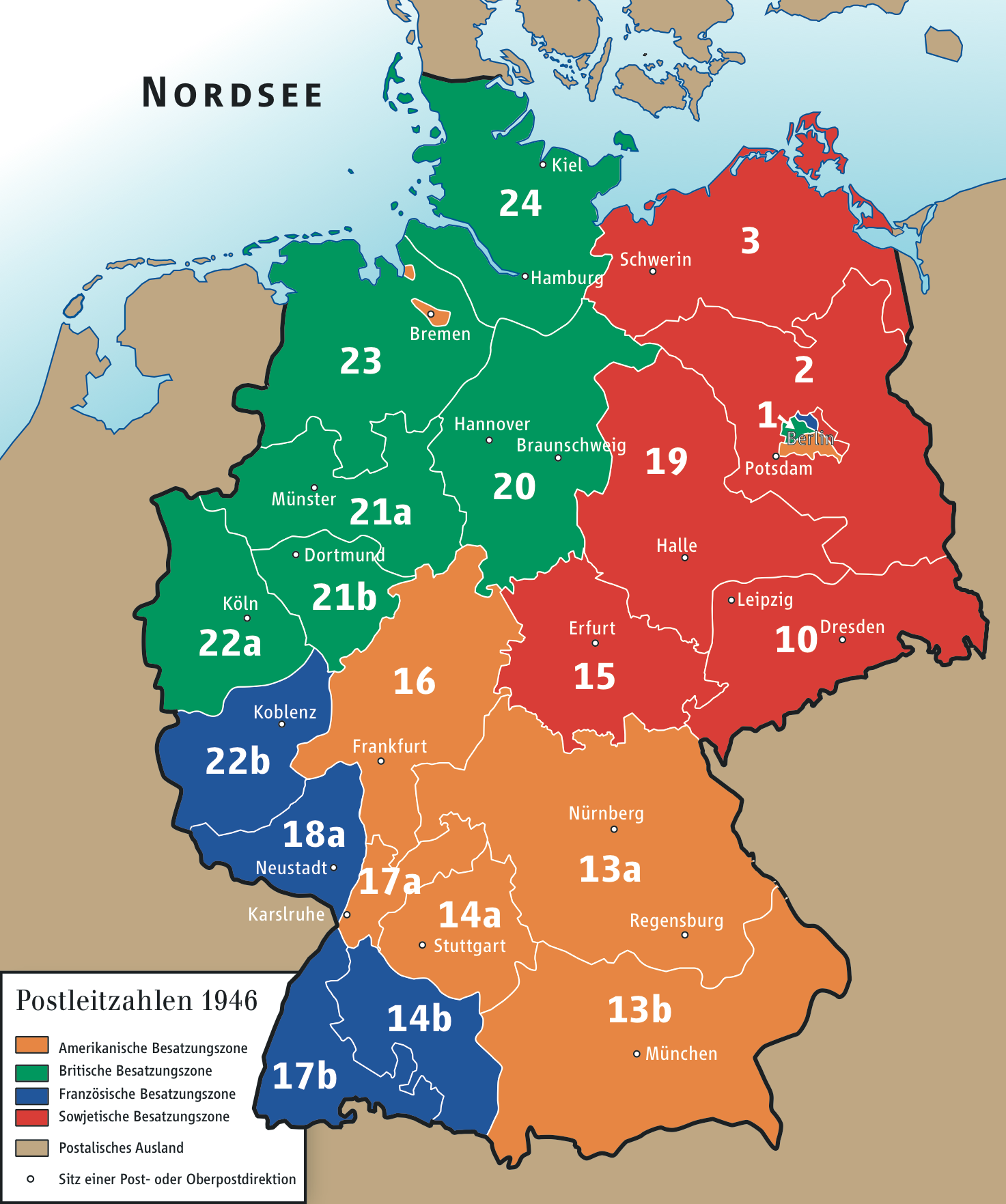
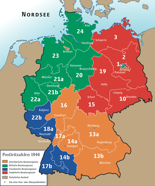
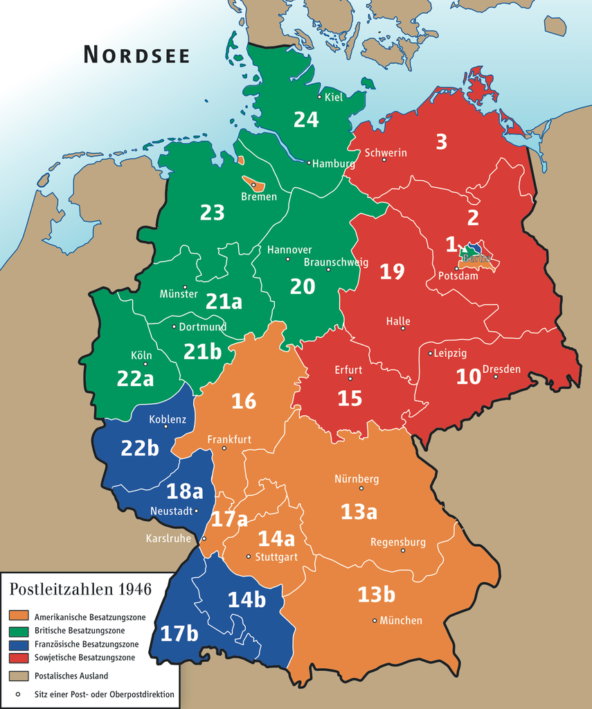
English: Postcode zones of Deutsche Reichspost, 1946
Deutsch: Postleitgebiete der Deutschen Reichspost, 1946. |
| Date | |
| Source | Postkarte der Reichspostdirektion Hamburg, 1. Juli 1946 |
| Author | Ziegelbrenner |
Licensing[edit]
| I, the copyright holder of this work, release this work into the public domain. This applies worldwide. In some countries this may not be legally possible; if so: I grant anyone the right to use this work for any purpose, without any conditions, unless such conditions are required by law. |

|
This map has been made or improved in the German Kartenwerkstatt (Map Lab). You can propose maps to improve as well.
|
File history
Click on a date/time to view the file as it appeared at that time.
| Date/Time | Thumbnail | Dimensions | User | Comment | |
|---|---|---|---|---|---|
| current | 15:08, 26 April 2010 | | 1,473 × 1,763 (490 KB) | Ziegelbrenner (talk | contribs) | {{Information |Description={{en|1=ssaf}} {{de|1=scscs}} |Source=gsdgds |Author=Ziegelbrenner |Date=2010-04-26 |Permission= |other_versions=unknown }} |
You cannot overwrite this file.
File usage on Commons
There are no pages that use this file.
File usage on other wikis
The following other wikis use this file:
- Usage on als.wikipedia.org
- Usage on de.wikipedia.org