File:Père-Lachaise - Plan - 1825.jpg

Original file (5,100 × 4,379 pixels, file size: 9.19 MB, MIME type: image/jpeg)
Captions
Captions
Summary[edit]
| Description |
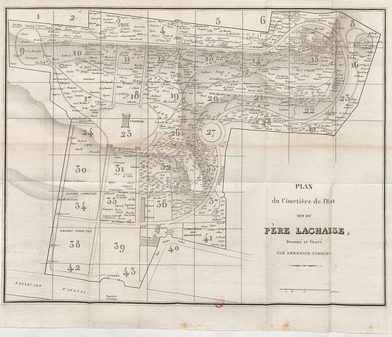
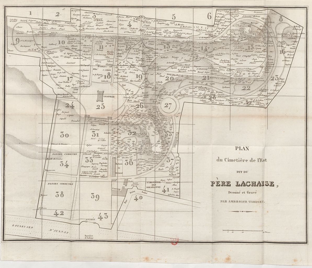
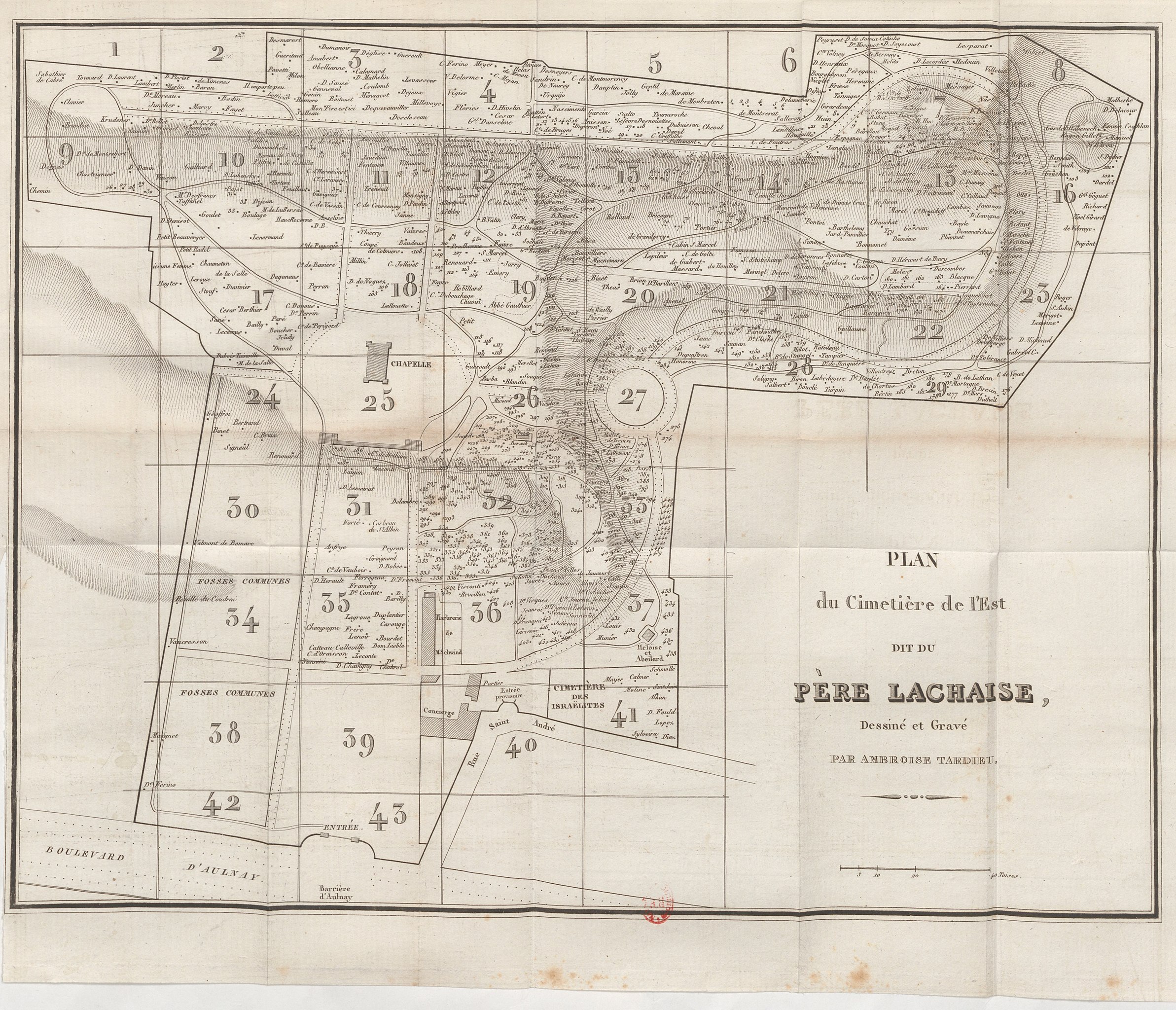
Français : Plan du Cimetière de l'Est dit du Père Lachaise, dessiné et gravé par Ambroise Tardieu |
||
| Date | |||
| Source |
|
||
| Author | Ambroise Tardieu |
Licensing[edit]
|
This work is in the public domain in its country of origin and other countries and areas where the copyright term is the author's life plus 70 years or fewer.
| |
| This file has been identified as being free of known restrictions under copyright law, including all related and neighboring rights. | |
File history
Click on a date/time to view the file as it appeared at that time.
| Date/Time | Thumbnail | Dimensions | User | Comment | |
|---|---|---|---|---|---|
| current | 17:32, 31 December 2012 | | 5,100 × 4,379 (9.19 MB) | ~Pyb (talk | contribs) | {{Information |Description= |Source={{own}} |Date= |Author= ~Pyb |Permission= |other_versions= }}== {{int:filedesc}} == {{Information |Description = {{fr|Plan du Cimetière de l'Est dit du Père Lachaise, dessiné et gravé par Ambrois... |
You cannot overwrite this file.
File usage on Commons
There are no pages that use this file.
- Old maps of the Père-Lachaise Cemetery
- Père-Lachaise Cemetery in the 19th century
- Boulevard d'Aulnay (Paris)
- Rue Saint-André (Paris)
- Grave of Duvergier de Hauranne (Père-Lachaise, division 13)
- Père-Lachaise in 1825
- Grave of Martin de Vaucresson (Père-Lachaise, division 58)
- Mur des Hauziaux
- Grave of Férino (Père-Lachaise, division 60)
- Grave of Maignet (Père-Lachaise, division 60)
- Grave of Renouard (Père-Lachaise, division 22)
- Grave of Ney (Père-Lachaise, division 29)
- Grave of Bonnomet (Père-Lachaise, division 28)