File:Ottoman Empire 1914 h.PNG
Jump to navigation
Jump to search

Size of this preview: 518 × 600 pixels. Other resolutions: 207 × 240 pixels | 415 × 480 pixels | 640 × 741 pixels.
Original file (640 × 741 pixels, file size: 27 KB, MIME type: image/png)
Captions
Captions
Add a one-line explanation of what this file represents
Summary[edit]
| Description |
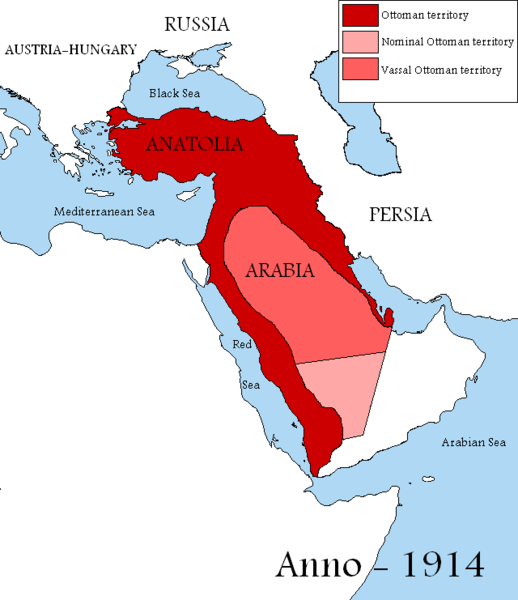
English: Map showing the territories of the Ottoman Empire in 1914, including nominal and vassal territories.
According to the information on the map in http://ottomanmilitary.devhub.com/ |
| Date | |
| Source | Own work |
| Author | DragonTiger23 |
| Other versions |
[]
|


Many people actually lived in this empire from time to time
Licensing[edit]
| I, the copyright holder of this work, release this work into the public domain. This applies worldwide. In some countries this may not be legally possible; if so: I grant anyone the right to use this work for any purpose, without any conditions, unless such conditions are required by law. |

|
This historical map image could be re-created using vector graphics as an SVG file. This has several advantages; see Commons:Media for cleanup for more information. If an SVG form of this image is available, please upload it and afterwards replace this template with
{{vector version available|new image name}}.
It is recommended to name the SVG file “Ottoman Empire 1914 h.svg”—then the template Vector version available (or Vva) does not need the new image name parameter. |
File history
Click on a date/time to view the file as it appeared at that time.
| Date/Time | Thumbnail | Dimensions | User | Comment | |
|---|---|---|---|---|---|
| current | 13:04, 29 August 2019 | | 640 × 741 (27 KB) | Aybeg (talk | contribs) | Cyprus was under British control. |
| 14:20, 28 August 2019 |  | 640 × 741 (27 KB) | Aybeg (talk | contribs) | In 1914, the Ottomans did not rule over Egypt and Sudan. | |
| 13:03, 13 January 2011 |  | 640 × 741 (33 KB) | DragonTiger23 (talk | contribs) | {{Information |Description={{en|1=Map showing the territories of the Ottoman Empire in 1914, including nominal and vassal territories. According to the information on the map in http://ottomanmilitary.devhub.com/}} |Source={{own}} |Author=[[User:DragonTi |
You cannot overwrite this file.
File usage on Commons
The following 5 pages use this file:
File usage on other wikis
The following other wikis use this file:
- Usage on ar.wikipedia.org
- Usage on be.wikipedia.org
- Usage on bg.wikipedia.org
- Usage on en.wikipedia.org
- Usage on fr.wikipedia.org
- Usage on he.wikipedia.org
- Usage on hu.wikipedia.org
- Usage on it.wikipedia.org
- Usage on nl.wikipedia.org
- Usage on pt.wikipedia.org