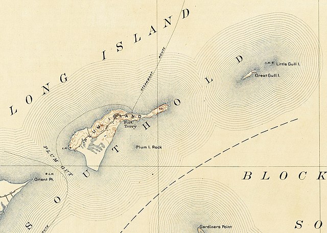
File:Orient Point, Plum Island, Great Gull Island, Little Gull Island, from a 1904 USGS map.jpg
Jump to navigation
Jump to search

Size of this preview: 800 × 570 pixels. Other resolutions: 320 × 228 pixels | 640 × 456 pixels | 1,024 × 730 pixels | 1,280 × 912 pixels | 1,602 × 1,142 pixels.
Original file (1,602 × 1,142 pixels, file size: 732 KB, MIME type: image/jpeg)
Captions
Captions
Add a one-line explanation of what this file represents
Summary[edit]
| Description | |
| Date | |
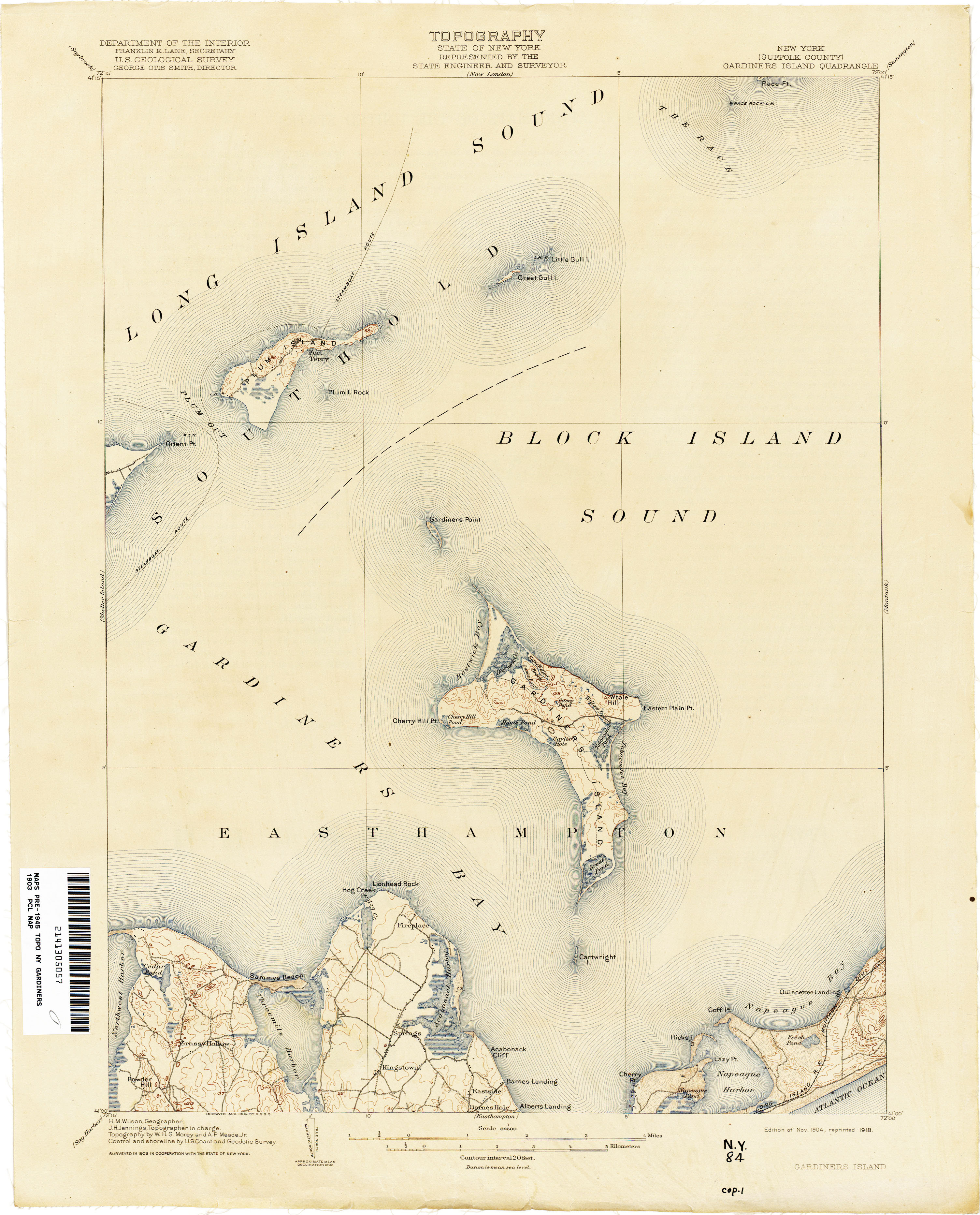
| Source | http://www.lib.utexas.edu/maps/topo/new_york/txu-pclmaps-topo-ny-gardiners_island-1903.jpg |
| Author | U.S. Geological Survey |
| Other versions |

Licensing[edit]
This work is in the public domain in the United States because it is a work prepared by an officer or employee of the United States Government as part of that person’s official duties under the terms of Title 17, Chapter 1, Section 105 of the US Code.
Note: This only applies to original works of the Federal Government and not to the work of any individual U.S. state, territory, commonwealth, county, municipality, or any other subdivision. This template also does not apply to postage stamp designs published by the United States Postal Service since 1978. (See § 313.6(C)(1) of Compendium of U.S. Copyright Office Practices). It also does not apply to certain US coins; see The US Mint Terms of Use.
|
 | |
| This file has been identified as being free of known restrictions under copyright law, including all related and neighboring rights. | ||
File history
Click on a date/time to view the file as it appeared at that time.
| Date/Time | Thumbnail | Dimensions | User | Comment | |
|---|---|---|---|---|---|
| current | 09:32, 18 September 2020 | | 1,602 × 1,142 (732 KB) | Geo Swan (talk | contribs) | File:Gardiners Island 1904 USGS map.jpg cropped 47 % horizontally, 69 % vertically using CropTool with precise mode. |
You cannot overwrite this file.
File usage on Commons
The following page uses this file:
File usage on other wikis
The following other wikis use this file:
- Usage on en.wikipedia.org
- Usage on fr.wikipedia.org